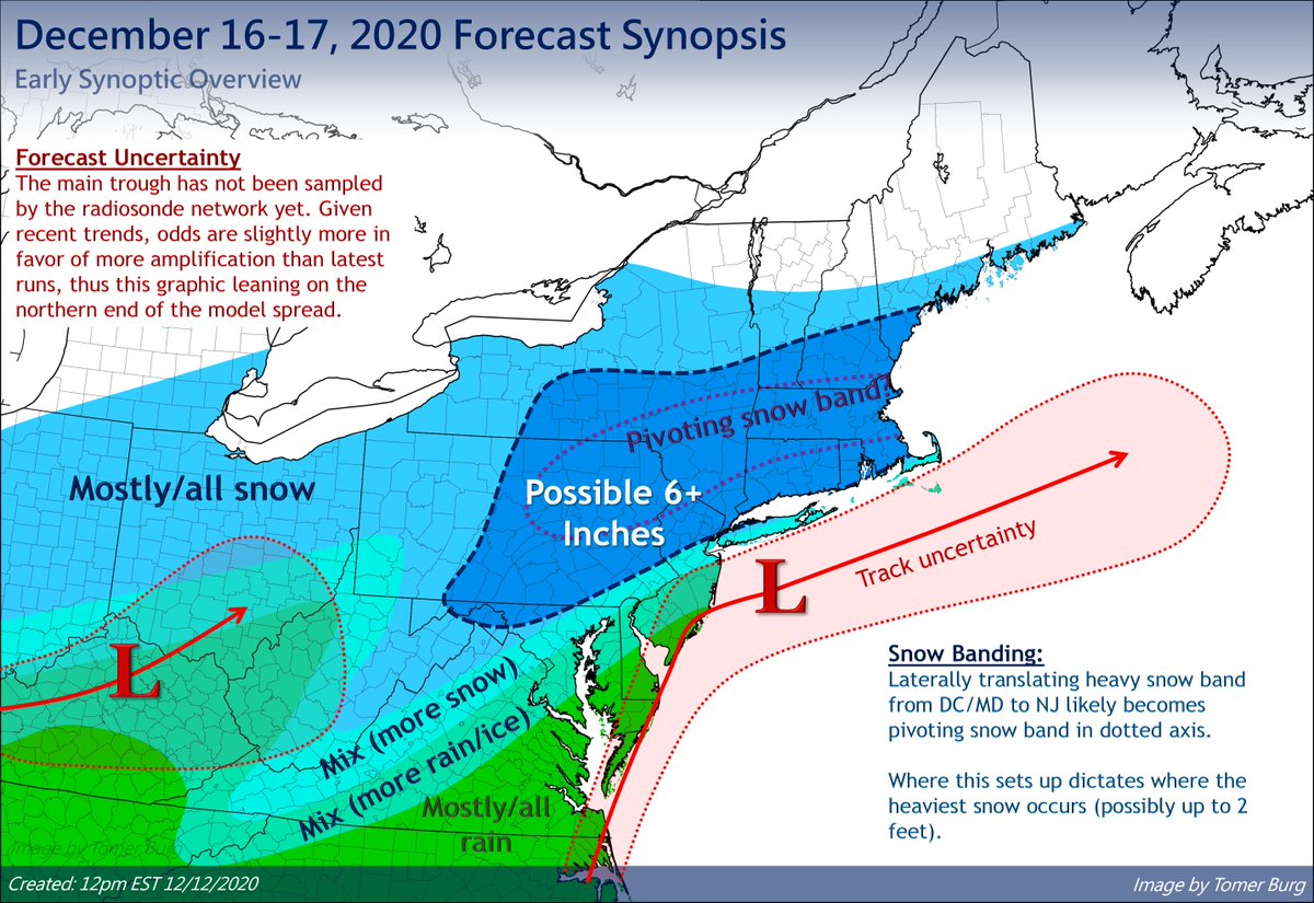
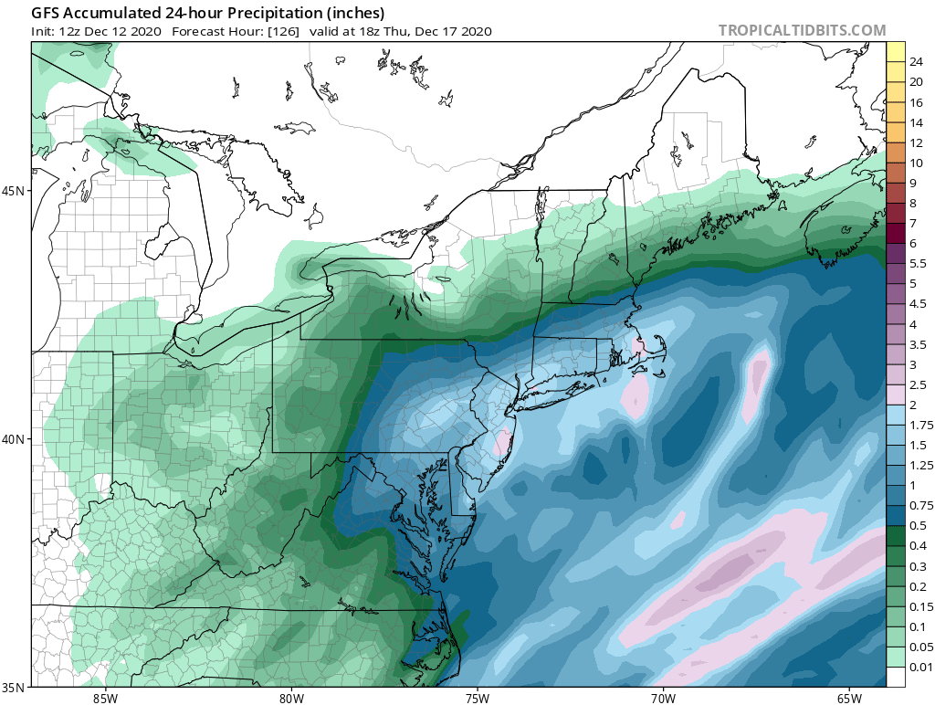
I sketched out my *preliminary* thoughts impact-wise for the upcoming Wed-Thu storm. I'll discuss my basis in subsequent tweets below, but overall while I don't think there's much room for a major NW shift vs. current guidance consensus, some NW adjustments are possible.
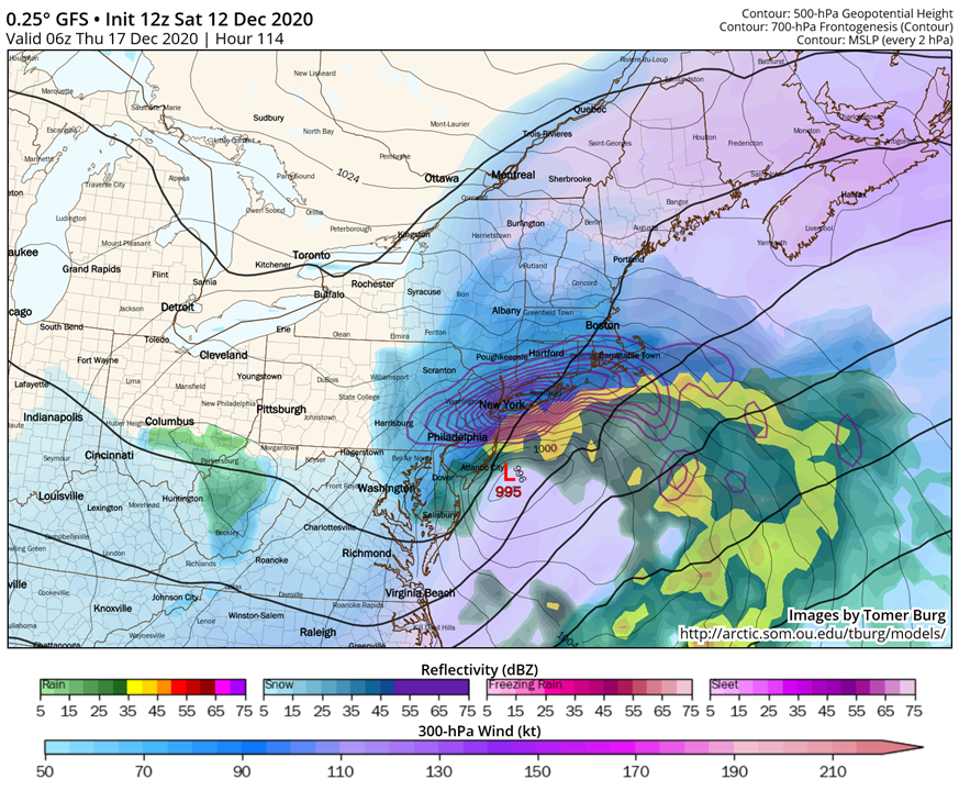
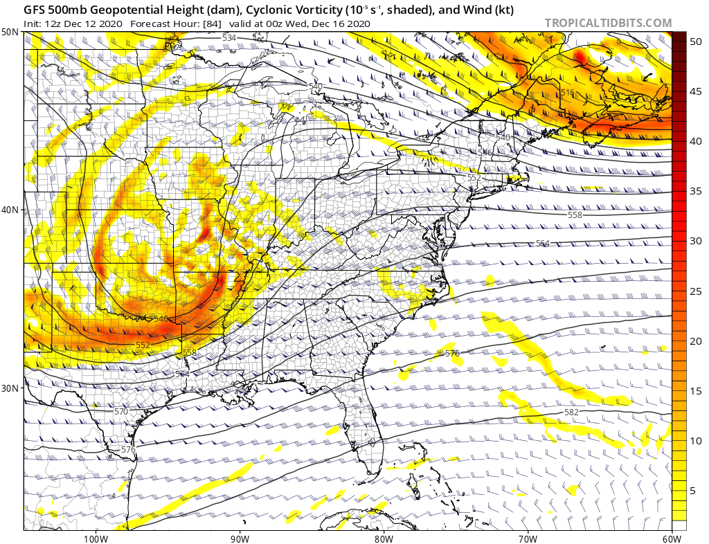
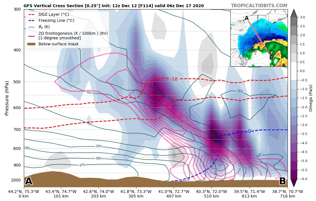
Synoptically we have a s/w trough progressing east w/ initial cyclogenesis into OH Valley. Sfc cyclone then quickly deepens just off the NE coast downstream of the trough & w/ ascent associated with DCVA and dual jet streak. Mesoscale forcing associated w/ strong frontogenesis.
Antecedent cold air will be plentiful w/ CAA upstream of a prior Monday cyclone, w/ confluent zone downstream of the main trough. This should prevent a low track too far north, but esp if trough trends more amplified this could favor a slightly more NW track than currently shown.
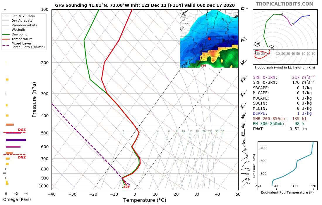
While it's too early to iron out the exact mesoscale banding location (my early guess is somewhere btwn NJ/NY border & Albany), thermo profiles & strong fgen associated w/ WAA aloft support a quasi-stationary/perhaps pivoting snow band w/ favorable snow growth & >10:1 ratios.
I will avoid posting any snow maps for the duration of this event, but given ample moisture to produce heavy precipitation & enhancement from mesoscale banding and favorable snow ratios, I wouldn't be surprised to see as much as 20-24" locally under the band.

 Read on Twitter