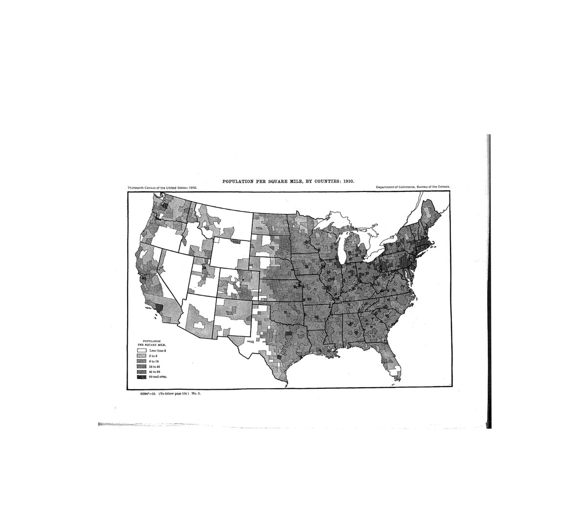
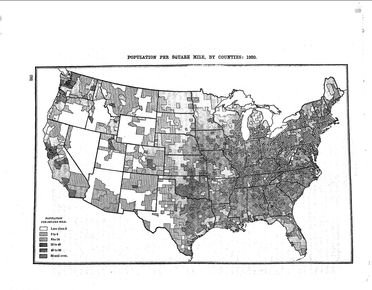
This #ThrowbackThursday, some maps to show how Native Americans were erased from the census.
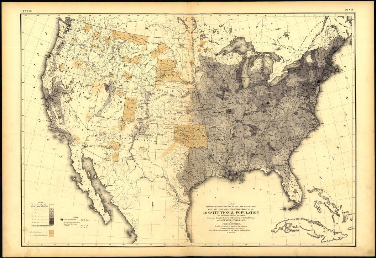
The first map of "population" distribution & density was produced by Superintendent of the Census Francis Walker for the 1870 census (you can see why the quotation marks). 1/
The first map of "population" distribution & density was produced by Superintendent of the Census Francis Walker for the 1870 census (you can see why the quotation marks). 1/
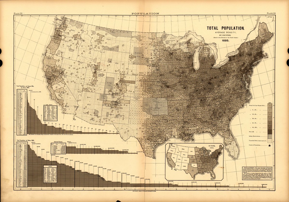
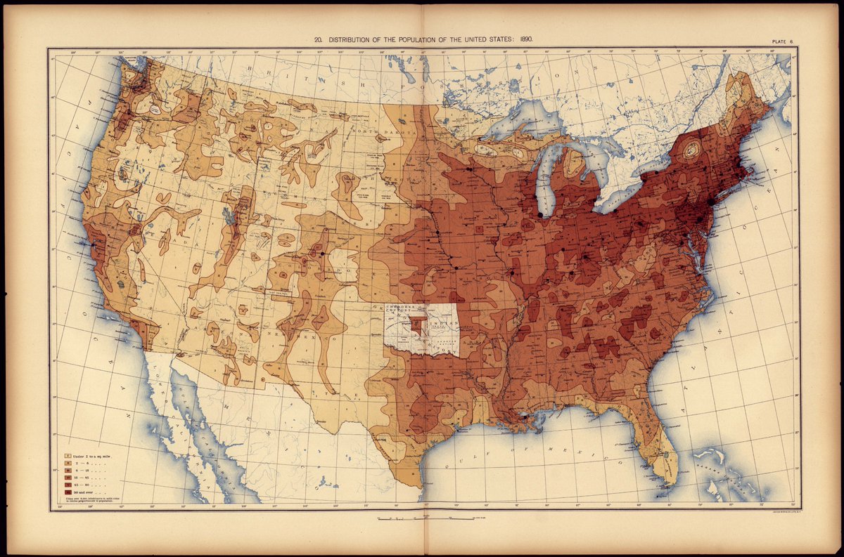
I find the 1890 map quite revelatory. Also this text verbatim from the Census site "Population distribution maps from the mid-nineteenth century show a vast and unsettled midsection of the country that is gradually filled in as the frontier shrinks and closes entirely by 1890" 2/
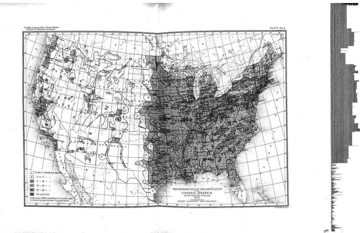
These are the 1900-1920 maps.
As geographers, we face two challenges here IMO. The first is to address how power structures literally erased evidence, w/ our professional complicity. The second it to FIND that evidence and put it back on the map - where it belongs. 3/
As geographers, we face two challenges here IMO. The first is to address how power structures literally erased evidence, w/ our professional complicity. The second it to FIND that evidence and put it back on the map - where it belongs. 3/
Here is the census website these come from:
https://www.census.gov/history/www/reference/maps/population_distribution_over_time.html
And if you think this is ancient history, think again: 4/4 https://twitter.com/ProfSecchi/status/1304148816166354950?s=20
https://www.census.gov/history/www/reference/maps/population_distribution_over_time.html
And if you think this is ancient history, think again: 4/4 https://twitter.com/ProfSecchi/status/1304148816166354950?s=20

 Read on Twitter