MARS!!
I’m really excited for tomorrow’s #Mars2020 landing! Not only will we for the first time have aerial views—a huge challenge in a planet with such a thin atmosphere—but the landing site is right on the boundary between Syrtis Major and Isidis! Why’s that cool? Well, (1/?)
I’m really excited for tomorrow’s #Mars2020
 landing! Not only will we for the first time have aerial views—a huge challenge in a planet with such a thin atmosphere—but the landing site is right on the boundary between Syrtis Major and Isidis! Why’s that cool? Well, (1/?)
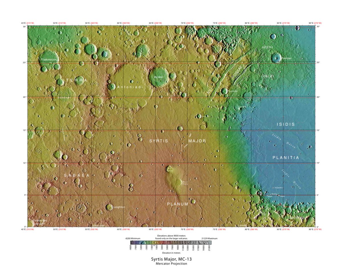
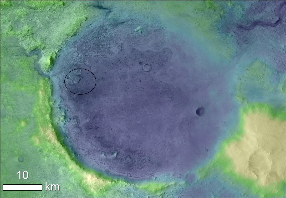
Take a look at a map of the landing site in USGS survey quadrilateral MC-13. Jezero Crater, the exact landing target, is situated on the border between two major Martin areographic features: Isidis Basin, the third-largest visible impact structure; and old shield volcano Syrtis
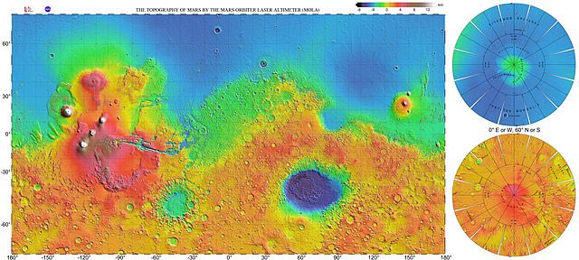
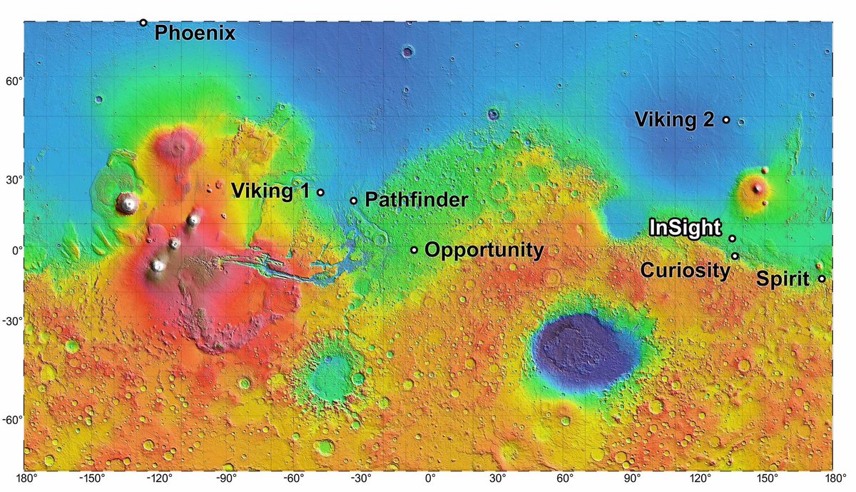
Major Planum. So it’s between a big crater and a volcano. So what? Well, besides the fact that extraterrestrial volcanoes are just objectively awesome, taking an even bigger step back reveals something special about this boundary region. Here’s a planet-wide elevation map.
Notice anything strange? Perhaps the fact that the Northern Hemisphere sits an average of 2 kilometers or 1.24 miles lower than the Southern Hemisphere with a VERY noticeable drop-off? That’s something called the Martian Dichotomy, and while its origins may still elude us
to this day (the current best theory is a MASSIVE impact event so large the crater covered half the planet), what’s really, really obvious here is that this is where all the water would go if Mars had liquid water. Hellas Basin, the smaller blue-purple low area,
may be the lowest lying part of the planet *overall*, but in terms of sheer volume it could never compete with the Northern Hemisphere and would likely just be a large Caspian Sea-type inland body of water.
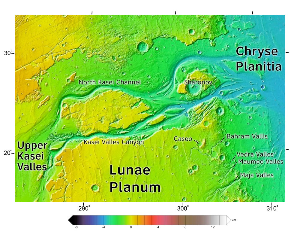
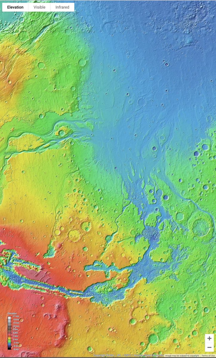
Okay, now let’s zoom back in a little bit. If the Northern Hemisphere is much lower than the Southern Hemisphere with that dramatic of a slope, and Mars once had liquid water, we’d expect to find evidence of the water flowing out into this lower-lying area, right? And sure enough
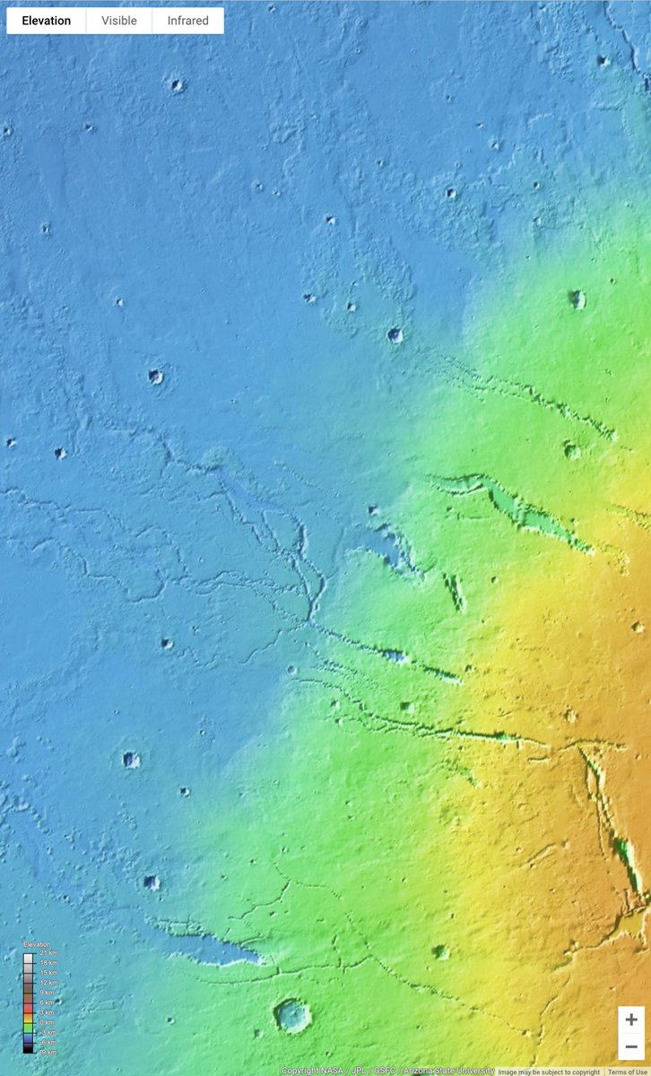
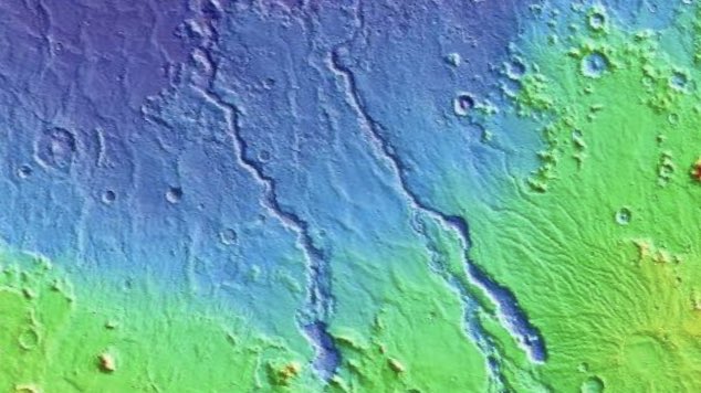
You can load up Google Mars and instantly find loads and loads of features that are so obviously rivers and river deltas flowing out to sea. Other areas require a bit more zooming in or hard thinking because past landslides, volcanic activity, and erosion have obscured them, but
there are DEFINITELY water-based features on Mars. That’s undisputed. Now can you start to piece together why the Mars 2020 target landing site is really cool? It’s right on the border of an ancient sea that has confirmed rivers and deltas flowing out to it. But that’s not all!
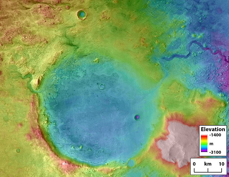
Every single rover we’ve sent to Mars has been in this ancient seabed, so that’s not cool in and of itself. What’s *really* special about this landing site, Jezero Crater, SPECIFICALLY is that not ONLY is it on the ancient shoreline, but it’s ALSO part of an ancient river and
lake system! For the first time, we’ll have direct access to a Martian lake, river system and delta, and nearby ocean ALL AT THE SAME TIME!! That’s practically every important liquid water feature on the planet all accessible at once!
There’s a HUGE delta, just like, say, the Mississippi, that brought water into the lake, and an outflow channel to carry water onwards and out to sea! And the best part? Deltas that big take hundreds of thousands of years to form, so this water wasn’t a single fluke flood event.
Gale Crater, where Curiosity went, also was flooded at points, but since it didn’t have any inflow or outflow channels it’s pretty safe to assume it would flood under specific circumstances but then dry up for the majority of the time. Not great for developing aquatic life.
Jezero Crater? It’s got that well-developed delta coming into it, proving the watershed system it was a part of was stable for hundreds of thousands to even millions of years, bringing in dissolved matter from upstream for life to potentially grow off of.
And how much did it fill? Very, very much. The presence of that outflow channel at a higher elevation suggests when the river first started flowing into the lake, it filled it so much it overflowed and burst the crater rim, tearing an outflow to the sea.
Again, the fact that there was enough time to form this kind of well-defined channel that stretches for dozens upon dozens of kilometers without drying up gives a clue to how much water there was (a lot) and how long it was there for (also a lot).
So to recap, the Mars 2020 landing site is located in an ancient crater lake that we know was filled to the brim by a large river rich in nutrients for hundreds of thousands to millions of years. That’s a pretty incredibly perfect haven for life to develop, more so
than possibly anywhere else on the entire planet. Oh, and to tie things wayyy back to the start, volcanoes can make some pretty fertile soil, and the nearby Syrtis Major Planum is potentially a great and somewhat consistent source for nutrients to come washing down from.
And finally, did I mention that at 18°N the crater and by extension ancient lake and river have a tropical climate (well, what passes for one on Mars nowadays) which is the best Earth climate for biodiversity?
So yeah, a mission to an ancient lake that’s pretty much paradise on Mars and a really amazing place to study almost all major aerographic features. That’s stuff to really get excited about, because whatever happens we’ll learn so so many more cool things about the Red Planet!
PS: Also the mission has a drone which can fly around and give us sick aerial shots for the first time and that’s pretty tight. Not really relevant when I’m mostly talking about the coolness of the location itself but I thought it’s still cool enough to be worth mentioning anyway

 Read on Twitter
