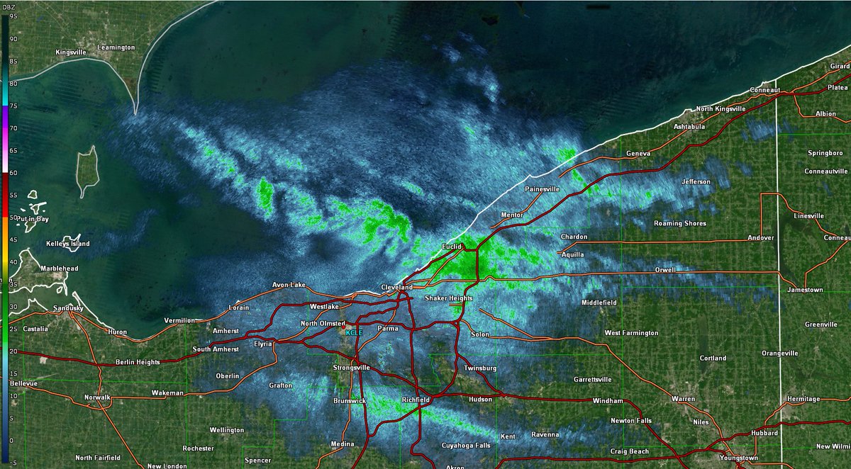
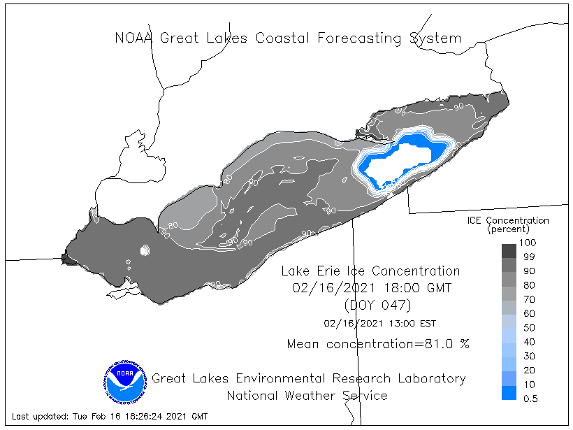
There's advisory-criteria lake effect snow occurring right now off of Lake Erie, with the bulk of the fetch over ice cover of 80-90%+. This happens every now and then, and is one of my favorite meteorological phenomena ever. 1/5
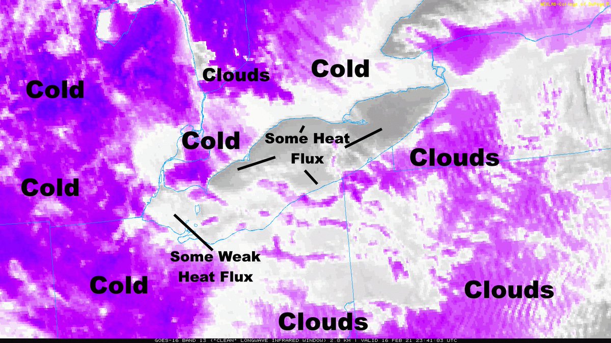
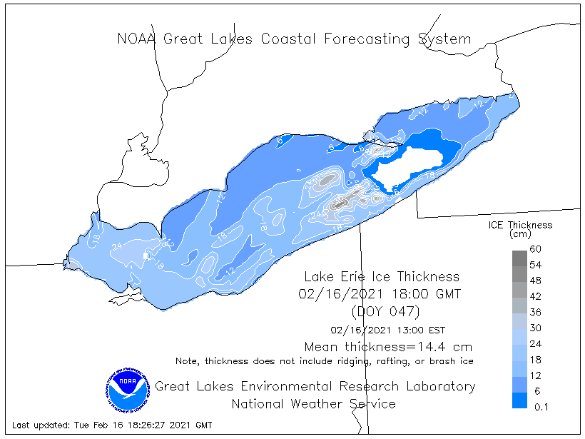
How/why? There is still some heat/moisture flux through the ice. It is notably limited when the ice concentration is >70%, but is still somewhat noteworthy until the ice is greater than a foot thick. Can see evidence of the heat flux on IR satellite compared to the cold land. 2/5
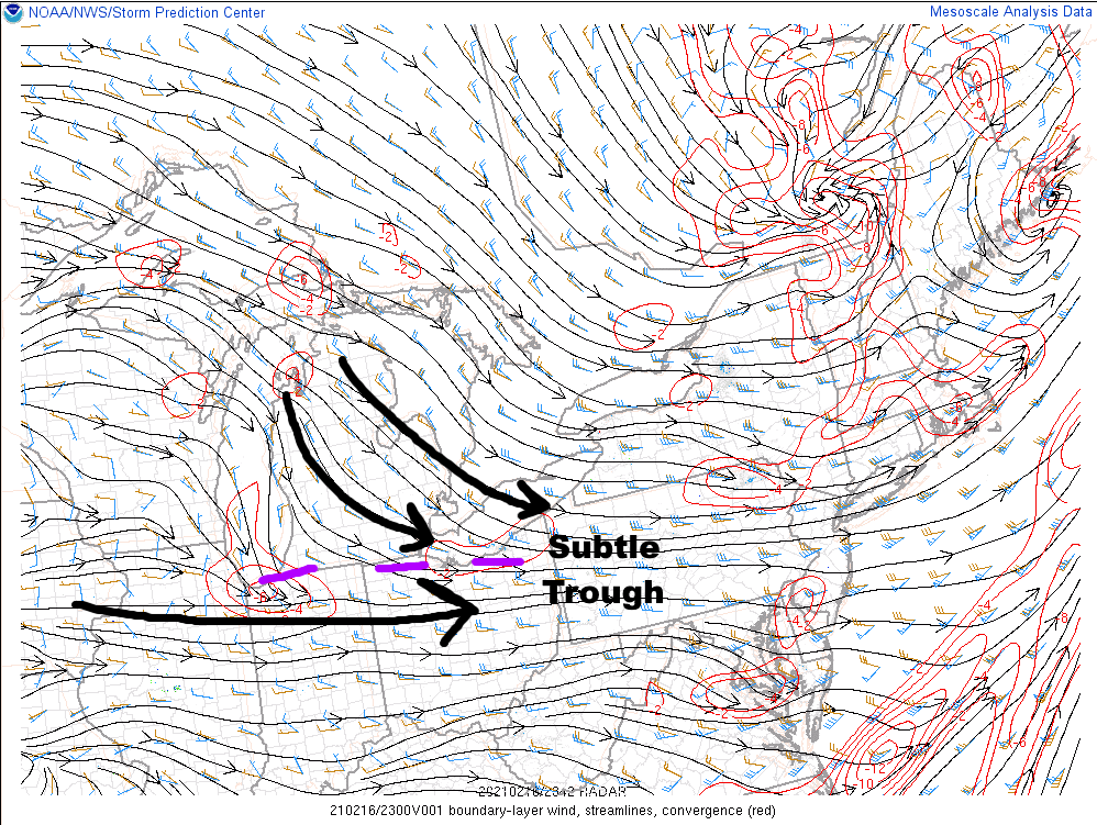
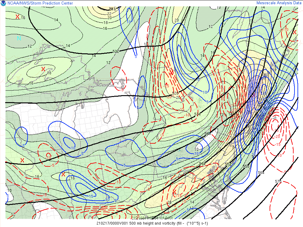
There's a trough (caused by Lake MI's modification to the flow and airmass). Frictional convergence near the shoreline enhances this, & the differential in heat flux between thicker/thinner ice mid-lake aligns with the strongest band. Also, some very weak PVA. Any lift helps. 3/5
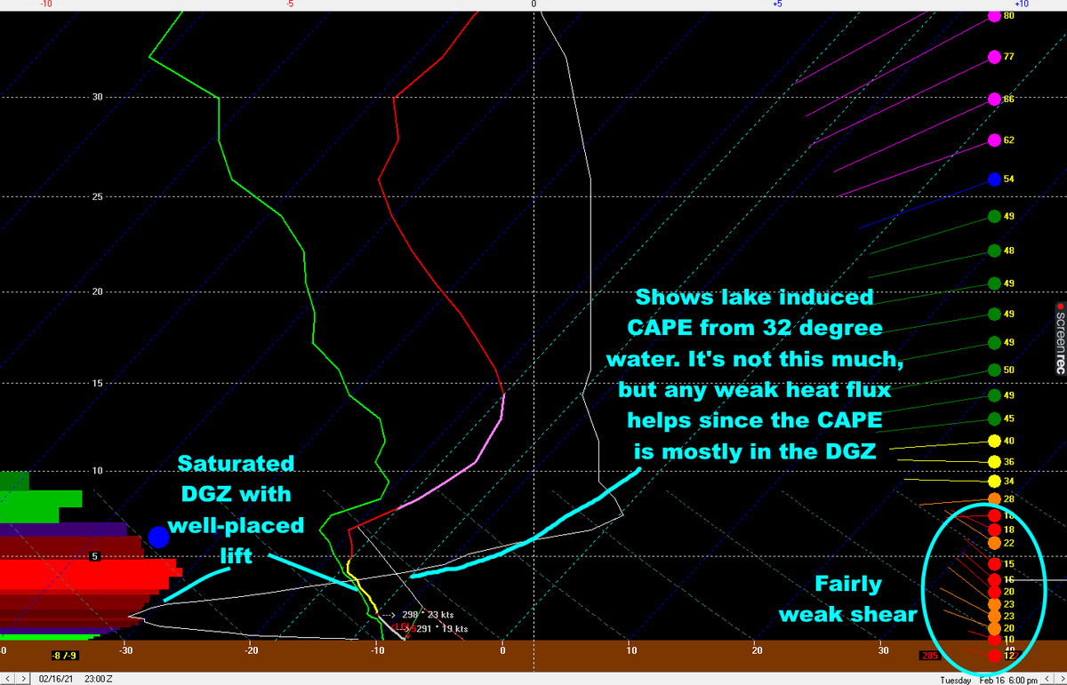
The thermodynamics are weak, but the lack of shear helps with band organization and maximizes what heat flux there is. Also, pretty much all of the moisture, lift, and CAPE is in the DGZ. The lake doesn't need to add much juice to make dendrites here. 4/5
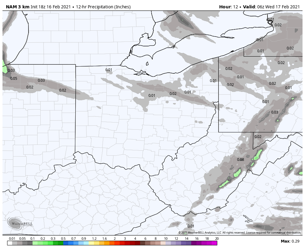
Meteorologists know not to *completely* dismiss lake effect off of a frozen Lake Erie, but these advisory+ type events are quite difficult to predict in advance, and usually involve a goldilocks combination of factors like this. It's also never modeled well (ie, this). 5/5

 Read on Twitter