Lets talk about Thursday. For starters this setup is much better than today's system as we have a massive man high to the north usher cold dry air south (CAD). This is what is missing from todays system and why I was not a fan of the big ice amounts, the airmass is very stale.
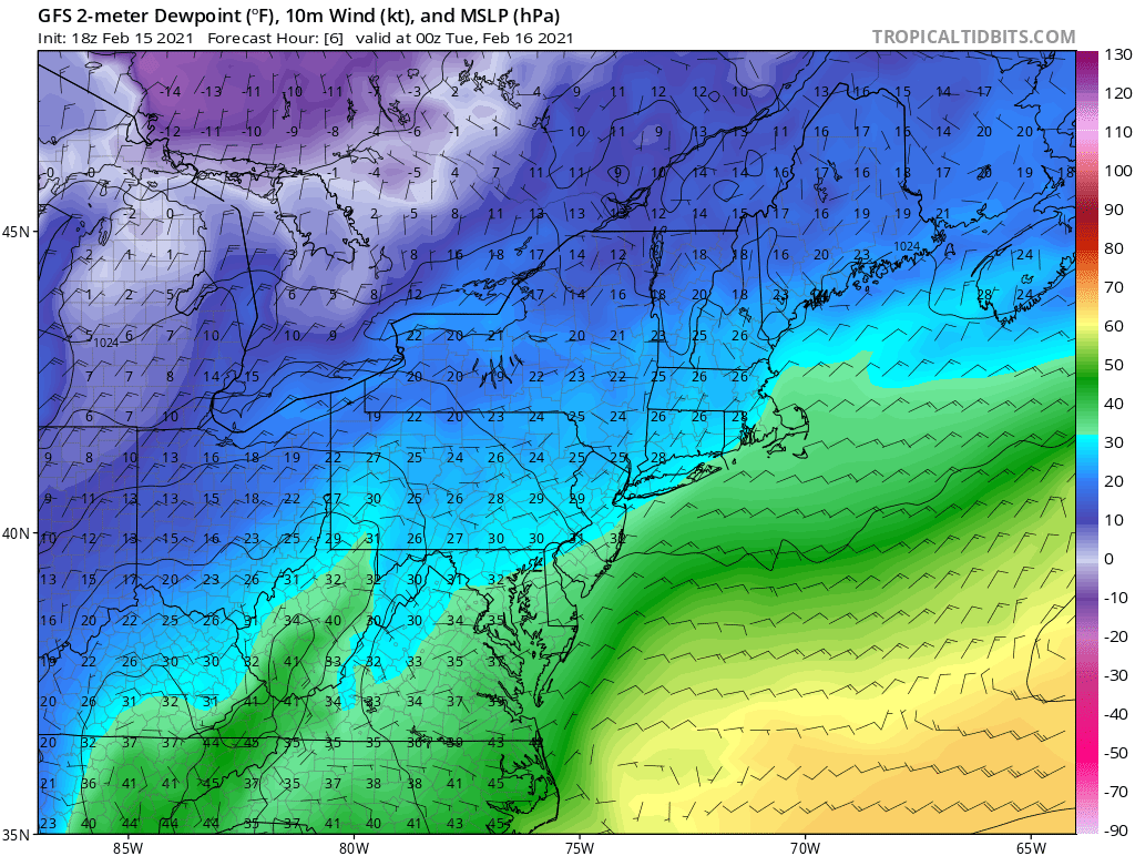
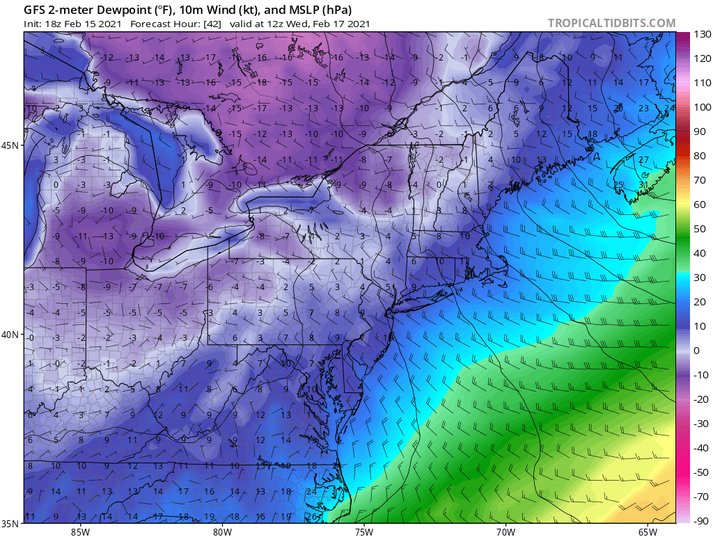
Look at the difference in dew points for this system compared to thursday. Right now we have dew points in the upper 20s to low 30s. (1st image) Thursday's system has dew points in the single digits (2nd image)
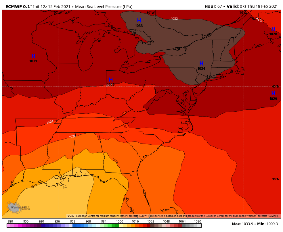
Note the massive high pressure in a perfect spot to funnel cold air southward into our area. Thats a 1034 hp of arctic origin.
Originally, it looked like Thursday's system was suppose to be the warmer of the two because it looked like the tpv was going to slide across the northeast and knock down the se ridge and make Tonight's system colder then move out of the way for Thursday to cut west.
Well that changed as the tpv stayed west and dumped all the cold southward, which then allowed the flow along the east coast to amplify and shift the storm track west of us.
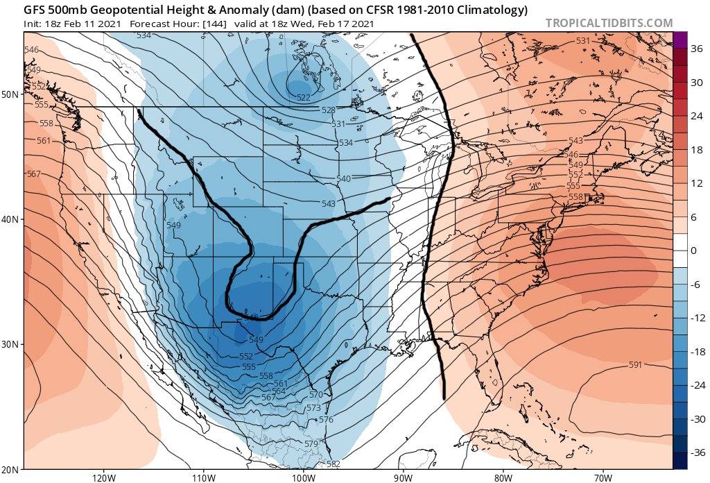
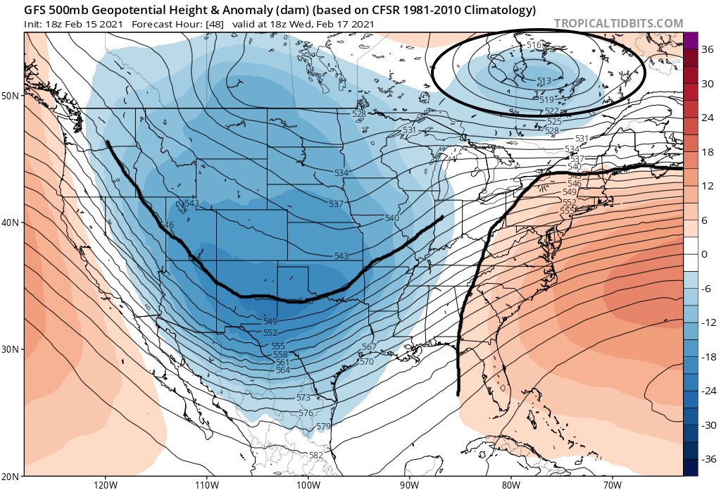
This is what the h5 map was looking like last Thursday as it seemed the tpv was going to slide across the lakes knock down the hgts for tonight's system then get out of the way to allow a more amplified flow for Thursday.
Note the tpv is gone, so the low pressure in the plains can really amplify and pump the se ridge. Look at where we are at. Tpv is over the lakes instead of well east of our area. This then knocks down the se ridge and causes the storm in the plains to be a bit more progressive
look at the overall trend here from last Thursday to now. Watch how the tpv completely backs up and what it does to the ridging on the east coast which also helps to not allow the low pressure to really go on roids.
This system reminds me of the December system as its an overunning type system where we have warm sw flow overunning cold dense air at the surface. This causes precip to break out. The bigger differences in airmass, heavier the precip can be with the warm air advection.
So as of now looks like we start as snow Thursday morning thumps pretty good for about 6 hrs, then transition to sleet then to ice and maybe rain before ending. Potential is there for accumulating snow. I will post a snow map tomorrow night.
Couple things I am watching going forward is do we get the nw trend like every storm it seems has done this winter. The gulf is wide open for business, and when you pump a lot of convection into a storm it can increase the ridging downstream of it. That can push this storm nw.
Also, how strong is the piece of energy coming out of the Rockies into the plains. Numerous times, and it happened with tonights system models under do the strength of systems when they emerge out of the rockies.
When they emerge stronger than modeled it then leads to stronger ridging out ahead of the system. Which causes a further nw storm track and pumps more convection out of the gulf.

 Read on Twitter