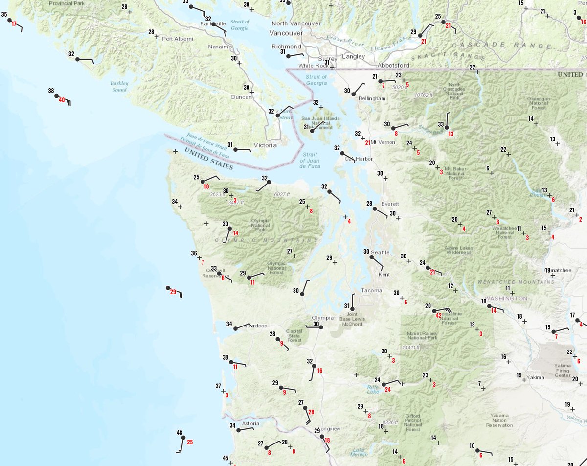
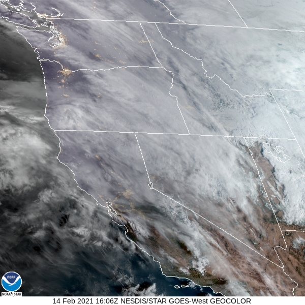
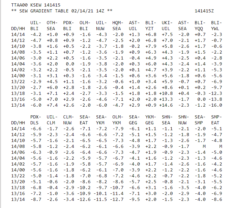
1. More -SN today as mstr overruns cold air. Model performance : horrible/inconsistent! Best bet: watch observations, satellite imagery, pressure gradients, and radar. All show weak convergence ongoing. Likely amts up to 3 inches depending whether/where precip band holds. #wawx
2. Here is the Langely Hill Radar at 8 AM:
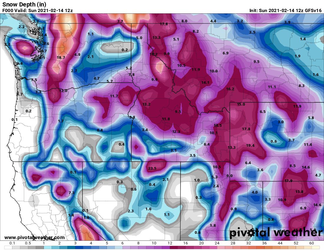
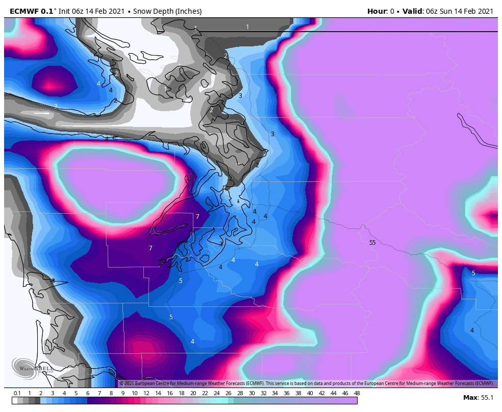
3. Going through the 06Z and 12Z models: all are initialized very poorly with initial snow depth. The Experimental GFS upgrade (version 16) appears best initialized at this point with a few inches on the ground. The 06Z ECMWF is not as good but better than yesterday. #wawx
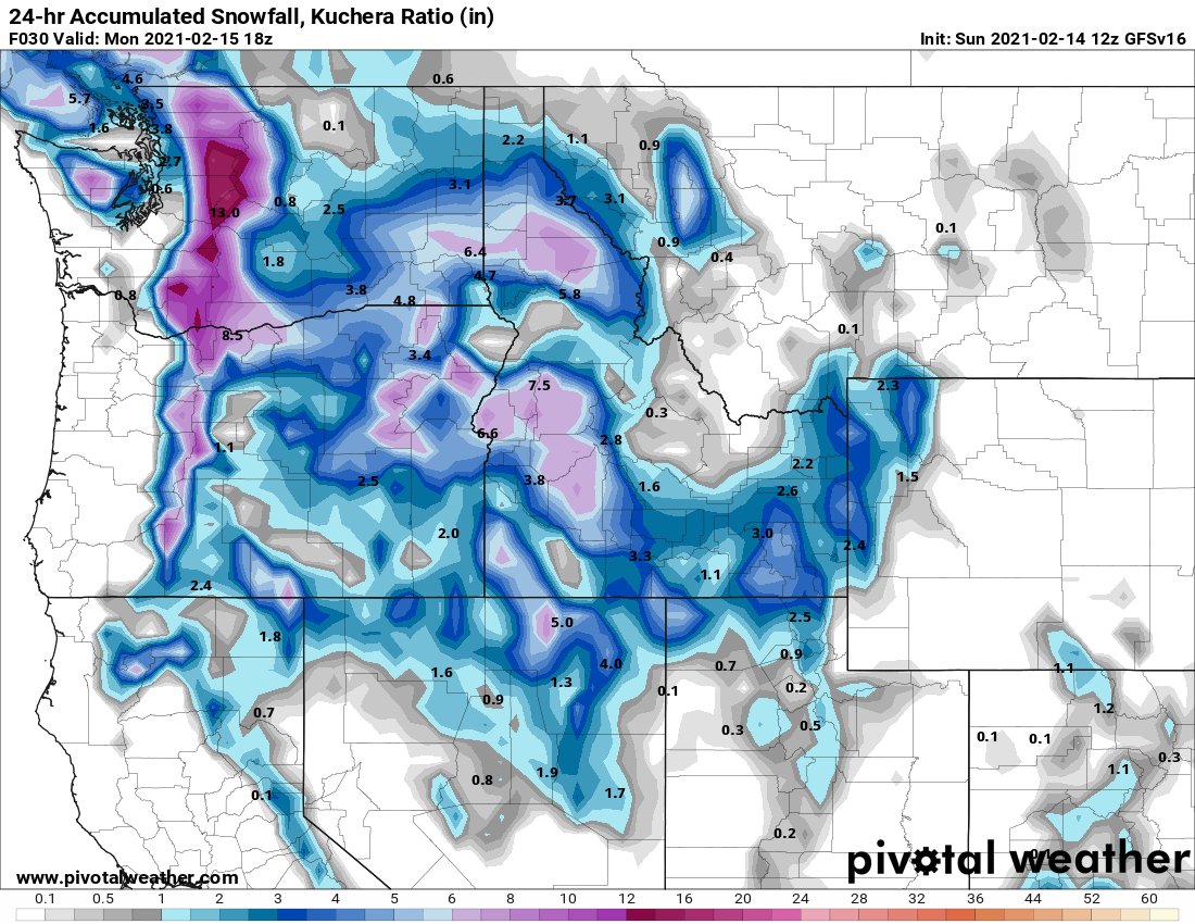
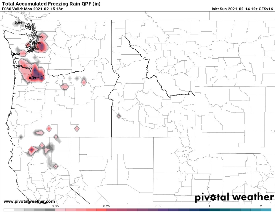
4. That may impact the fcst for precip type as we move through tonight and Mon morning. The Experimental GFS handles today best with 1-2" of snow, then maybe another inch north of Seattle Mon morning. It still shows 0.5" FZRA Seattle-North Bend Mon mrng though! #wawx
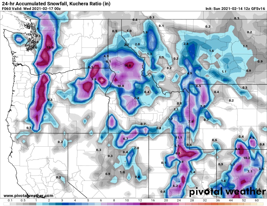
5. The Experimental GFS doesn't completely scour cold air out on Mon. It shows precipitation maybe going back to snow showers and further light accumulations Mon night into Tue. Most models scour cold air out. #wawx
6. Anyone's guess what will happen next 2 days. Recommendations: enjoy the weather, stay off roads, pay attention to @NWSSeattle latest forecasts as things evolve. I won't be able to respond to specific requests for what is happening locally. I have little clue! #wawx

 Read on Twitter