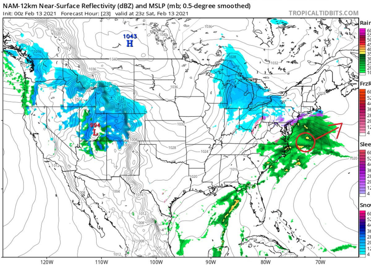
Analysis Thread: It's going to be long. Strap in. Let's start with Saturday evening courtesy of http://tropicaltidbits.com . You can see on Saturday evening a weak low well to our South and east. Heading just north of almost due east. This is not a spot conducive to give us a real...
significant amount of precip. The low is also very weak at this point. It will strengthen a touch as it moves away. But nothing to write home about. We'll be on the NW fringe of the shield of precip. We're looking at anywhere from a 0.10"-0.25" of liquid. The issue is, if most...
of this precip fall as rain or sleet and causes icing issues. It doesn't take much to wreak havoc on travel, and on tree branches and power lines. I will likely lower ice accretion totals a bit from first call map. But it doesn't make the threat of ice any less significant IMO...
Just look at what some overnight freezing drizzle did in Fort Worth the other day. I was planning to wait until tomorrow to bring up Tuesday. But here we are. So let's take a brief glance.
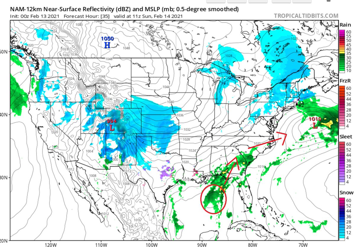
First, you might've noticed this little disturbance in the Gulf trailing far behind our Sunday system. This one should pull north, and then exit into the Atlantic out of E NC. It looks like it will pass far enough south to not give us any precip. This is NOT the system that...
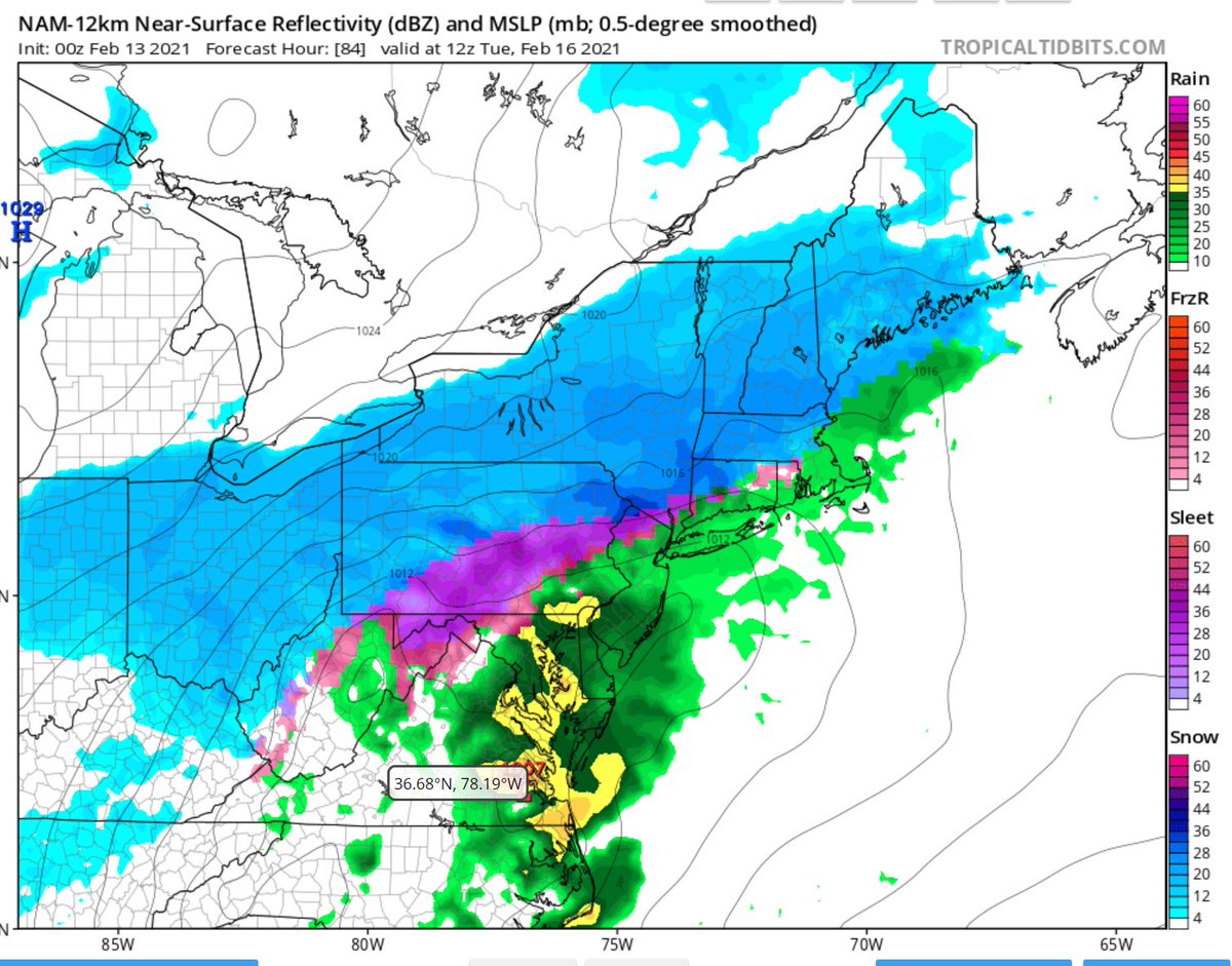
will effect us on Tuesday. That one will develop late Sunday night, early Monday morning over western Gulf. Possibly bringing sleet all the way down to Brownsville, TX. It will ultimately pull Northeast and cause a real mess in our area on Tuesday.
The issue on Tuesday is trying to figure out where Rain/Mix/Snow lines ultimately set up. I honestly think the NAM is too warm at the surface and 850 layer. I think we'll see it trend colder over the next few days. My gut tells me a mix sets up in NE NJ, NYC, and LI. And...
mostly snow in the HV and in CT away from the water. I hate to say it for those at the Jersey Shore. You're looking at mostly rain, with maybe a mix with sleet occasionally. These are early ideas though, and can change. If you made it this far, thanks lol. The weather pattern...
starting to become very complicated with these frequent storms. I feel it makes things easier to break everything down with these longer threads. To get my ideas out and have you understand better what I'm seeing, and why I'm drawing the conclusions that I am. Hopefully you...

 Read on Twitter


