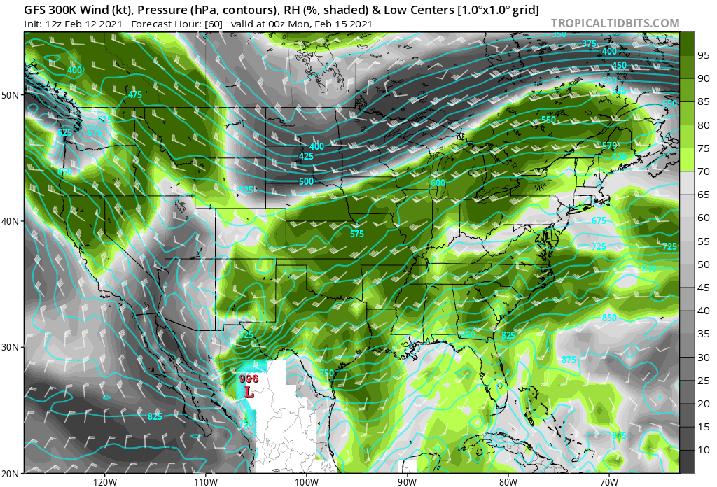
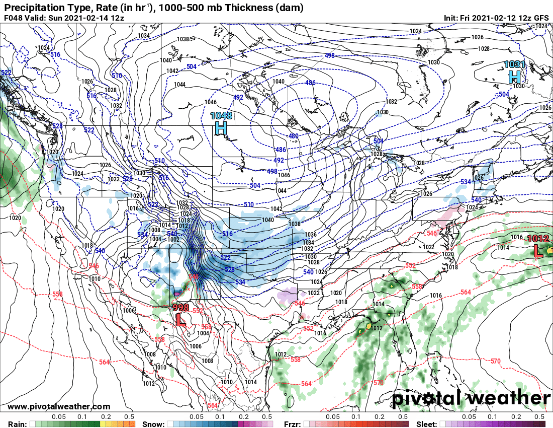
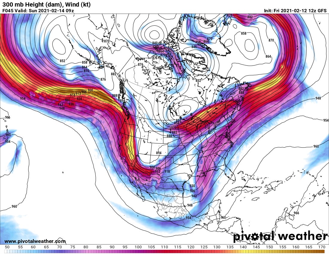
Looking toward late this weekend, there is a broad consensus among models that a "ski jump" trough will be entering the far southern Plains by late Sunday night. Despite some subtle differences in timing, the impact is the same: a broad region of focused ascent over OK and TX.
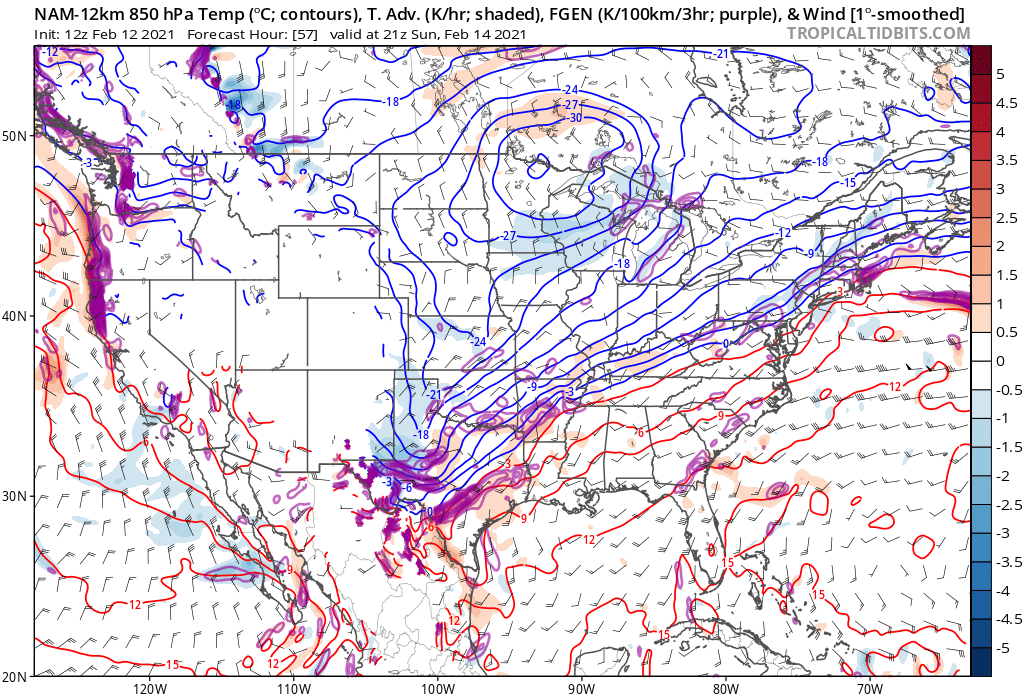
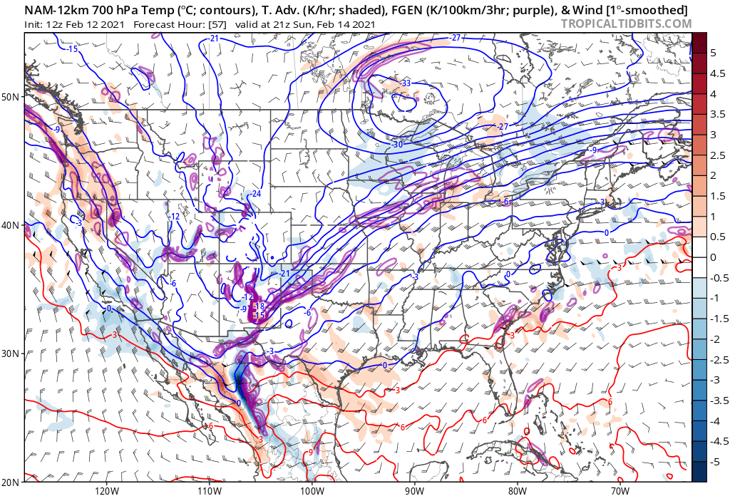
The ascent can be noted over central and west Texas in each model, where by Sunday night an 850 mb trough/low will form with WAA to its northeast.
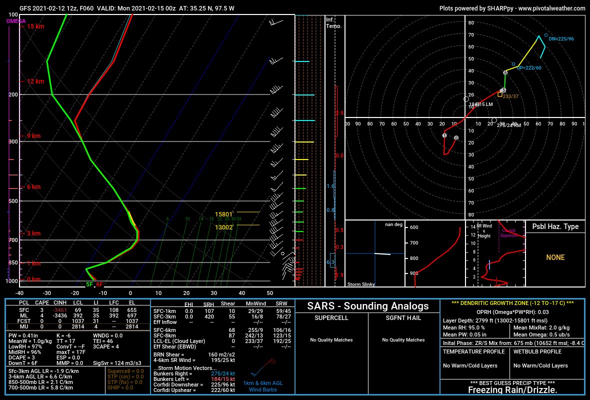
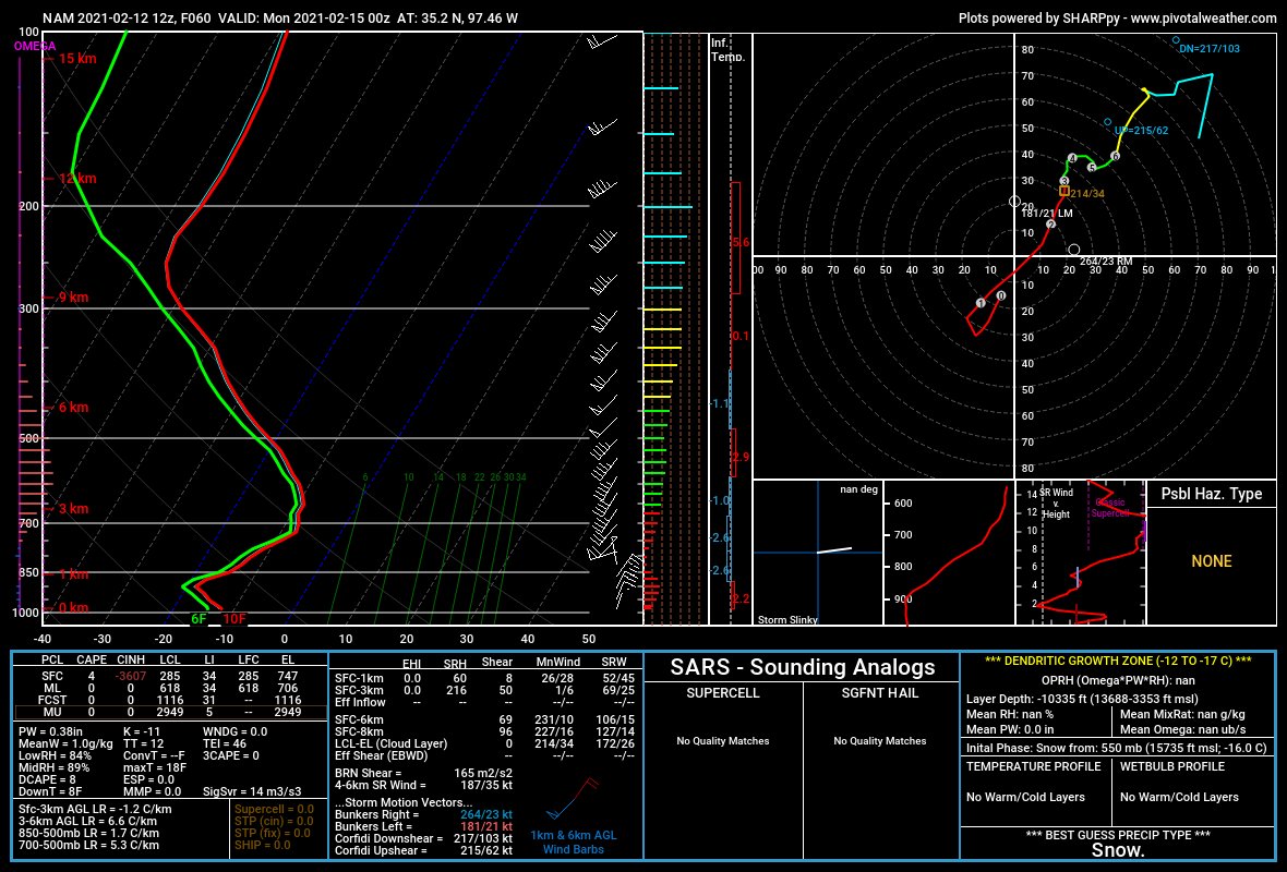
Forecast soundings on the GFS and NAM notably depict rather straight hodographs - although there's an abrupt shift from northerly/northeasterly surface winds to southwesterly aloft, I don't know if this is the old "180 degrees of veering" showing warm advection.
And... yeah. The whole "isentropic analysis" school of thought really doesn't yield a whole lot. Frontogenesis in the 850-700 mb layer is modest, there's generally light WAA... As someone who's learned winter forecasting here on the Southern Plains, I'm out of my element.
So what gives? Why is there talk of a major-impact snowstorm? Well, first of all, in the wake of a major northern-stream jet, a powerful anticyclone will develop over the northern Plains. This will push a *truly* Arctic (not just annoyingly cold like we've had) airmass south.
Speaking of that northern stream, by Sunday the central Plains should be between two phasing jet maxes - in the right entrance region of one, in the left exit region of the other. Both of those regions are the ascending branches of the general speed max circulation.
So instead of the canonical Oklahoma event where a few hours of warm advection/deformation banding hammer someone with heavy, wet aggregates, we're going to be in a position where moderate snowfall may occur over a prolonged period.
The 09Z SREF suggests that daybreak Sunday to daybreak Monday look like the likeliest times for snow to fall in Oklahoma City. I'd say the ensemble median QPF is about 0.5 inches.
So what are the bottom lines?
-Beginning early Sunday, snowfall is likely across most of Oklahoma. Given how fluffy it will be, it will accumulate efficiently and blow around easily. It may be impossible to measure anyway, so focusing on snowfall amounts doesn't make sense.
-Beginning early Sunday, snowfall is likely across most of Oklahoma. Given how fluffy it will be, it will accumulate efficiently and blow around easily. It may be impossible to measure anyway, so focusing on snowfall amounts doesn't make sense.
Instead, focus on impacts:
-Travel will likely be dangerous Sunday into Monday, even after the snow ends given the potential for blowing snow on roads reducing visibility.
-This may continue into Tuesday when another round of snow appears possible (stay tuned).
-Travel will likely be dangerous Sunday into Monday, even after the snow ends given the potential for blowing snow on roads reducing visibility.
-This may continue into Tuesday when another round of snow appears possible (stay tuned).
It will be really frickin' cold. I hate the phrase "dangerous cold" because it gets tossed around in willy-nilly in Oklahoma any time wind chills drop below 10, but with wind chills likely to drop into the negative 10s to 20s you really need to limit outdoor exposure Sun-Tues.

 Read on Twitter