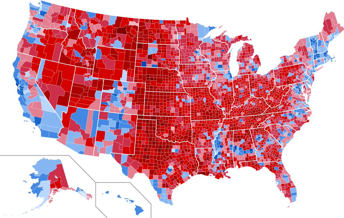
One of the reasons that looking at county maps of national elections is not very informative is that in every state in the Union, the majority of people live in a minority of the state's counties.
In some cases, the population concentration is pretty extreme. Some examples:
In some cases, the population concentration is pretty extreme. Some examples:
(In order of percentage of counties in which the bulk of the population lives)
Texas has 254 counties. But most of the population lives in the 7 largest counties.
Illinois has 102 counties. But most of the population lives in the 3 largest counties.
Texas has 254 counties. But most of the population lives in the 7 largest counties.
Illinois has 102 counties. But most of the population lives in the 3 largest counties.
Nebraska has 93 counties. But most of the population lives in just the 3 largest.
Kansas has 105 counties. But most people in the state live in the 4 largest counties.
Minnesota has 87 counties. And most Minnesotans live in just the 5 largest.
Kansas has 105 counties. But most people in the state live in the 4 largest counties.
Minnesota has 87 counties. And most Minnesotans live in just the 5 largest.
And, since we're coming off of the Election of 2020, the swing states are interesting to note.
Most of the population of Arizona lives in Maricopa county and not in the other 14 counties.
Georgia has 159 counties. But most Georgians live in just the 12 largest counties.
Most of the population of Arizona lives in Maricopa county and not in the other 14 counties.
Georgia has 159 counties. But most Georgians live in just the 12 largest counties.
Michigan has 83 counties. But most Michiganders live in the 6 largest counties.
Wisconsin has 72 counties. And most people in the state live in the 9 largest.
Pennsylvania has 67 counties. Most in the state also live in just the 9 largest counties.
Wisconsin has 72 counties. And most people in the state live in the 9 largest.
Pennsylvania has 67 counties. Most in the state also live in just the 9 largest counties.

 Read on Twitter


