[THREAD]
WEDNESDAY EVENING SNOW UPDATE:
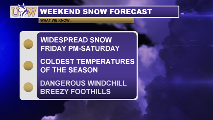
Some light snow showers are currently impacting the Northwest Interior. These areas could pick up light accumulations overnight, but eyes are ahead to tomorrow's system which will be more significant.
#wawx #wasnow
WEDNESDAY EVENING SNOW UPDATE:
Some light snow showers are currently impacting the Northwest Interior. These areas could pick up light accumulations overnight, but eyes are ahead to tomorrow's system which will be more significant.

#wawx #wasnow
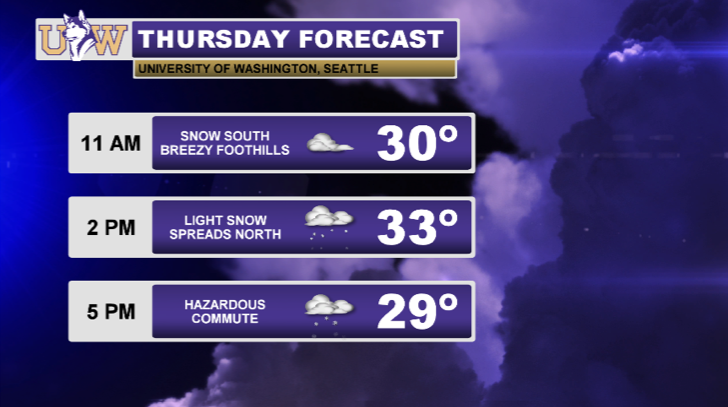
Here's a forecast for tomorrow:
Snow will spread from south to north throughout the day. Temperatures will struggle to surpass the freezing mark with accompanying #CascadiaWinds
Note: Temperatures are for Seattle. Wide range in temperatures throughout Western WA.
#wawx #wasnow
Snow will spread from south to north throughout the day. Temperatures will struggle to surpass the freezing mark with accompanying #CascadiaWinds
Note: Temperatures are for Seattle. Wide range in temperatures throughout Western WA.
#wawx #wasnow
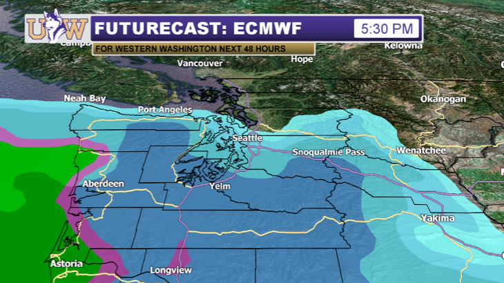
At 5:30pm, snow coverage will be quite widespread south of Seattle, but how far north the precipitation reaches is a wild card. Areas between #Tacoma and #Everett are the biggest question mark, as totals could range from a trace to 2".
#wawx #wasnow
#wawx #wasnow
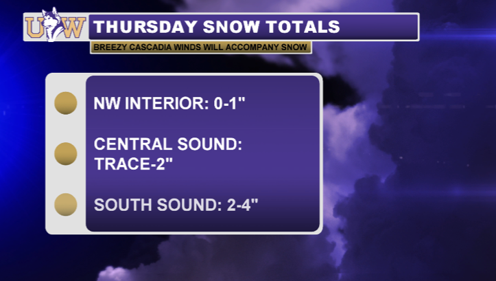
Here are expected totals for tomorrow morning-evening. Amounts will be light north of Seattle, but higher totals will impact areas such as #Olympia, where 2-4" is in the forecast.
#wawx #wasnow
#wawx #wasnow
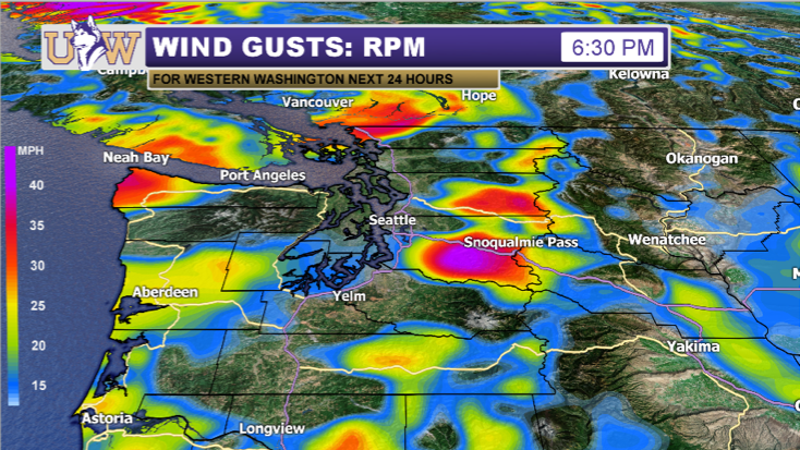
Along with the snow, #CascadiaWinds will be a headline tomorrow. Strong gusts of 40mph are expected near the Cascade gaps. Areas such as North Bend and Bellingham will be hit hardest by these winds. Wind Chill will cause real-feel temperatures in the teens and 20s!
#wawx #wasnow
#wawx #wasnow

 Read on Twitter
![[THREAD]WEDNESDAY EVENING SNOW UPDATE:Some light snow showers are currently impacting the Northwest Interior. These areas could pick up light accumulations overnight, but eyes are ahead to tomorrow's system which will be more significant. #wawx #wasnow [THREAD]WEDNESDAY EVENING SNOW UPDATE:Some light snow showers are currently impacting the Northwest Interior. These areas could pick up light accumulations overnight, but eyes are ahead to tomorrow's system which will be more significant. #wawx #wasnow](https://pbs.twimg.com/media/Et6sTzBUUAQ9Ik9.png)
