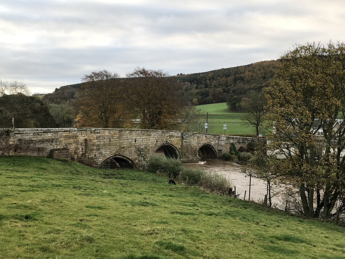
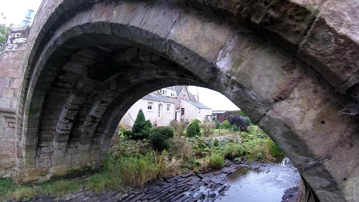
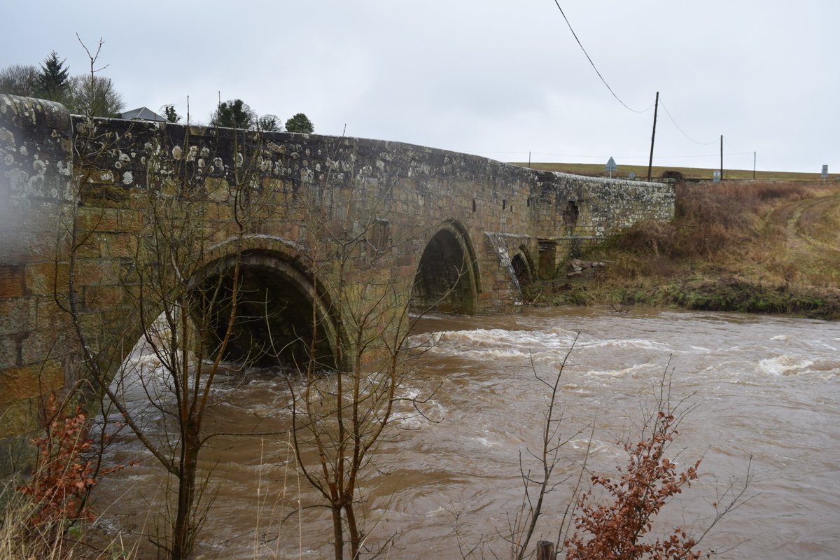
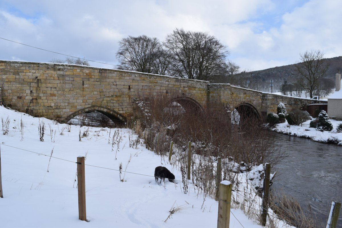
This is Dairsie Bridge. It is recorded as having been built by James Beaton, the Archbishop of St. Andrews, between 1522 and 1538. This makes it somewhere between 483 to 499 years old.
https://canmore.org.uk/site/32943/dairsie-bridge
https://canmore.org.uk/site/32943/dairsie-bridge
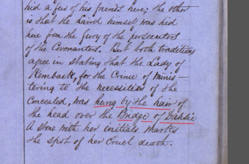
The OS Name Books record for the nearby Covenanters’ Cave, tell how Lady of Kemback, “was hung by the hair on her head over the Bridge of Dairsie”, for the crime of concealing Covenanters. So that's between 1660 and 1688.
https://scotlandsplaces.gov.uk/digital-volumes/ordnance-survey-name-books/fife-and-kinross-shire-os-name-books-1853-1855/fife-and-kinross-shire-volume-59/19
https://scotlandsplaces.gov.uk/digital-volumes/ordnance-survey-name-books/fife-and-kinross-shire-os-name-books-1853-1855/fife-and-kinross-shire-volume-59/19
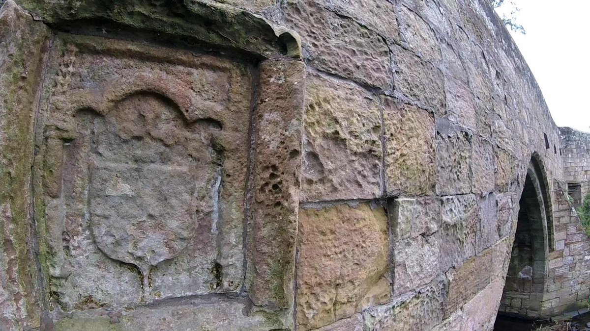
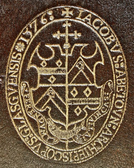
The bridge contains, what is described as an illegible armorial panel on the east elevation. In 1895, Alexander Millar identifies the panel as belonging to Archbishop, James Beaton.
The OS name book entry by James Ireland, dated 1853, states the panel marks the location of Lady Kemback’s execution with the panel containing her initials marking, “the spot of her cruel death”. I’m going with the panel belonging to Beaton.
https://armorial.library.utoronto.ca/stamps/IBEA002_s1
https://armorial.library.utoronto.ca/stamps/IBEA002_s1
The Transcriptions of the Edinburgh Architectural Association of 1892 state, “there was certainly an earlier bridge at Dairsie. There is no sign of it but this bridge was most likely wooden.
The Trans go on that, 'one summer day in 1496, as the king journeyed from St Andrew's to Stirling, he passed over it, and the Lord High Treasurer records the sum of 'Viijd' (one-third of a pound) as given 'to ane pur wif (a poor wife) at the brig of Dersie as the king raid by”.
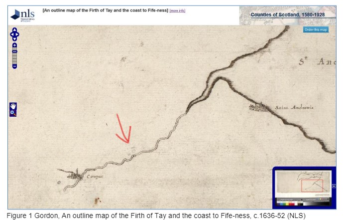
Between 1636 and 1652 the bridge is mapped. The map shows the two main burghs (St Andrews and Cowpar (Cupar)), the main obstacle to navigation (the river Eden) and the two ways to cross this obstacle.
http://maps.nls.uk/view/00000668#zoom=4&lat=1358&lon=4591&layers=BT
http://maps.nls.uk/view/00000668#zoom=4&lat=1358&lon=4591&layers=BT
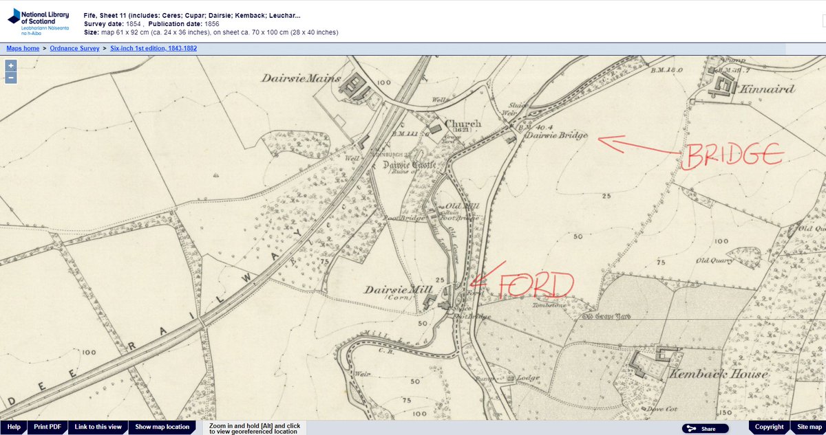
The OS 1st Edtion, 6-inch, 1854, shows a ford a short way to the west at Dairsie Mill. This is likely the original crossing point before the construction of the bridges and was likely the crossing point of many pilgrims heading to St Andrews cathedral.
https://maps.nls.uk/view/74426828#zoom=6&lat=8163&lon=9154&layers=BT
https://maps.nls.uk/view/74426828#zoom=6&lat=8163&lon=9154&layers=BT
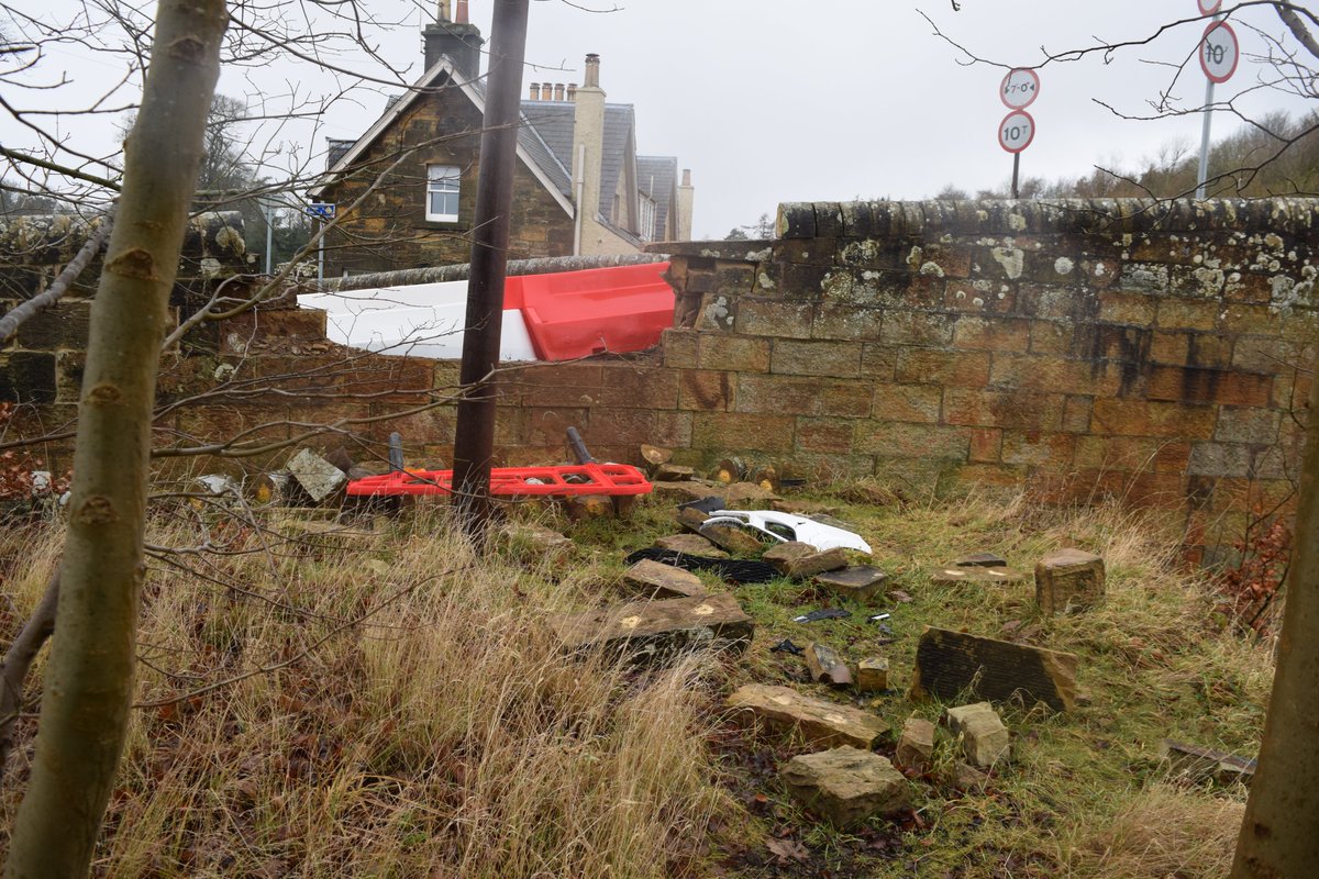
In recent years the bridge has undergone a number of misfortunes. In 2017 a car crashed through a wing at its south end. https://www.thecourier.co.uk/fp/news/local/fife/675139/historic-fife-bridge-in-urgent-need-of-essential-repairs/
This was repaired in 2019 only for a second car to smash through almost the same location early in 2020.
In the last week the bridge has been under pressure from flooding. Having only witnessed only one flood even in 25 years, there have been four in just the last year. The bridge looks tired and vulnerable. Note the fallen masonry on the NE wing.
The bridge continues to carry considerable volumes of traffic. I have seen huge tractors, fire engines and large trucks crossing it on a regular basis.
The bridge is between 483 to 499 years old.
This was the bridge this lunchtime.
The bridge is between 483 to 499 years old.
This was the bridge this lunchtime.
PS - Apologies to those who replied to the earlier version of this thread. I had to delete and repost due to a significant error of basic maths 


 Read on Twitter