Alright everyone, let's discuss the active weather pattern for this week. Here are the main areas of focus:
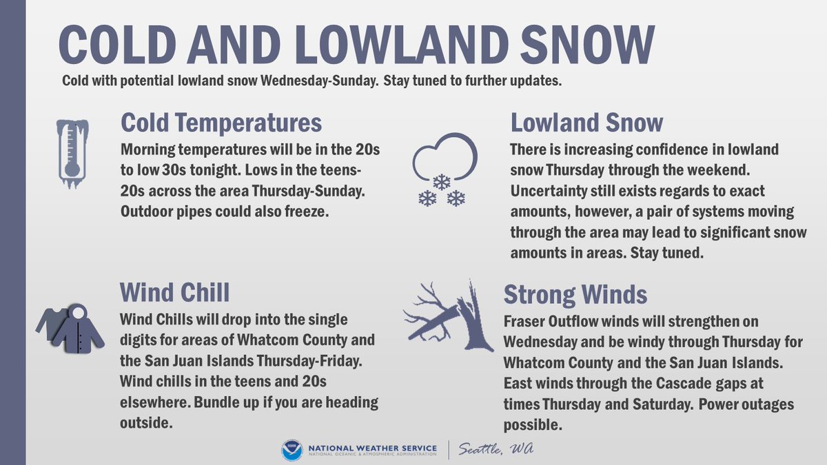
 Lowland Snow
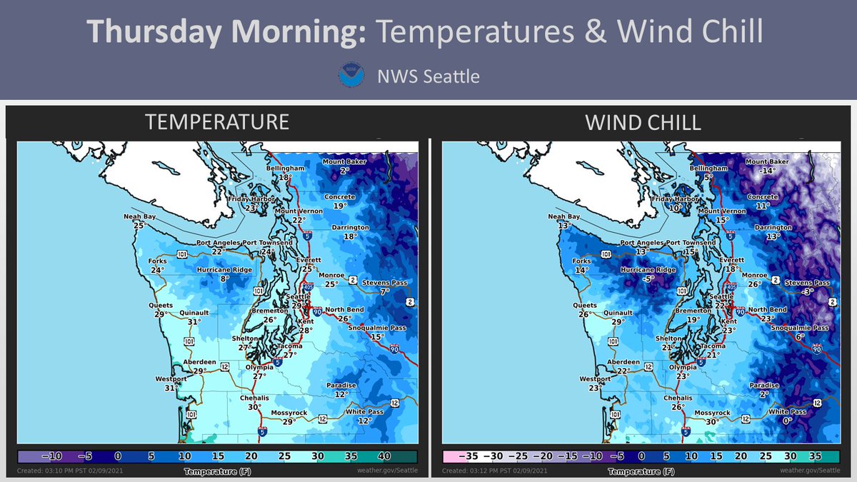
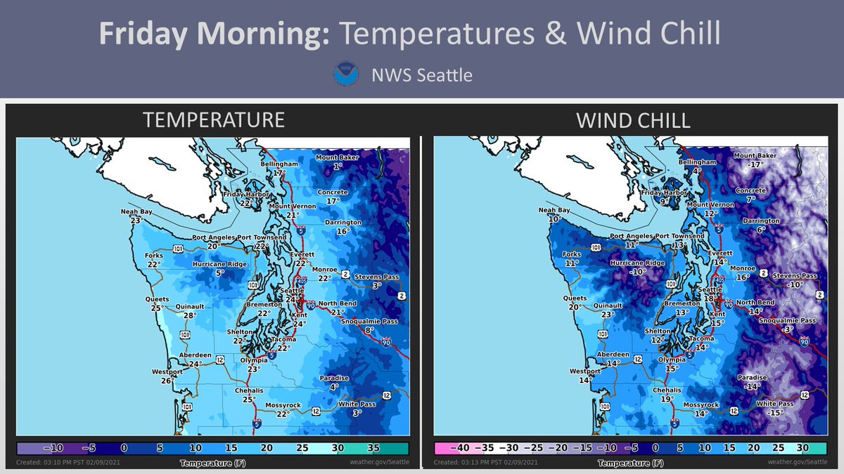
 Cold Temperatures & Wind Chill
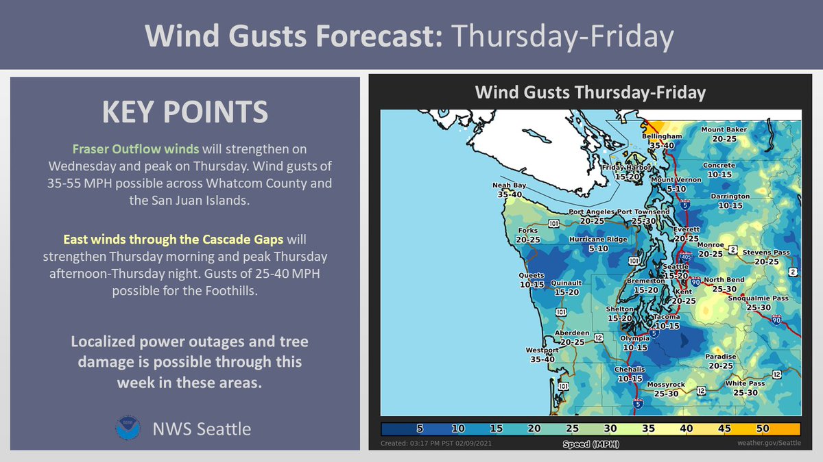
 Locally Strong Winds
 Lowland Snow
 Cold Temperatures & Wind Chill
 Locally Strong Winds
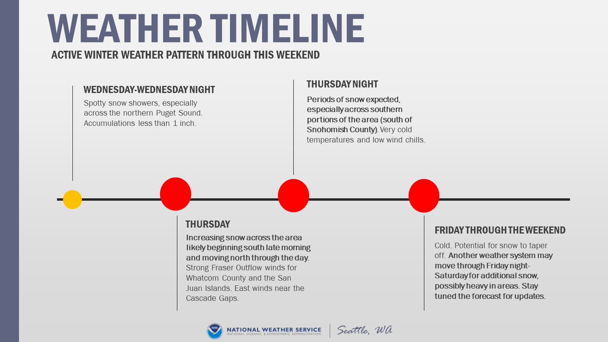
The active weather pattern is expected from Wednesday through the weekend. Spotty snow showers Wednesday, with increasing snow Thursday morning. The potential exists for another round of snow Friday night into the weekend. However, there is uncertainty in the forecast. #WAwx
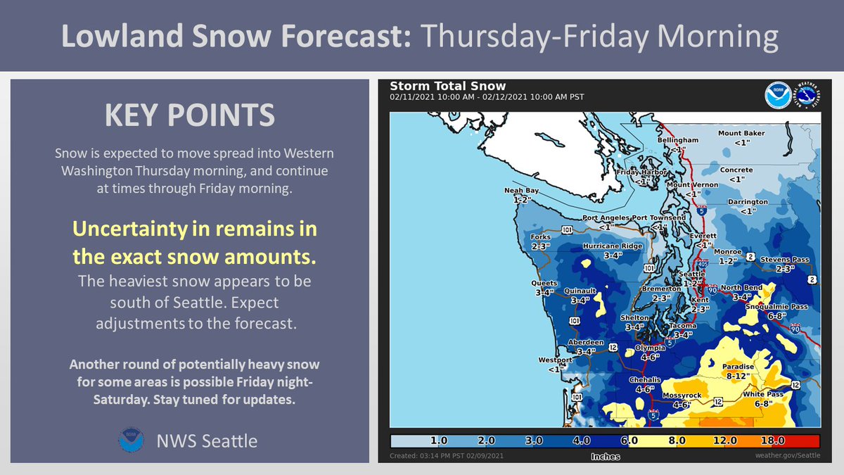
First call snow map for Thursday-Friday Morning:
Confidence is increasing in lowland snow for Thursday-Friday morning. Expect some adjustment to these snow amounts as we approach the event. Another round of snow potentially Friday night into the weekend. #WAwx
Confidence is increasing in lowland snow for Thursday-Friday morning. Expect some adjustment to these snow amounts as we approach the event. Another round of snow potentially Friday night into the weekend. #WAwx
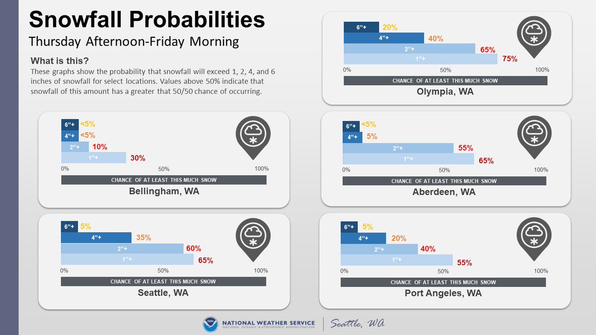
These graphs show the probability that snowfall will exceed 1", 2", 4", & 6" for select locations Thu PM-FRI AM. Values over 50% indicate that snowfall of this amount has a greater than 50/50 chance of occurring.
NOTE: there is still a chance of little to no accumulation. #WAwx
NOTE: there is still a chance of little to no accumulation. #WAwx
Along with the lowland snow, cold temperatures are expected through this week. Wind chills Thursday and Friday likely in the teens to 20s for most locations. Single digit wind chills for areas of Whatcom County and the San Juan Islands. Bundle up! #WAwx
Fraser Outflow winds will strengthen on Wednesday and peak Thursday. East winds will peak Thursday afternoon into Thursday night. Potentially windy into the weekend for these areas at times. Localized power outages possible. #WAwx
Monitor forecasts as we go through this week! Check http://weather.gov for the latest forecast for your location. #WAwx

 Read on Twitter