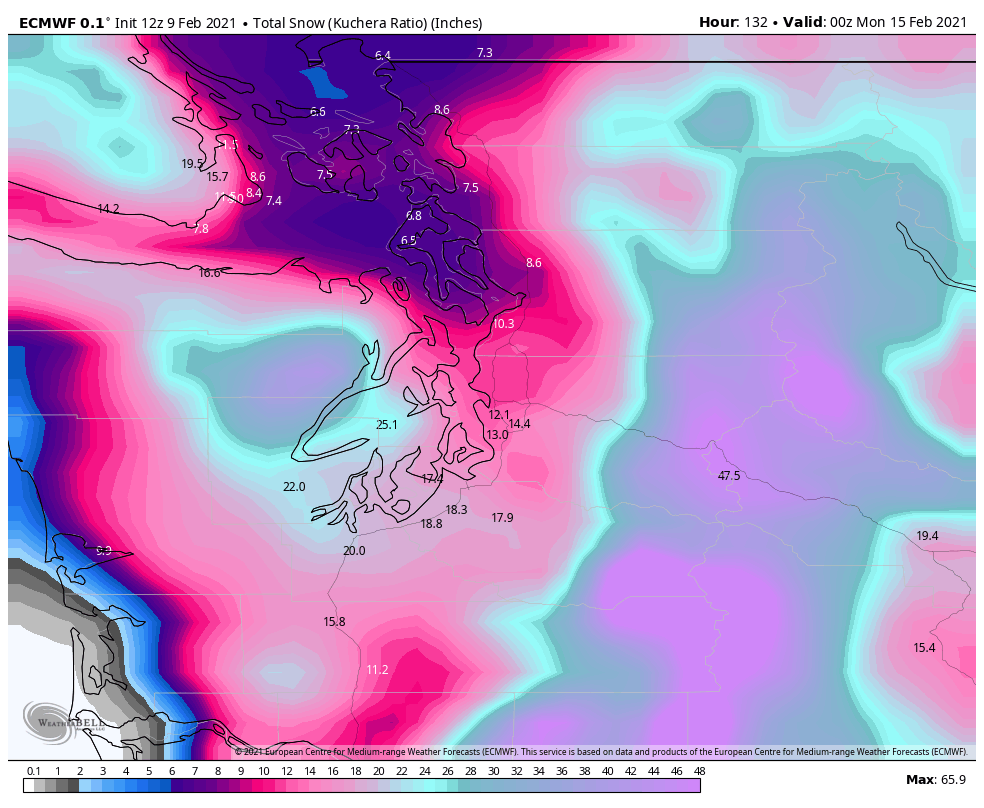
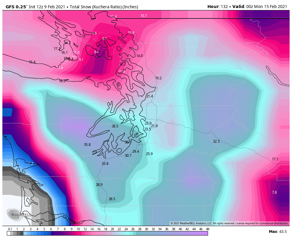
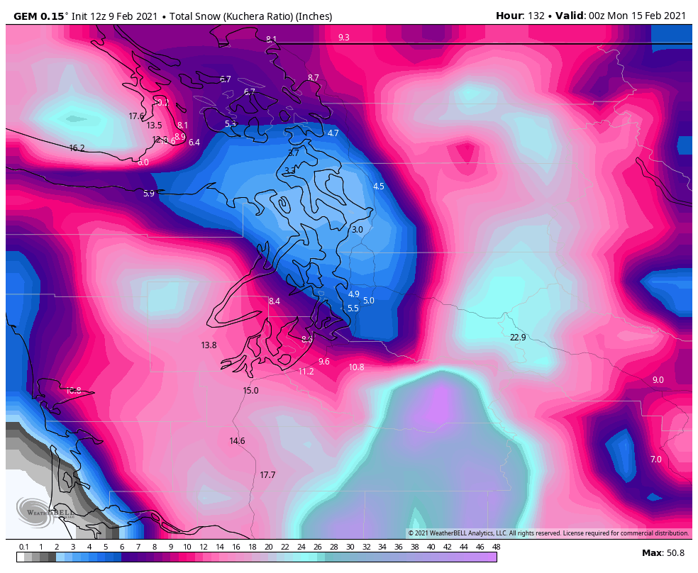
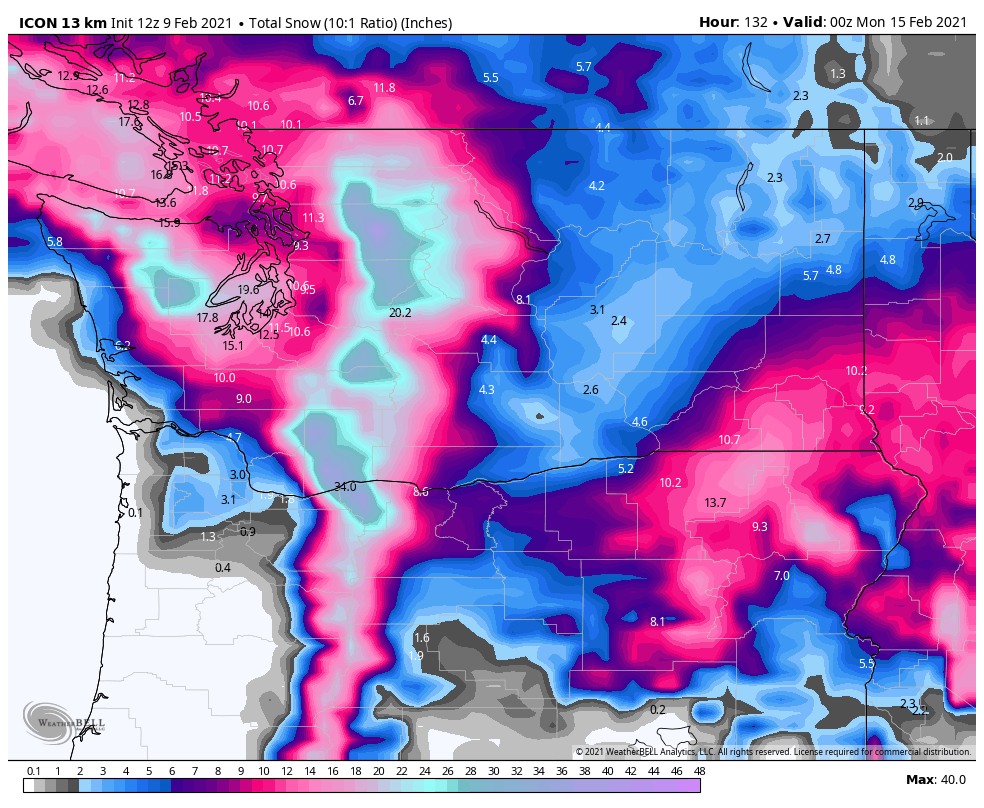
1/4 Alright, I've seen enough: I would start to prepare for snow starting some time Thursday AM and not really letting up until Saturday night at the earliest, at which point substantial accumulations could be seen across a wide swath of the area. Let's look at some models...
2/4 As has been noted across the #wawx universe this morning, the overnight & AM GFS runs (really the last holdout showing less amounts) have come around to the more snowy Euro solution. Here's some total snow maps from latest Euro, GFS, Canadian, & ICON models ending Sunday PM.
3/4 Even if we were to assume the insane snowfall amounts depicted on some of those maps are a little far-fetched, fairly widespread 4-8 inches still looks like a good bet. Two main rounds of snowfall to watch out for: Thursday/Friday & Saturday. Sat looks like the juicier system
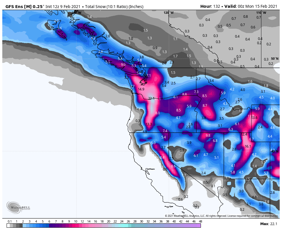
4/4 Let's look at some ensembles - a bunch of individual projections slightly tweaked from the main run to give an idea of possible outcomes. Included latest GEFS & EPS average snowfall amounts. High likelihood of significant snowfall accumulation across W WA, especially SW WA.
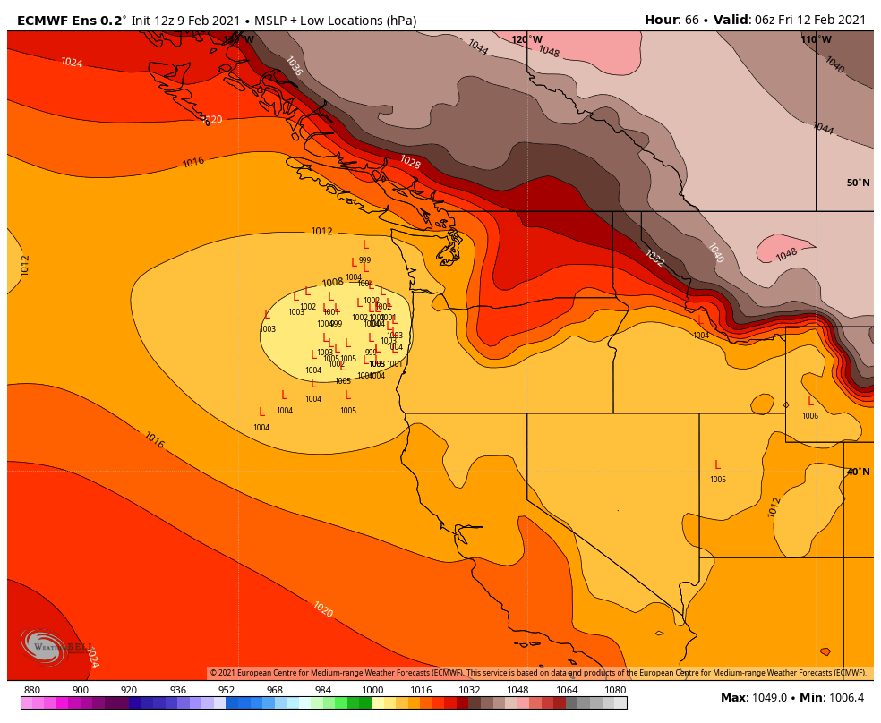
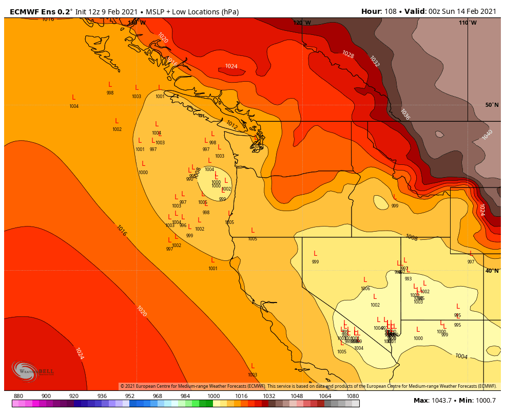
5/5 Finally, what could go wrong & cause us to have less snow amounts than what is shown? If systems continue to trend north they might pull in warmer air & cause less snow to fall. Latest EPS low locations map shows this isn't a large possibility for Thurs but Sat up in the air.

 Read on Twitter