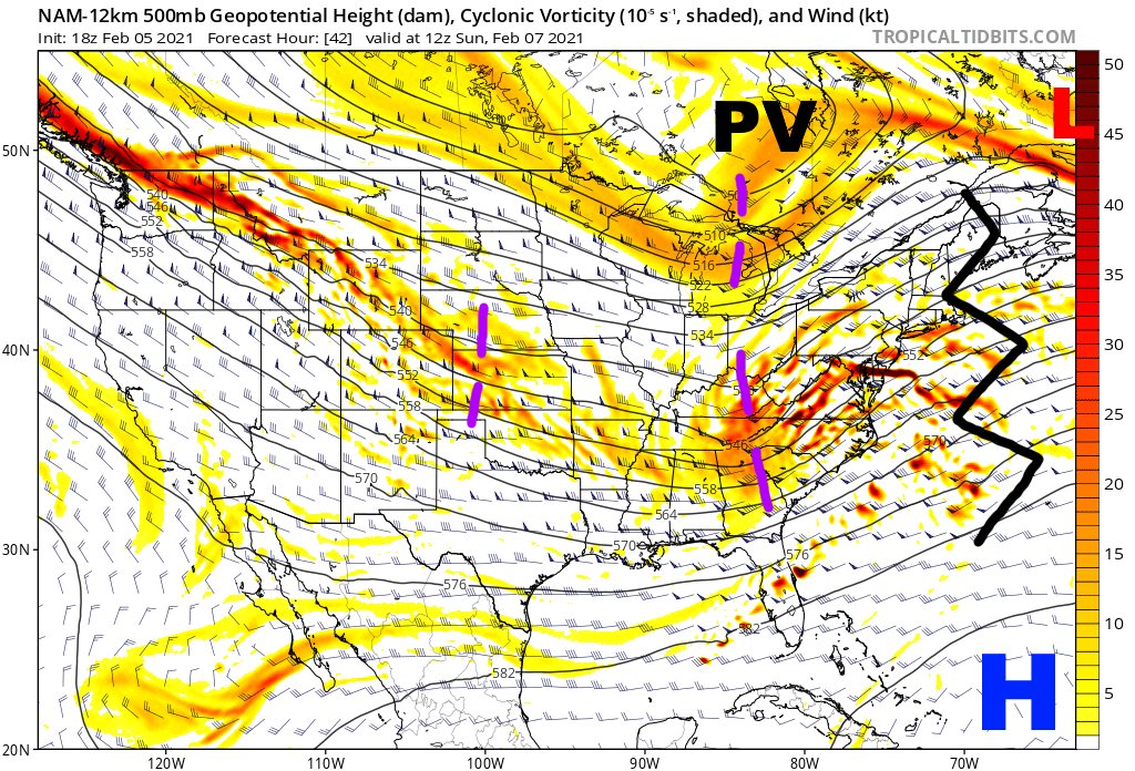
With models still bouncing around (but generally trending more amped) for the Sat Nt - Sunday coastal low and snow, it's important to keep stock of what may result in trends (in either direction). Lots of moving pieces still (NAM used to mark these features only) 1/8
Generally speaking, anything that allows for higher heights ahead of the storm encourages a more amped solution (and vice versa). A more favorable polar jet interaction and a more amped vort with our storm can both do this. Let's see how some models are trending... 2/8
The GFS trends are for a sharper vort with the storm, the TPV near James Bay to be located farther west, and for a sharper shortwave over the Great Lakes. This all allows for higher heights ahead of the storm, and a generally more amped trend. 3/8
While the RGEM has trended towards a sharper vort with the storm, it is shifting the location of the TPV east towards James Bay, which is beginning to limit height rises in New England despite a more amped storm initially. 4/8
The Euro hasn't trended that much sharper with the storm itself, but has trended towards a more amped shortwave over the Great Lakes, and towards lifting the trough over SE Canada out quicker, which still results in an overall northwest/amped trend. 5/8
Trends on the GFS ensemble match the op (generally). Note the trend towards an actual low closer to 50/50, which allows for better height rises ahead of the storm...and also note how the trend is for lower heights to shift towards the central CONUS, arguing for the NW trend. 6/8
The EPS features a similar trend for a better 50/50 low and better height rises ahead of our storm, along with a more amped shortwave with our storm. However, note the bump east with the PV near James Bay on the most recent run (which could limit further NW trends). 7/8
My guess is the vort with our storm comes in amped, and that the SE ridge trends a bit stronger in front of it. This is basically climo/clockwork. But, the TPV near James Bay is a big wild card. Inch that west and the storm may fly NW. Inch it east and it could bump back SE. 8/8

 Read on Twitter


