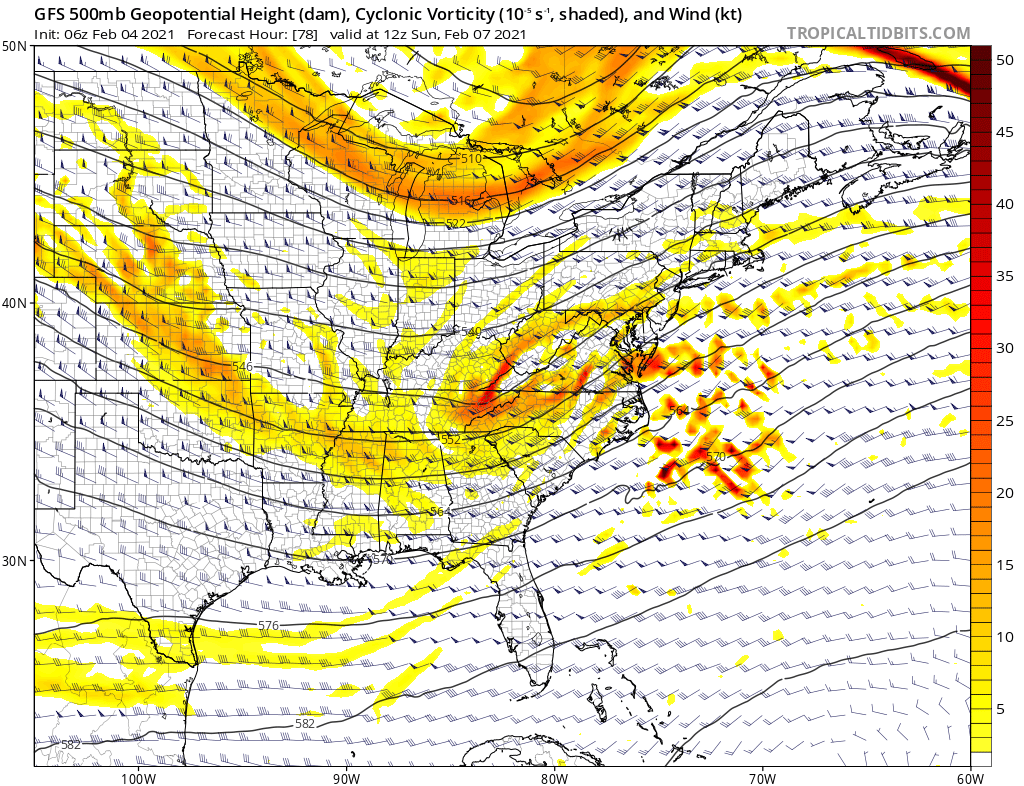
A complete "phase" of the northern and southern jet streams seems less likely this weekend, meaning the odds of a "Bomb Cyclone" are decreasing.
But that doesn't mean impactful winter weather is out of the forecast! It wouldn't take much adjustment for this setup to produce snow
But that doesn't mean impactful winter weather is out of the forecast! It wouldn't take much adjustment for this setup to produce snow
If the dip in the N stream (shown on the map above over the Great Lakes) is a little little farther west, a disturbance embedded within the S stream would have just enough room to move northeast and deliver potentially moderate/heavy snow.
Forecasts may be trending that way:
Forecasts may be trending that way:
For those with less practice reading the tea leaves at 500mb, here's a similar trend GIF for the sfc.
Note that the developing storm is a little closer to the coast in the more recent forecasts.
Veteran East Coast storm watchers know that this is the "sweet spot" for a NW trend
Note that the developing storm is a little closer to the coast in the more recent forecasts.
Veteran East Coast storm watchers know that this is the "sweet spot" for a NW trend

 Read on Twitter


