Yesterday I mentioned the Naval Operational Orders for the invasion of Normandy, it did not post some of my snippets I extracted on the detail of the planning, a few things that stood out to me contained within were..
Many of you will have seen this detail, but here is the breakdown of each beach area and task force including the beach area names and grid co ordinates. Not ground breaking information but very important to makes sure you head for the correct area.
It wasn't just as simple as sailing over, the convoys were prescribed exact details of formations down to yardage and even angles.
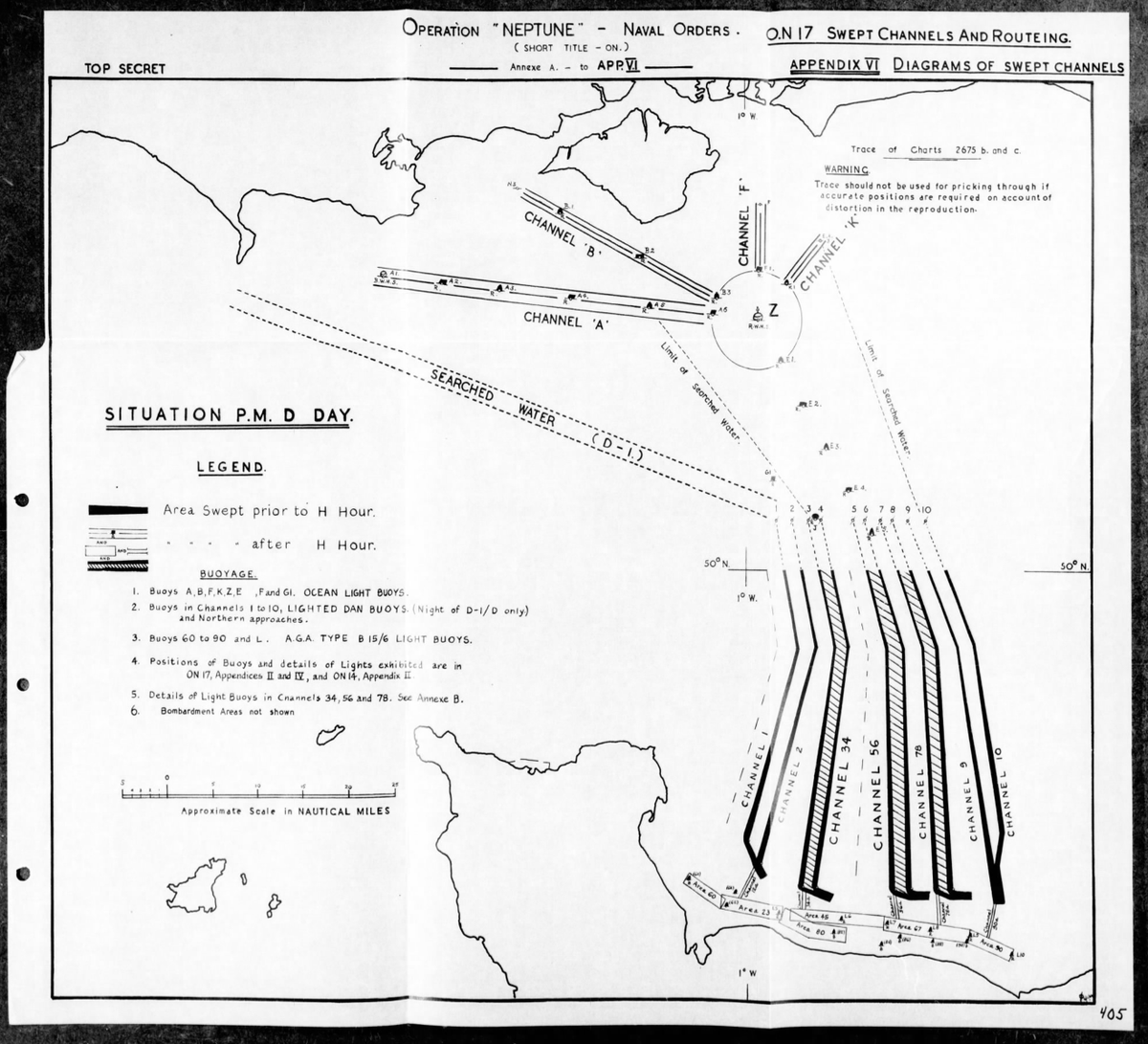
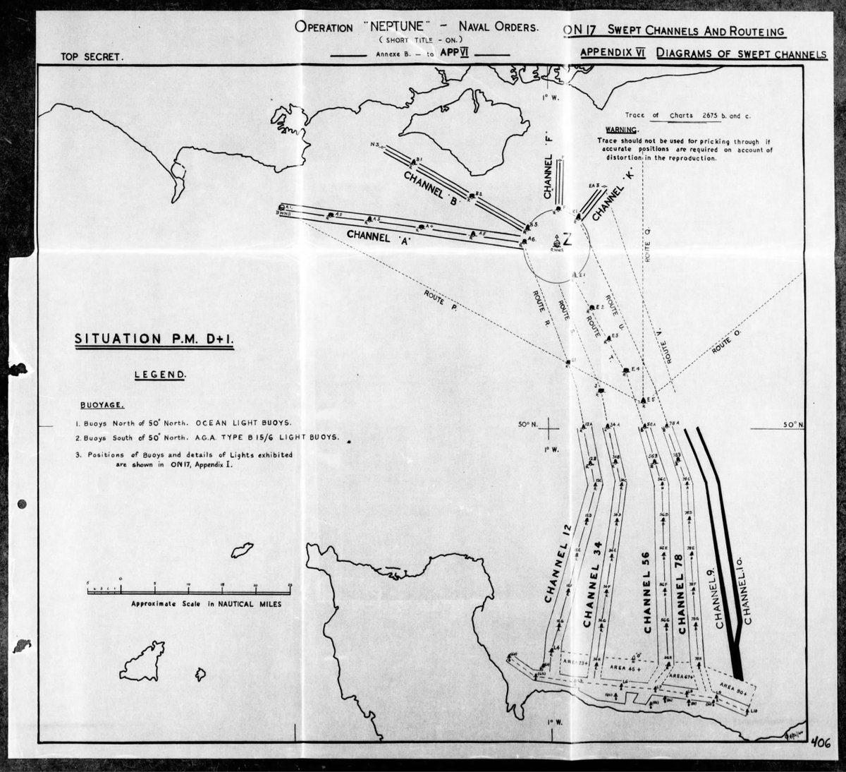
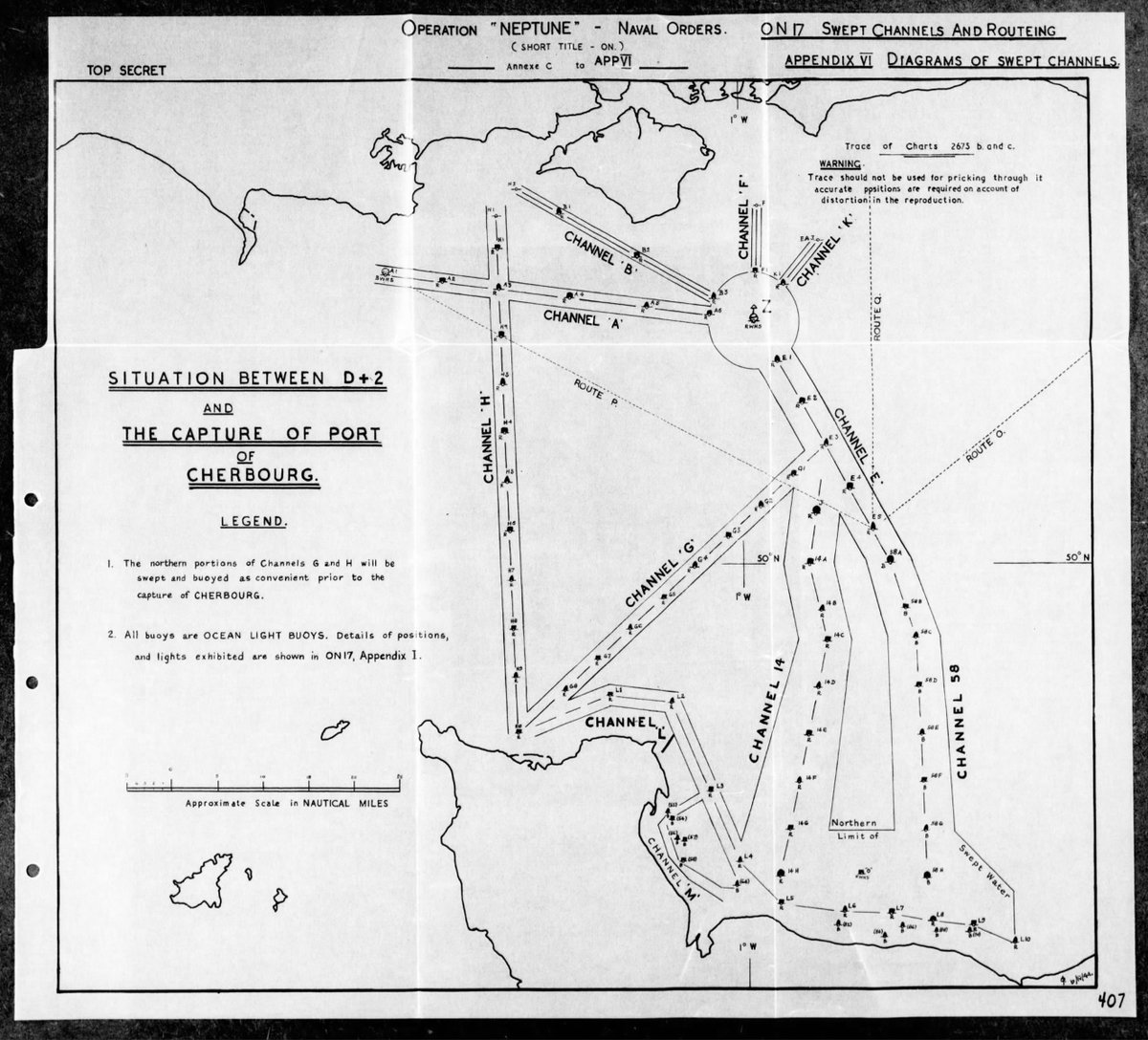
Minesweepers, not a case of head out on the 5th and come back once the landings started. Sweeping would continue to protect the naval fleet, allow supplies to get in and plan for trying to capture a port, here we can see the sweeping around Cherbourg.
The sea would become a giant ship park with designated anchorage points as you can see here. This is just for Sword beach and also details the defensive positions of the Trout line to the east.

 Read on Twitter


