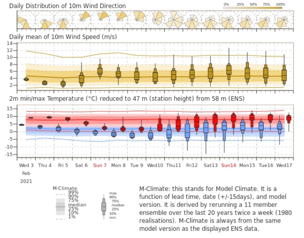
W COUNTRY OUTLOOK 1/3: After a periodically showery & comparatively mild phase Thurs-Fri, we shift into a markedly colder period developing through weekend & on into next week. By Sunday, temperatures will be well below avg (ECMWF ensemble v climatology below, #Bristol shown)...
2/3...with marked windchill in brisk NE wind. Mostly dry; a few snow showers perhaps getting across esp into NE/E districts. The cold conditions continue into *at least* early nxt week (models won't adequately resolve small-scale features at that range so snow risk uncertain)...
3/3...Timing & evolution of how cold conditions are eventually overridden from W/SW is uncertain. Models *can* lean to this outcome happening too quickly. Current indications suggest poss shift midweek (Weds-Thurs), w broader potential for snow in SW/S England around that period.

 Read on Twitter


