I have been asked by a few why I have so much confidence that we will turn very cold late this week. This will be the first of a number of tweets explaining the process and why it is science, not computer model output, that leads to the end result.
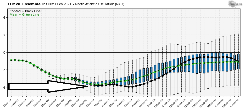
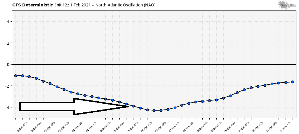
If there is one thing that specifically spells cold for our part of the world, it is a negative NAO (North Atlantic Oscillation). When the NAO goes negative, it blocks storms over the NE US. That block will tug the Polar Vortex southward. It is a reliable indicator of very cold.
Armed with this info, we look at the NAO through mid February. This is coming from the EPS and GEFS (both ensembles). These two are showing the exact same thing... a SUPER negative NAO through mid February. This isn't slightly, but it is a MONSTER negative NAO.
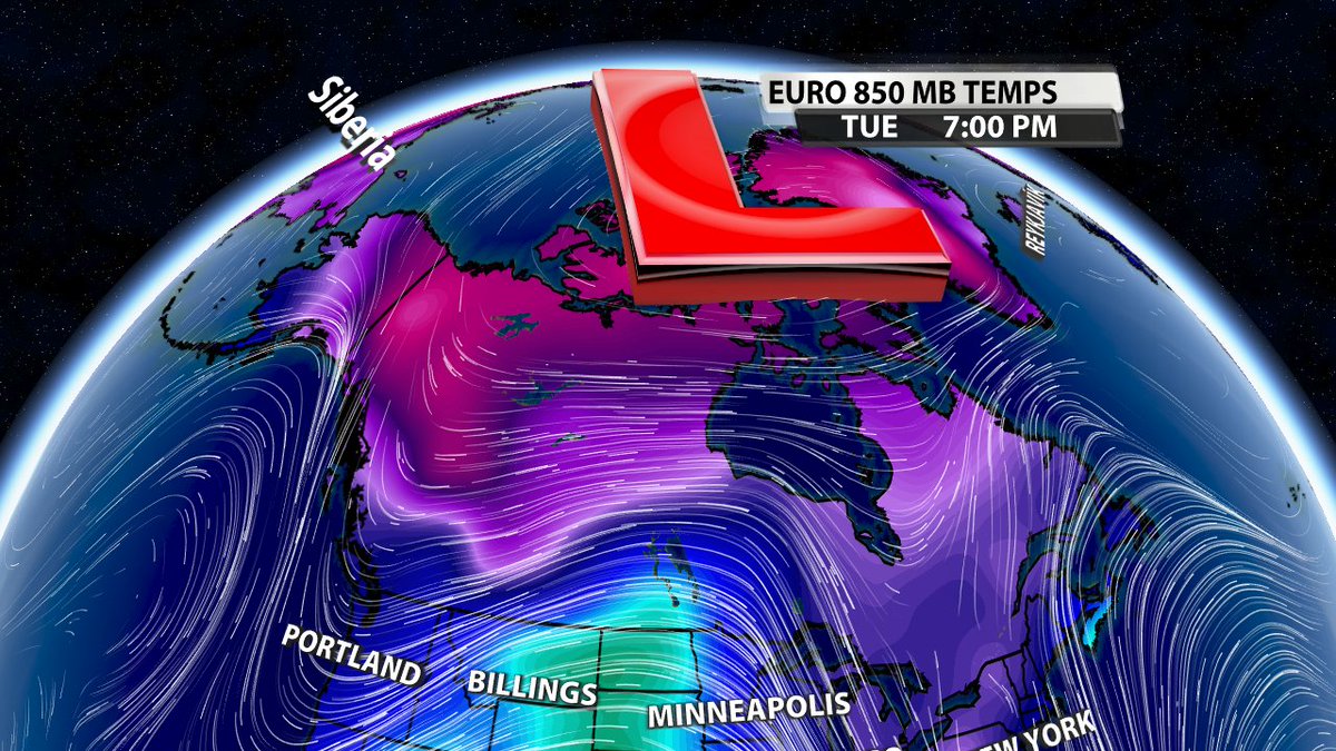
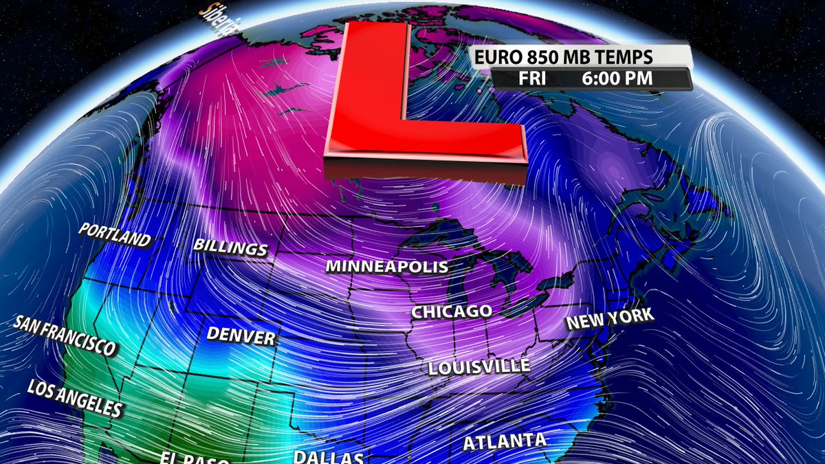
Negative NAO = blocked storms in the NE US. This is **critical**. This will pull the Polar Vortex (PV) or a lobe of the Polar Vortex toward the US. We use this knowledge to test the reliability of the data. It must show the PV moving toward us or it is erroneous.
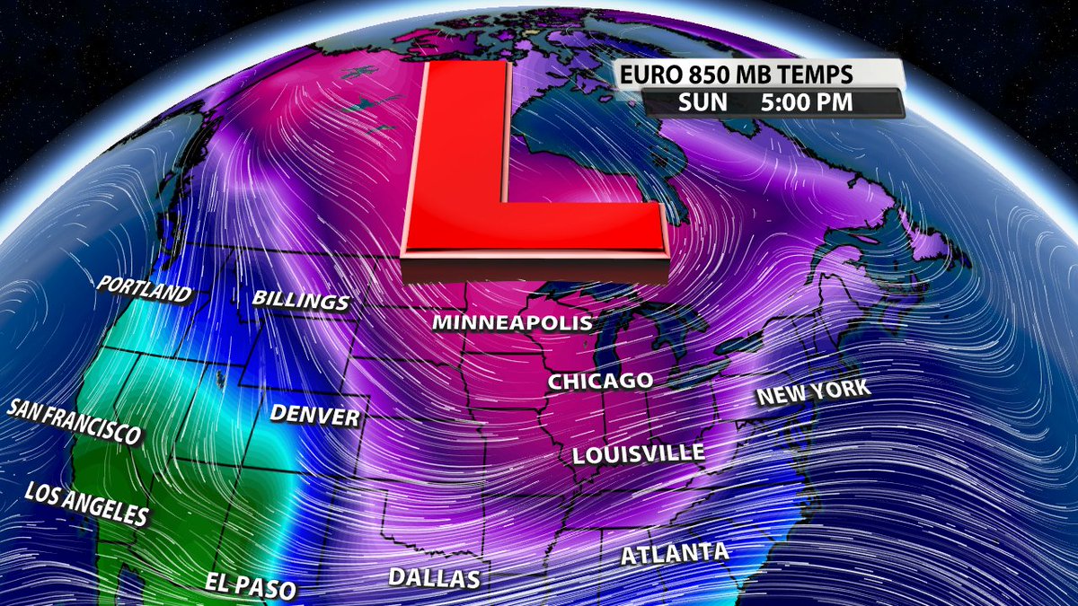
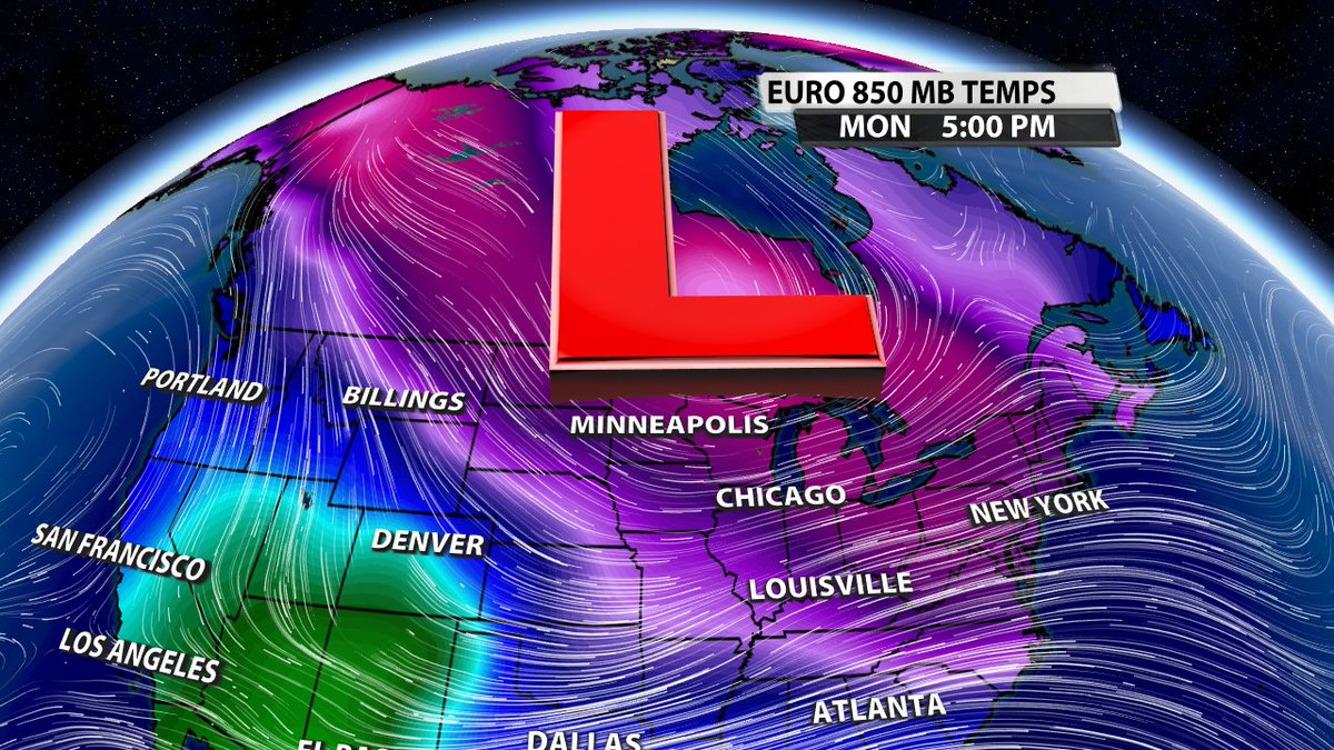
Armed with this expectation, we dive into the data. The following 4 images show the placement of the Polar Vortex Tue through early next week. Notice how it gets tugged further and further south to near the Great Lakes before camping. This is EXACTLY what should occur.
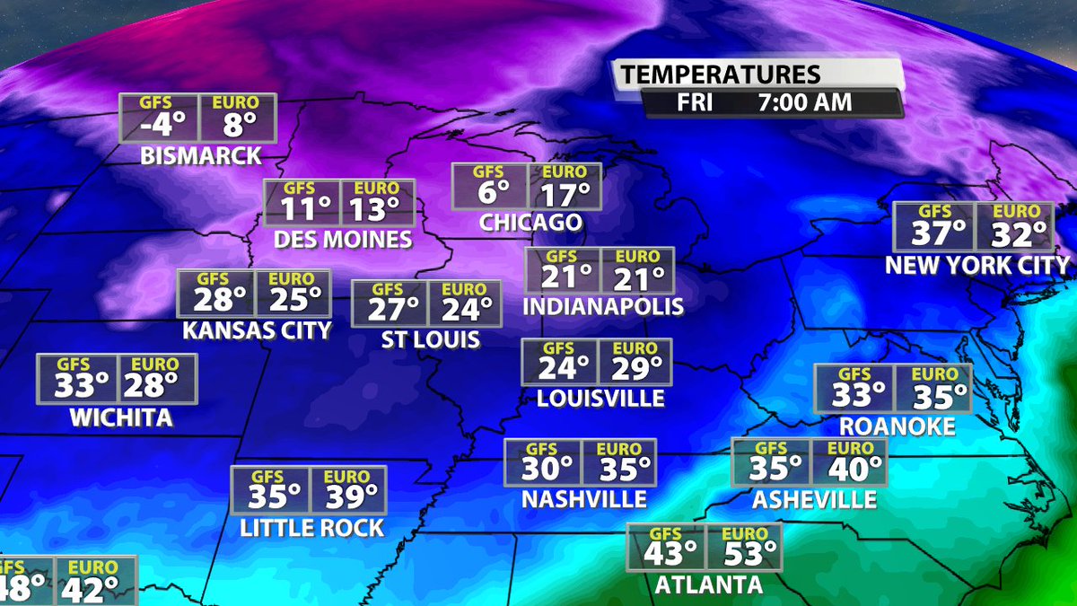
From here, we know the cold should follow the Polar Vortex southward. Looking into the data, you can see by Friday morning, the cold has started to spread into the N. US. Notice the both the GFS and EURO have frigid temps near the Canadian border.
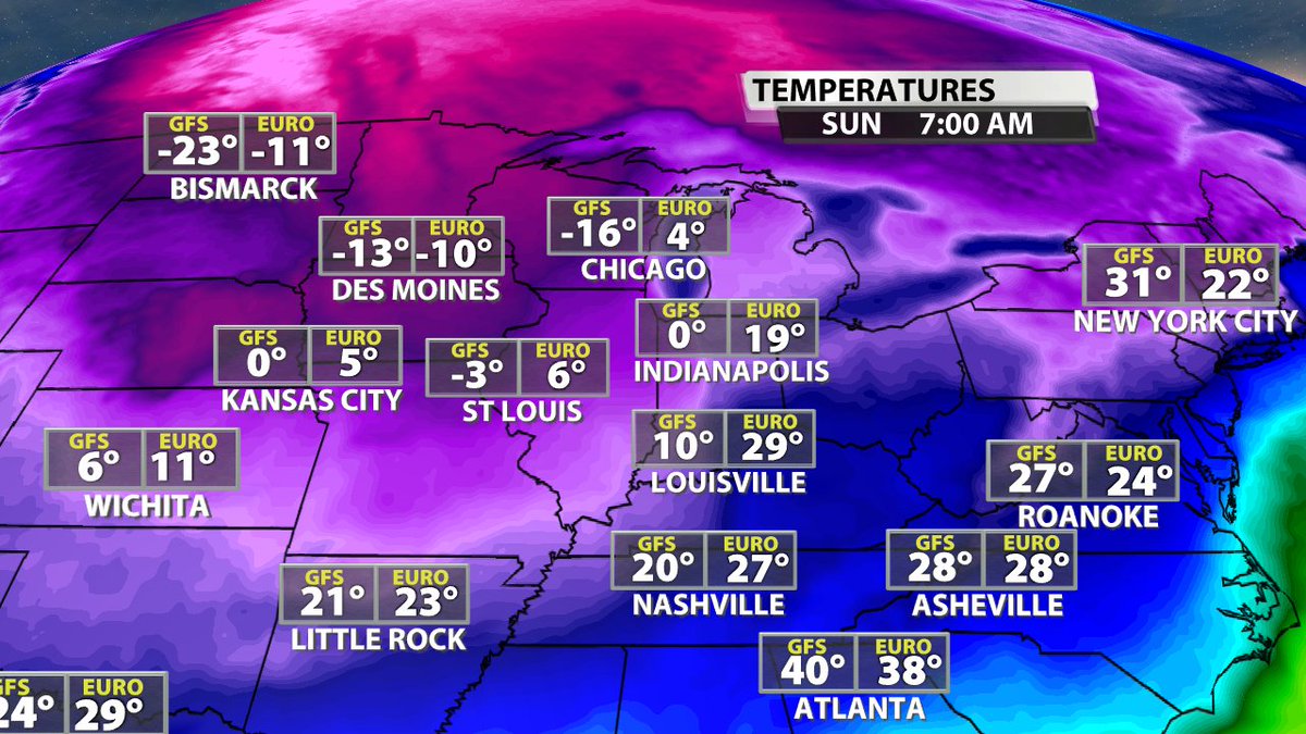
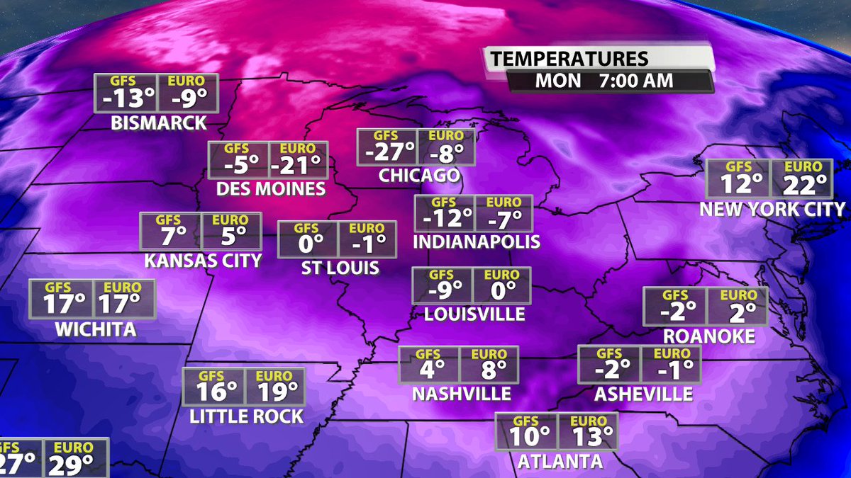
By Sunday, this brutally cold air has blasted into the US. Notice the widespread sub zero temps all the way to Midwest. These are AIR TEMPS, not wind chills. The timing differences between the two models frontal passage show up with the wide range of temps in #Louisville.
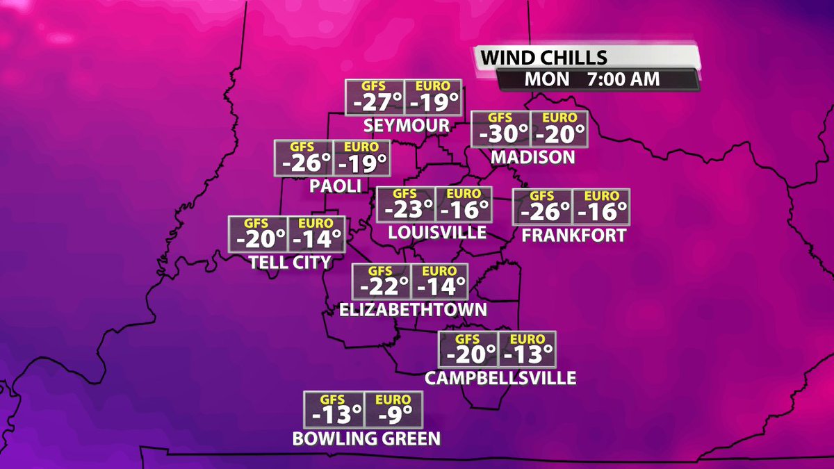
By Monday, there are no differences anymore in #Louisville. Both the GFS and EURO are showing absolutely brutally cold **air temperatures** in our area. The wind chills would be 10 to 20F colder than these numbers. This is absolutely brutal.
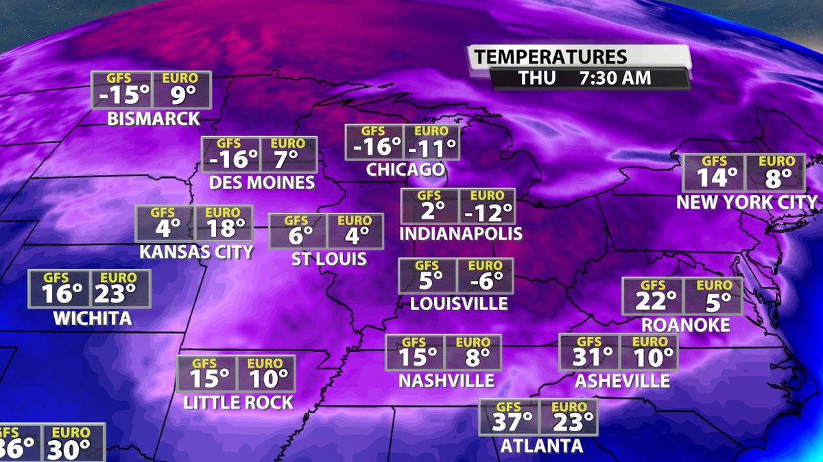
After another storm moves through on Tuesday, you can see how it re-enforces that cold in our area. GFS goes 5F here while the EURO goes -6F. This is nothing less than painful cold.
The icing on the cake here is that this cold will be accompanied by wind. The air temps are frigid, but the wind chills are next level. You see exceptional consistency between the GFS and EURO for early next week.
Ultimately, this will be the coldest in a couple years here.
Ultimately, this will be the coldest in a couple years here.
The analysis of the data took us from a trigger event occurring when the NAO goes very negative. That causes a cascade of events that tugs the Polar Vortex toward the US, draws in extremely cold air, then dumps it into the US and our area. This analysis verifies the model data.
We can therefore acknowledge the accuracy of the model data through this analysis,
-- The bottom line... it is about to get REALLY cold starting Sunday. so prepare.
-- The bottom line... it is about to get REALLY cold starting Sunday. so prepare.

 Read on Twitter