Good morning, it's Monday, if you teach in North America you should know about the city of #Cahokia ( https://whc.unesco.org/en/list/198/ ), the kingdom it was the heart of, the pyramids they built, and the MASSIVE cultural and historic footprint it had. #VastEarlyAmerica 1/
First and foremost, it wasn't called Cahokia--we are left with deeply imprecise terms. It gets called Cahokia from the Cahokia tribe of the Illiniwek Confederacy who lived in the region when the French came in the 17th c. 2/
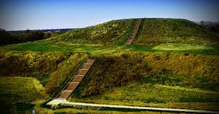
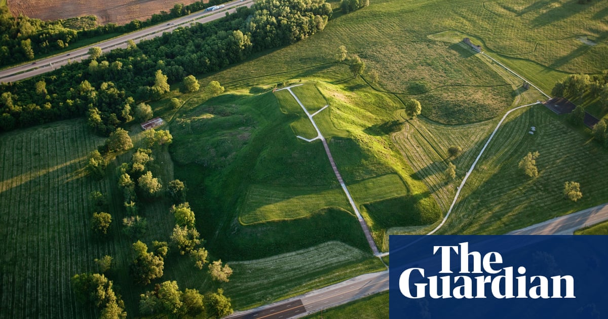
Monk's Mound, similarly, is named for the French Trappist who lived on it.
I would desperately love to find Illiniwek oral histories of their encounter with the Cahokia site and surrounding areas, if any of y'all know, but. 3/
I would desperately love to find Illiniwek oral histories of their encounter with the Cahokia site and surrounding areas, if any of y'all know, but. 3/
What "Cahokia" was was the heart of not only a powerful in its own right urbanized kingdom--with pilgrimage settlements as far north as Trempealeau, Wisconsin ( http://www.cahokia.illinois.edu/documents/Pauketat%20et%20al%202015.pdf), but the heart of an architectural, religious, cultural movement that covered 1/3 of the US. 4/
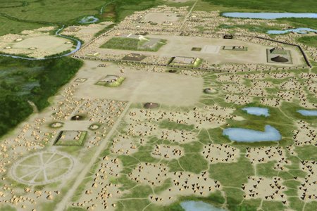
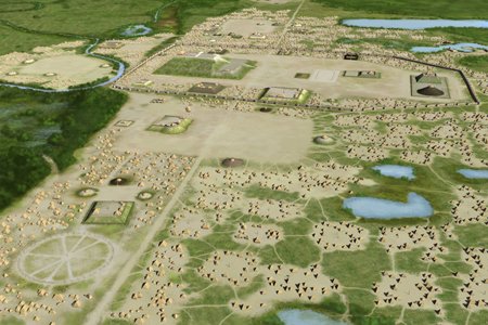
The heart of it, the urban area around Monk's Mound, covered at least 1,600 hectares with some 120 mounds in the core region and a population of somewhere above 20,000 at its height--bigger than London or Paris at the time--and the biggest city in N. America until the 1780s. 5/
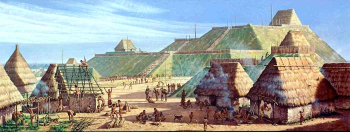
Monk's Mound, the central feature of the city, is about the same size as the Great Pyramid of Giza at its base--955 feet long and 775 feet wide-- bigger at the base than the Pyramid of the Sun at Teotihuacan. And around 100 feet tall in four terraced steps, 10 stories tall. 6/
On top of that mound was a building, over 100 feet long, the biggest building found at Cahokia.
Almost assuredly the house of the leader, serving public and probably religious functions in addition to being a home.
From there they looked out at the vast central plaza. 7/
Almost assuredly the house of the leader, serving public and probably religious functions in addition to being a home.
From there they looked out at the vast central plaza. 7/
There are open areas in the cityscape of Cahokia--public areas for religious, public and sporting events.
At the bottom left of the image is "Woodhenge," ( https://drloihjournal.blogspot.com/2019/06/the-cahokia-woodhenge.html) a massive solar calendar and possible aligner for mound construction (there may be others) 8/
At the bottom left of the image is "Woodhenge," ( https://drloihjournal.blogspot.com/2019/06/the-cahokia-woodhenge.html) a massive solar calendar and possible aligner for mound construction (there may be others) 8/
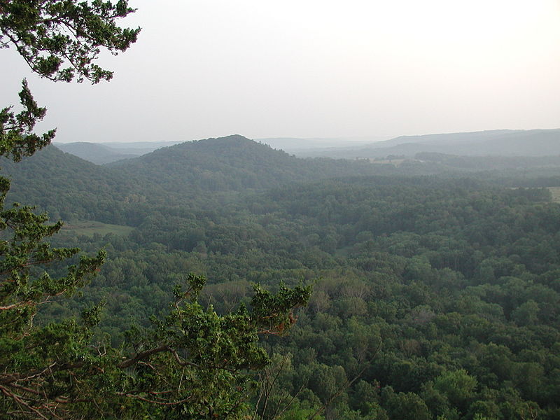
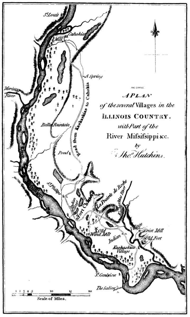
Cahokia was surrounded by suburbs and secondary platform mound cities, across the region called the "American Bottoms" ( http://theamericanbottom.org/itineraryFritzMiller.html), a 175 square mile floodplain in southern Illinois of swamps, lakes, and creeks--excellent farmland that still grows medieval crops: 9/
CORN. Cahokian platform mounds, pottery, sports, and massive corn agriculture spread across the Midwest and southeast, from 900 onwards, in the time of the Medieval Climate Anomaly ( https://iedro.org/articles/the-medieval-climate-anomaly/).
So when you drive through the corn field covered Midwest... 10/
So when you drive through the corn field covered Midwest... 10/
I'm going to stop there for today; threads on Wednesday and Friday on other aspects, starting with sports and religion on Wednesday and other sites and long term historic impact Friday.
I highly recommend Timothy Pauketat and Susan Alt's work as starting point for more reading!
I highly recommend Timothy Pauketat and Susan Alt's work as starting point for more reading!
This edited volume, the "Medieval Mississippians" ( https://sarweb.org/medieval-mississippians/) is a good start, and I like teaching Pauketat's "Cahokia: Ancient America's Great City on the Mississippi" in my 100-level surveys ( https://www.penguinrandomhouse.com/books/296469/cahokia-by-timothy-r-pauketat/).

 Read on Twitter