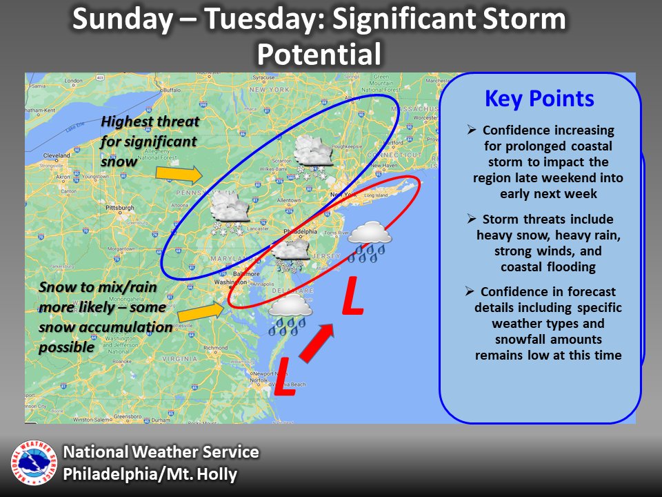
There is an increasing threat for a significant and potentially prolonged coastal storm system to impact the region late this weekend into next week. Here are the key points: (thread) #NJWX #MDWX #DEWX #PAWX
Precip could arrive as early as mid day Sunday & likely start as snow for most. Snow should continue for several hours into Sunday night with precipitation gradually becoming heavier by the overnight into Monday morning as winds also increase.
Snow and rain, potentially heavy at times, are likely to affect the region Monday along with strong northeast winds. There is uncertainty on where the rain/snow line will be during this time as it will depend on the exact track and evolution of the storm
The storm may linger into Tuesday but should be easing in intensity before moving out by Tuesday night. Also, the rain/snow line may shift back to the south and east into Tuesday on the back side of the storm as it starts to pull away.
Coastal flooding may also be an issue with this storm due to its slow speed resulting in prolonged NE winds. The biggest concern is for coastal Delaware and New Jersey around the time of Monday and Tuesday morning’s high tides.
This system is still a few days away so overall confidence is moderate and confidence in specific weather types and snow amounts remains low.
For the latest forecast visit http://www.weather.gov/phi
For the latest forecast visit http://www.weather.gov/phi

 Read on Twitter


