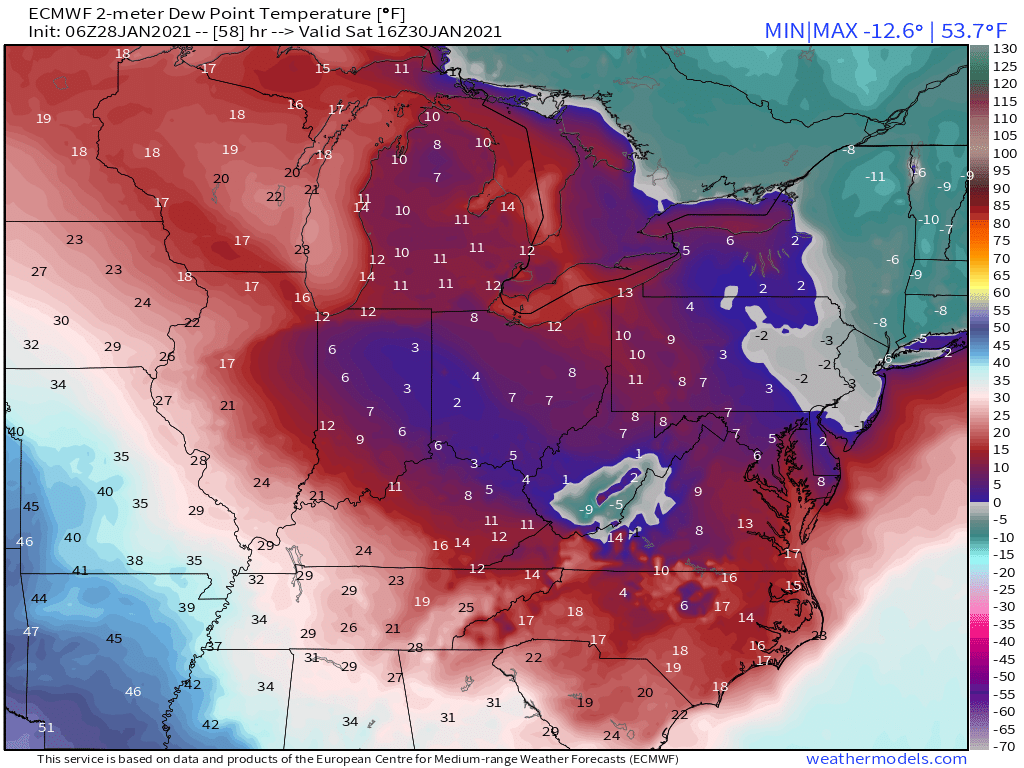
For the weekend This is how I see it now A cold/dry air mass will be in place Sat Here is the 6z ECMWF DPs mid-day Saturday. Notice 6F at RDU and single digits all around, below 0 in Northeast. This shows an airmass in place that can support strong evaparational cooling (1/6)
6z ECMWF shown. A storm system in the Midwest will turn ESE towards the mid-Atlantic with a secondary low developing in time off the mid-Atlantic coast (Miller B). As clouds/moisture move in Saturday night/Sunday it will serve to help lock in a CAD wedge east of the Apps. (2/6)
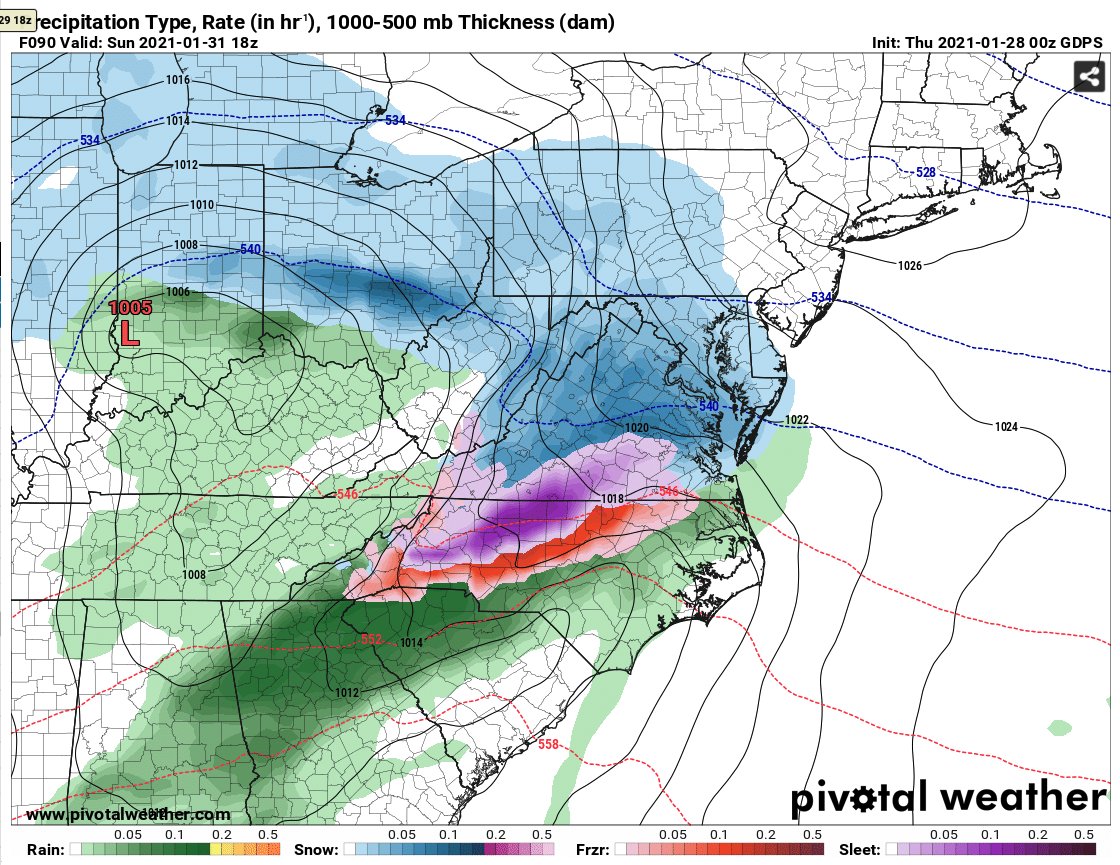
6z ECMWF shown This should support precip starting as snow then changing to freezing rain/sleet and as the wedge breaks down rain 6z ECMWF/00z CMC show this and have to varying degrees for several cycles. The GFS is warmer and shows little wintry precip and mostly all rain (3/6)
IMO the GFS is not resolving this wedge correctly and the ECMWF/CMC are. So this scenario could lead to some light snow accumulations east of the mtns Sat night/Sun am and then a period of ice. How long the wedge holds on will determine how severe the ice is and where (4/6)
My hunch is that typical climo favored areas of the foothills/NW piedmont may struggle to change to rain and could see significant ice accrual. If the wedge is really strong, the eastern piedmont (RDU) could see a longer period of ice. Here is the 00z CMC valid 1pm Sunday. (5/6)
Of course the GFS could always be right the NAM isnt too excited either, but I do think it is eroding the wedge way too quick. So stay tuned, Hopefully I can narrow in on this in the next day or so.

 Read on Twitter


