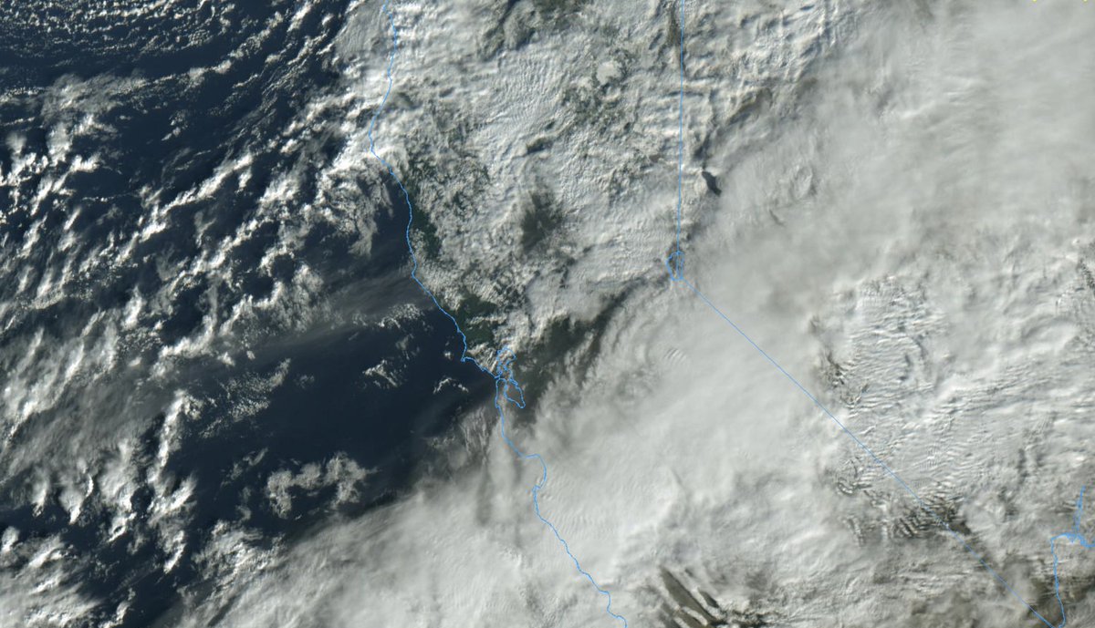
Mid-storm update (yes, this multi-day event is less than half over). Last night brought a multitude of wild weather across NorCal, including heavy snow at low elevs that rarely see it & widespread strong winds/power outages. But there were some differences from forecast... #CAwx
Widespread snow occurred down to 1,000 ft in elev--and to near sea level in the northern Sac Valley (Redding/Red Bluff). Some spots in coastal mountains between 1k-2k feet in elev saw *1-2 feet* of snow--which is extremely impressive for places that rarely see snow accums. #CAwx
Pretty widespread strong & damaging winds occurred, especially across Central Valley and across portions of the south/east SF Bay Area. These winds were actually a bit stronger than forecast, and caused widespread power outages/tree damage (~750,000 people without power this AM).
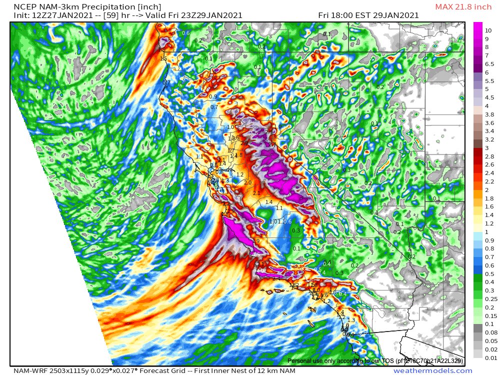
Total rainfall has been a bit of a mixed bag. It has been lower than originally predicted across urban core of the Bay Area and central Sac Valley, but has been on target elsewhere (including across Santa Cruz Mountains and Monterey County thus far). (Cue the "total bust" calls.)
Why was this? Models (significantly) underestimated the strength of local orographic rain shadowing in some places. Also, the much-advertised "NCFR" feature, though it did develop, was not as intense as it could have been and actually had a gap in it around central Bay Area.
HOWEVER...it's not over yet! The #AtmosphericRiver is currently stalled over Monterey Co & is draped into southern Sierra. Mudslides/flooding/very heavy snow rates are ongoing there. This AR is actually expected to re-strengthen slightly & "retrograde" back northward a bit. #CAwx
In fact, the atmosphere over NorCal will becoming increasingly moist & unstable. Periods of convective showers and possible thunderstorms will intensify as AR shifts back northward slightly. Some parts of NorCal could see more rain on back half of this storm than first half! #CAwx
Very heavy rainfall will continue across Monterey Co for next 24 hrs (!), & concern regarding mudslide/debris flow risk remains quite high. Heavier downpours will also shift back across Bay Area. & heaviest snowfall in the high Sierra is yet to come! #CAwx
And a final note regarding predictions vs. expectations. Lots of folks (some pretty angrily) have already asked me why this storm "was not historic, as forecast." Well, this was *not* expected to be a historic storm, by nearly any metric! The key concerns were (and remain)...
...the debris flow risk in recent wildfire burn areas (which is driven more to very high rainfall *rates,* not very high total amounts), possible wind damage/power outage issues, and accumulating snowfall in unusual places/extremely heavy snowfall in usually snowy spots.
All of those things have actually transpired (and again: the event is not over yet!). Historic rainfall amounts were most definitely *not* in the forecast (except, perhaps, where the AR stalls in Monterey County--and we're still on track for extreme totals there).
So, to summarize: 1) The storm is not over yet! 2) Key expected impacts occurred, or are still unfolding, 3) Yes, winds were stronger and rains lighter than expected in some areas, but 4) There seems to have been mismatch between public expectations and actual forecasts, as well.

 Read on Twitter


