So why only the classic "cold rain" in Central Arkansas?
A thread:
1st we need to have a good Dendritic Growth Zone overhead w/temps at that level of generally -10C to -20C for best results. Can be fluctuation in that. Mid-level disturbance brought that into area. #arwx
A thread:
1st we need to have a good Dendritic Growth Zone overhead w/temps at that level of generally -10C to -20C for best results. Can be fluctuation in that. Mid-level disturbance brought that into area. #arwx
We also need near freezing temps at the Surface in this case, along with below freezing temps down to very close to the surface.
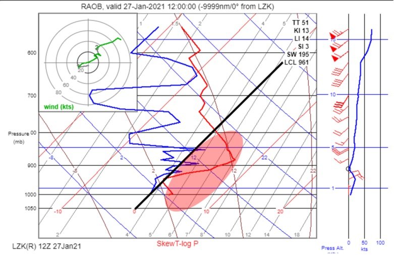
So what happened? Let's look at Skew-T from LZK to find out.
Image:
Quite a warm pocket between 6000FT and the surface unfortunately. #arwx
So what happened? Let's look at Skew-T from LZK to find out.
Image:
Quite a warm pocket between 6000FT and the surface unfortunately. #arwx
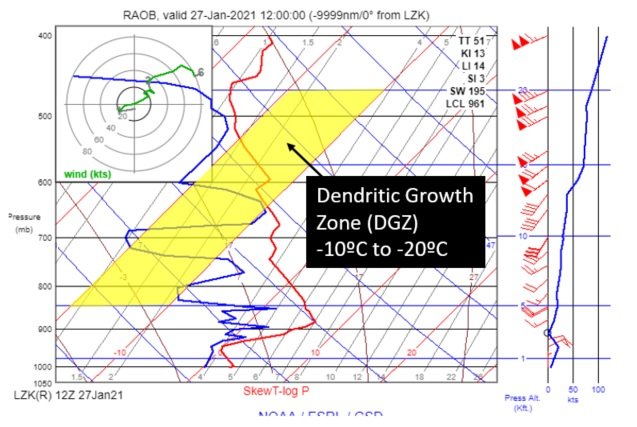
And unfortunately not a healthy dendritic growth zone over C Arkansas anyway as indicated in this skew-t image from LZK.
Not a lot of saturation going on at time of balloon.
DGZ area is highlighted in yellow.
Again, DGZ can be outside this zone. This area is optimal. #arwx
Not a lot of saturation going on at time of balloon.
DGZ area is highlighted in yellow.
Again, DGZ can be outside this zone. This area is optimal. #arwx
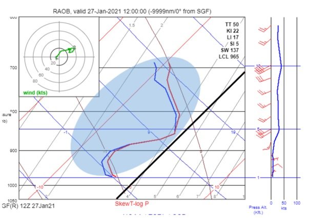
Further North, in Springfield, MO and areas of N Arkansas, much colder air is available in lowest portions of Atmosphere.
Better saturation occurred as well in the dendritic growth zone.
Note subfreezing temps along entire profile.
These were more modified in N AR. #arwx
Better saturation occurred as well in the dendritic growth zone.
Note subfreezing temps along entire profile.
These were more modified in N AR. #arwx
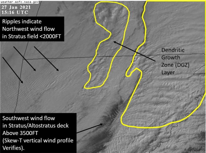
Finally let's look at this from a satellite perspective.
In this visual image, we can see the DGZ (mid-clouds) highlighted in yellow. Where these areas are N of about HWY 64 in AR, we had snow.
We can see NW winds in Stratus out W and SW winds in higher stratus in C AR. #arwx
In this visual image, we can see the DGZ (mid-clouds) highlighted in yellow. Where these areas are N of about HWY 64 in AR, we had snow.
We can see NW winds in Stratus out W and SW winds in higher stratus in C AR. #arwx

 Read on Twitter


