Thread: A potentially strong #AtmosphericRiver is forecast to make landfall over Northern to Central California and could potentially produce widespread hydrologic impacts across a large portion of California. #CAwx
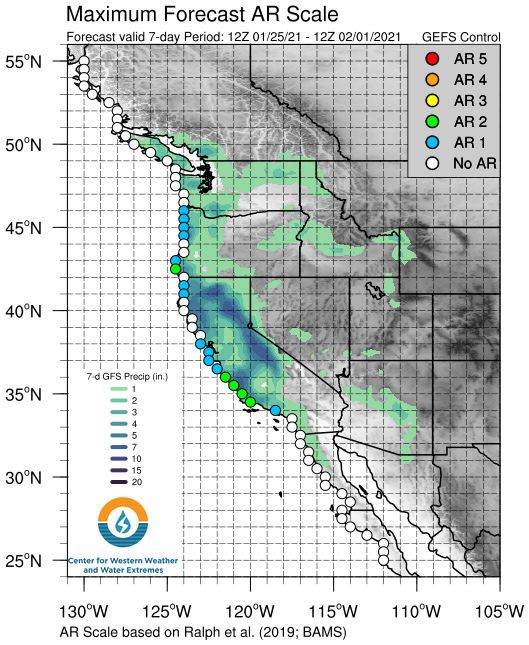
The #AtmosphericRiver is forecast to bring AR 1 to 2 conditions to a large stretch of the coast from the North Bay to Point Conception. An upper-level shortwave is also forecast to interact with the AR, stalling the core near Point Conception and increasing the overall duration.
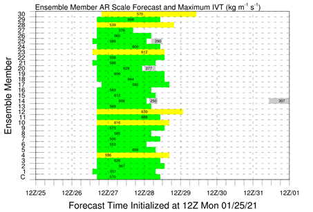
There is currently larger forecast uncertainty associated with overall duration and therefore AR Scale where the AR is forecast to stall and potentially shift northward. 25 ensemble members are predicting AR 2, while 6 are predicting AR 3 conditions.
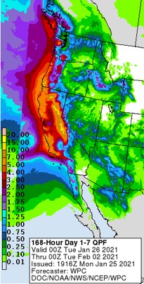
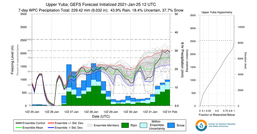
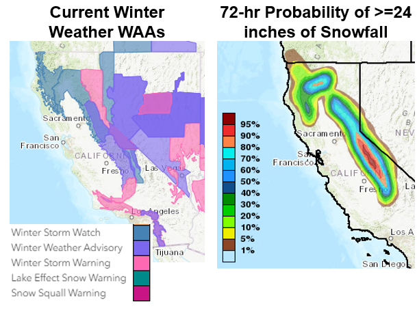
More than 10 inches of precipitation are forecast to fall over the Sierra Nevada and Central Coast where the AR is forecast to stall and over. Low freezing levels (<4k ft) could also result in more than 2 feet of snow in several locations.
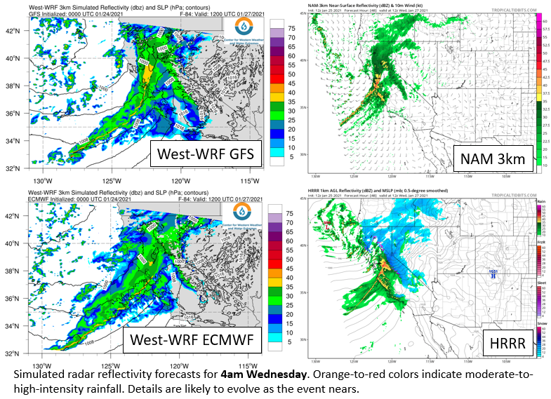
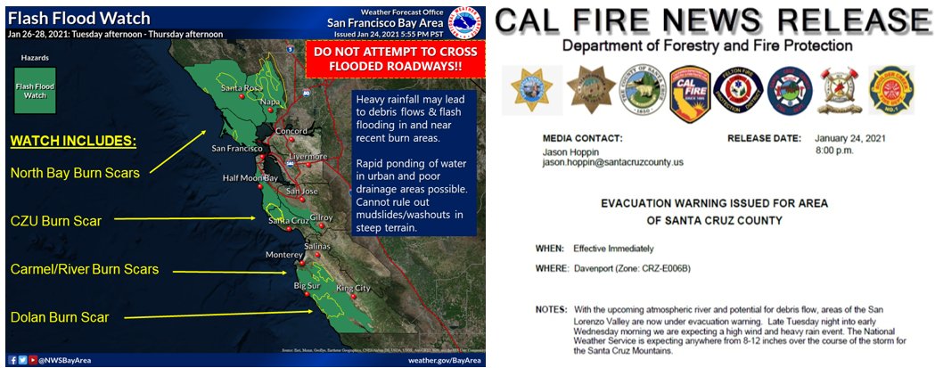
Hi-res models are suggesting the potential for short duration high-intensity precip which can cause debris flows on recent burn scars. While most models suggest a narrow cold frontal rainband, there is large uncertainty around timing and strength.
Visit https://cw3e.ucsd.edu/cw3e-ar-update-25-january-2021-outlook/ for an in-depth analysis of the upcoming #AtmosphericRiver
Visit https://cw3e.ucsd.edu/iwv-and-ivt-forecasts/ for AR specific forecast products
Visit https://cw3e.ucsd.edu/iwv-and-ivt-forecasts/ for AR specific forecast products

 Read on Twitter