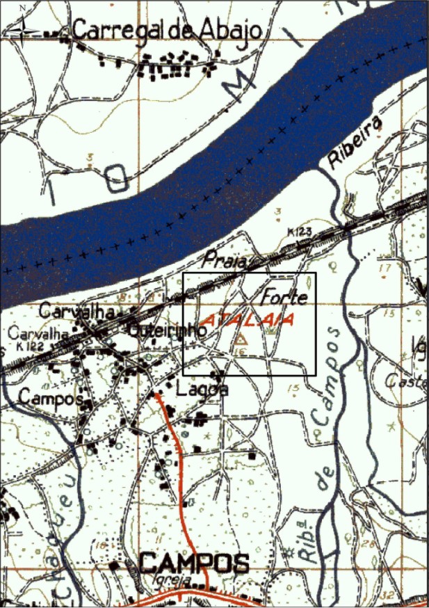
(1/6) On the second #RomanFortThursday (& #RomanCampThursday), we are going to tell you about the first camp we documented in the north of Portugal, during @blanco_rotea's PhD research, in Campos (Vilanova de Cerveira, Portugal).
We tell you here: https://doi.org/10.1016/j.jasrep.2016.10.008
We tell you here: https://doi.org/10.1016/j.jasrep.2016.10.008
(2/6) Historical sources mentioned a Modern Age fortress in Campos, built during the Portuguese War of Restoration (1640-1668). The area has been destroyed by an industrial estate, but the Portuguese military map (1953) included the toponyms watchtower and fort #RomanFortThursday
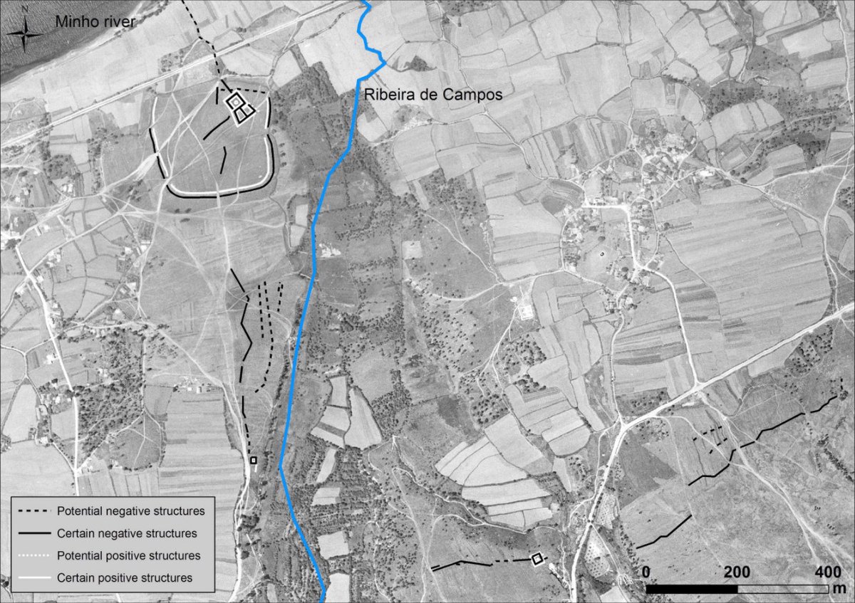
(3/6) We acquired several historical aerial photos from the Portuguese Army Geospatial Information Center (CIGeoE) @Exercito_pt to carry out detailed photogrammetric restitution in order to digitally recover this vanished area #RomanFortThursday
(4/6) We orthorectified and georeferenced the stereoscopic images from historic flights available for this area, the RAF (1947–5074 & 5075), SPLAL (1949–120 and 121) and the USAF (1958–10246 & 10247), with Agisoft PhotoScan. Here, the results: #RomanFortThursday
(5/6) Photointerpretation showed a square structure surrounding another circular structure, with an additional section stretching towards the south-east. But this all was inside a larger, square structure with rounded corners, and other structures!!! #RomanFortThursday
(6/6) This way, the joint work of @blanco_rotea, @costagarcia_jm, @fonte_joao and @magago allowed to interpret the square structure as the first castra aestiua which was positively identified in the north of Portugal #RomanFortThursday

 Read on Twitter


