Stoked to announce that the new #openaccess paper "Open source tools for geographic analysis in transport planning" has just been published 
Paper: https://doi.org/10.1007/s10109-020-00342-2
Code: https://github.com/Robinlovelace/open-gat
My first ever solo-authored paper!

Paper: https://doi.org/10.1007/s10109-020-00342-2
Code: https://github.com/Robinlovelace/open-gat
My first ever solo-authored paper!
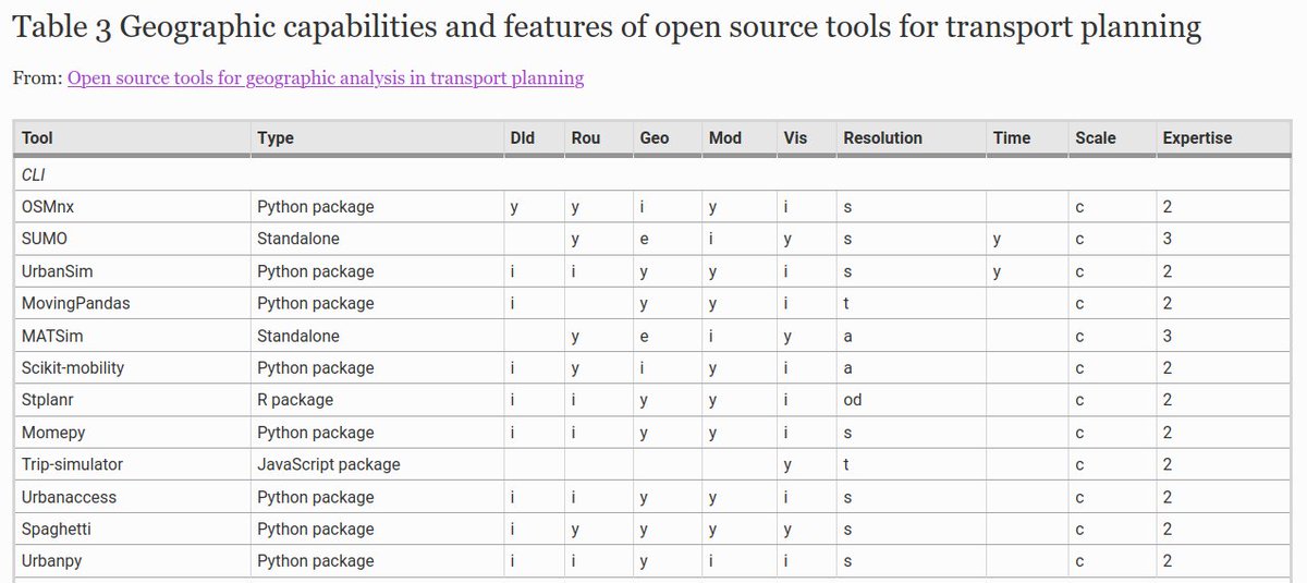
It discusses the landscape of free and open tools/software for working with geographic transport datasets (thanks everyone who helped crowd-source this list). https://link.springer.com/article/10.1007/s10109-020-00342-2/tables/2
It shows that the 'ecosystem' of free and open source software for transport planning is maturing, with tools that can support every stage in the transport planning process.
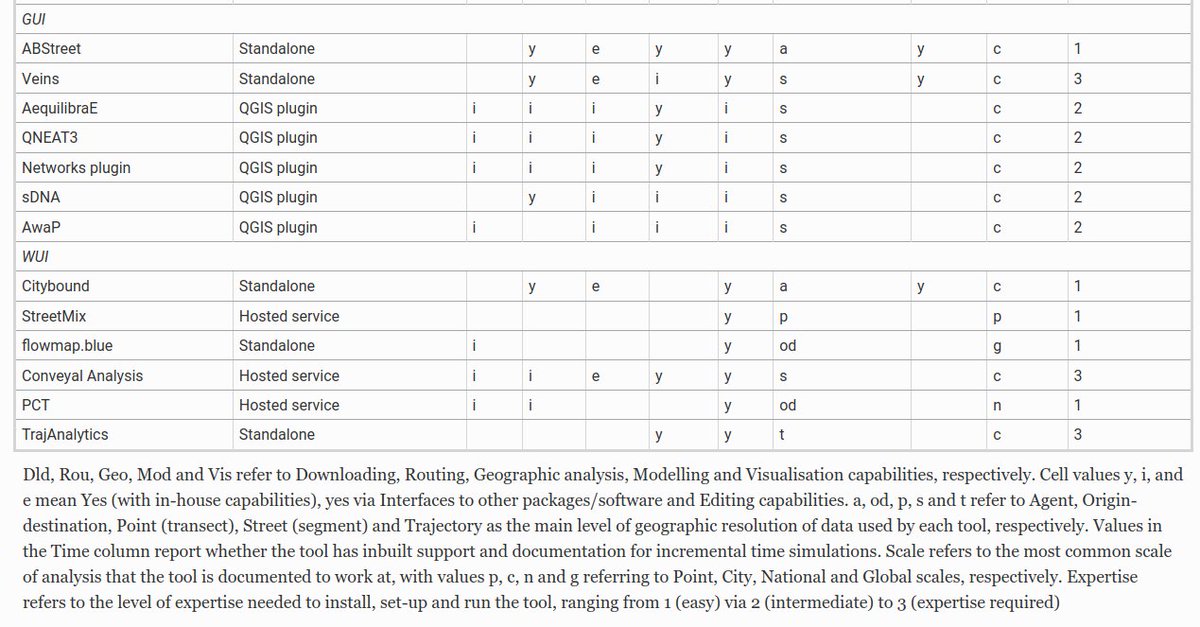
It also provides a summary of which tools do what (this table is a bit of an eyeful, apologies!): https://link.springer.com/article/10.1007/s10109-020-00342-2/tables/3
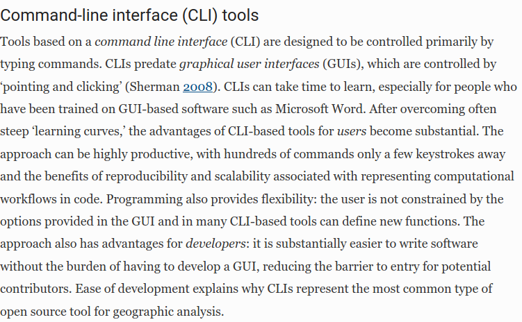
Command-line Interface Tools (CLIs) are thriving and are here to stay, but require some time to get used to.
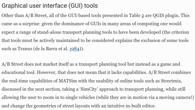
Graphical User Interface (GUI) tools tend to be easier to get started with. Lots of @qgis plugins for working with transport data. (Note: the description of A/B Street is now slightly out of date - it's also has a web-UI).
And perhaps most excitingly, a new breed of Web User Interface (WUI) tools is emerging. A great example of this is A/B Street, an immersive and gamified transport planning tool created by @CarlinoDustin. See the source code of that tool here: https://github.com/dabreegster/abstreet/#ab-street
Conclusion: "Game-like approaches ... such as A/B Street, CityBound and the intuitive and popular Streetmix web service demonstrate the huge potential for tools to revolutionise not only how transport plans are developed but who can be involved in the planning process."

 Read on Twitter


