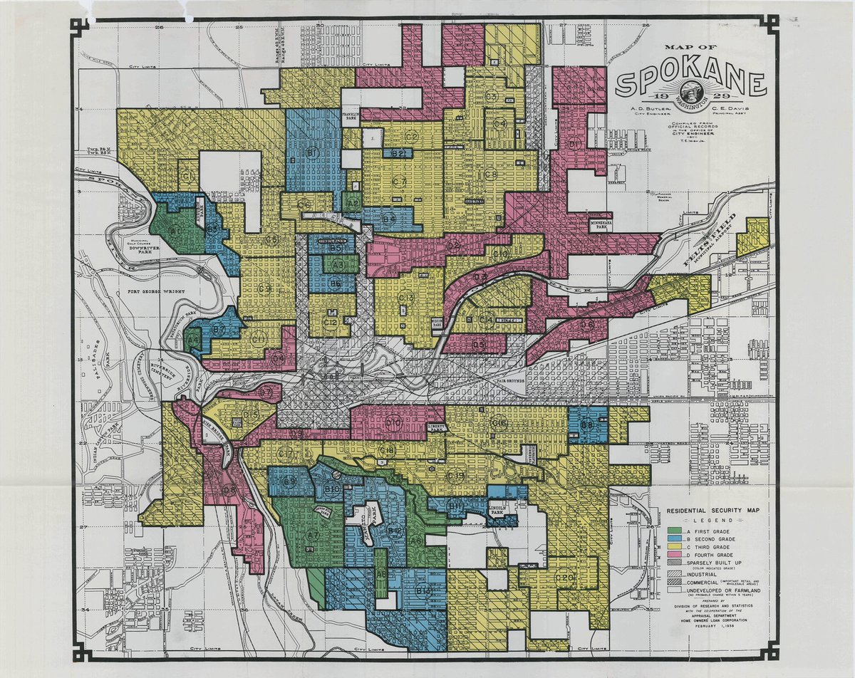
This redlining map of #Spokane from 1929 makes painfully clear that the legacy of racist housing discrimination continues today.
The redlined areas in Hillyard and near Liberty Park in East Central tell a painful story of how our infrastructure decisions are shaped by racism.
The East Central neighborhood, historically Spokane’s most diverse, and home to many Black residents, was infamously torn apart in the 1950s with the construction of I-90.
Black wealth in this neighborhood has never recovered from those losses.
Black wealth in this neighborhood has never recovered from those losses.
The Hillyard neighborhood, meanwhile, was historically redlined for similar reasons.
Today, it is being torn apart by construction of another freeway: the US-395 North Spokane Corridor. The NSC was originally set to run up Hamilton near Gonzaga, but opposition shut that down.
Today, it is being torn apart by construction of another freeway: the US-395 North Spokane Corridor. The NSC was originally set to run up Hamilton near Gonzaga, but opposition shut that down.
This redlining map also shows the legacy of generational wealth which has accumulated to residents of the South Hill, particularly near Manito and Comstock Parks.
These residents have access to better schools, better libraries, and better parks than their peers, even today.
These residents have access to better schools, better libraries, and better parks than their peers, even today.
It is eye-opening and disturbing how much a single map from almost 100 years ago can reveal about the complex systems of social and economic hierarchy which continue to drive #Spokane today.

 Read on Twitter


