THREAD:
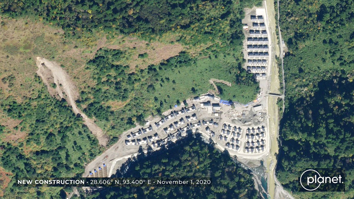
A new @ndtv report shows satellite imagery showing a village (2020扶贫村) constructed by China on the banks of the Tsari Chu ( https://www.ndtv.com/india-news/china-has-built-village-in-arunachal-pradesh-show-satellite-images-exclusive-2354154). It seems to be within Indian claimed territory, but before a Chinese installation that's been in place since before 2000
A new @ndtv report shows satellite imagery showing a village (2020扶贫村) constructed by China on the banks of the Tsari Chu ( https://www.ndtv.com/india-news/china-has-built-village-in-arunachal-pradesh-show-satellite-images-exclusive-2354154). It seems to be within Indian claimed territory, but before a Chinese installation that's been in place since before 2000
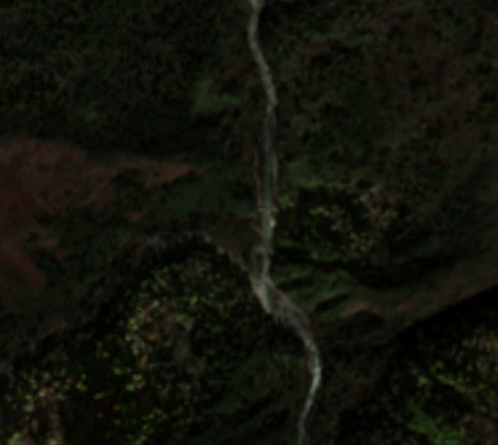
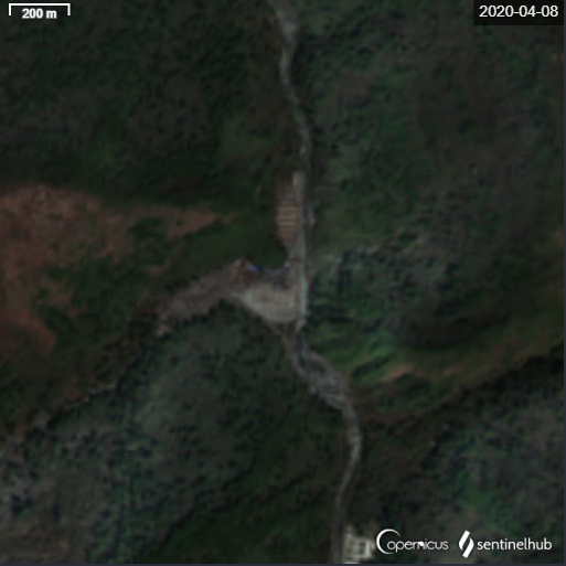
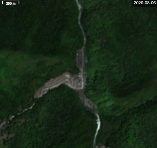
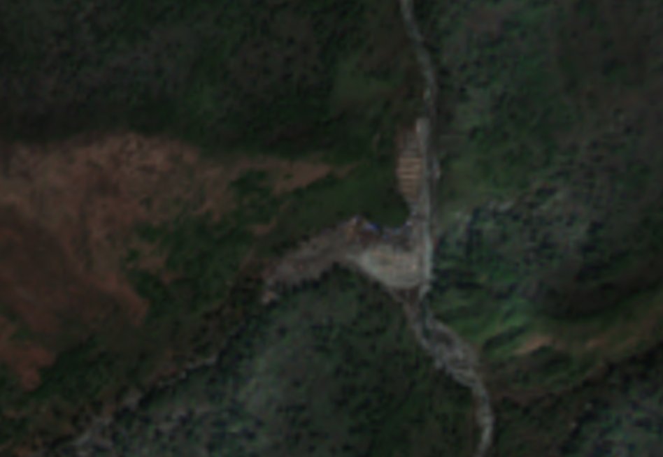
First, let's look at a timeline of the site. In December 2019, the site was a forested confluence of a stream and the Tsari Chu river, by April 2020 the area had been cleared, and some construction appears to have begun. By August, much of the construction seemed mostly finished.
The bigger issue with boundary disputes between China and India like this is not just that both sides have different claims, but they have different interpretations of eachother's claims. In Galwan/Pangong that was the main sticking point.
So in order to determine the severity of this provaction you have to know two things that are hard to know:
1) Where India considers India's claim to end;
2) Where China considers India's claim to end.
1) Where India considers India's claim to end;
2) Where China considers India's claim to end.
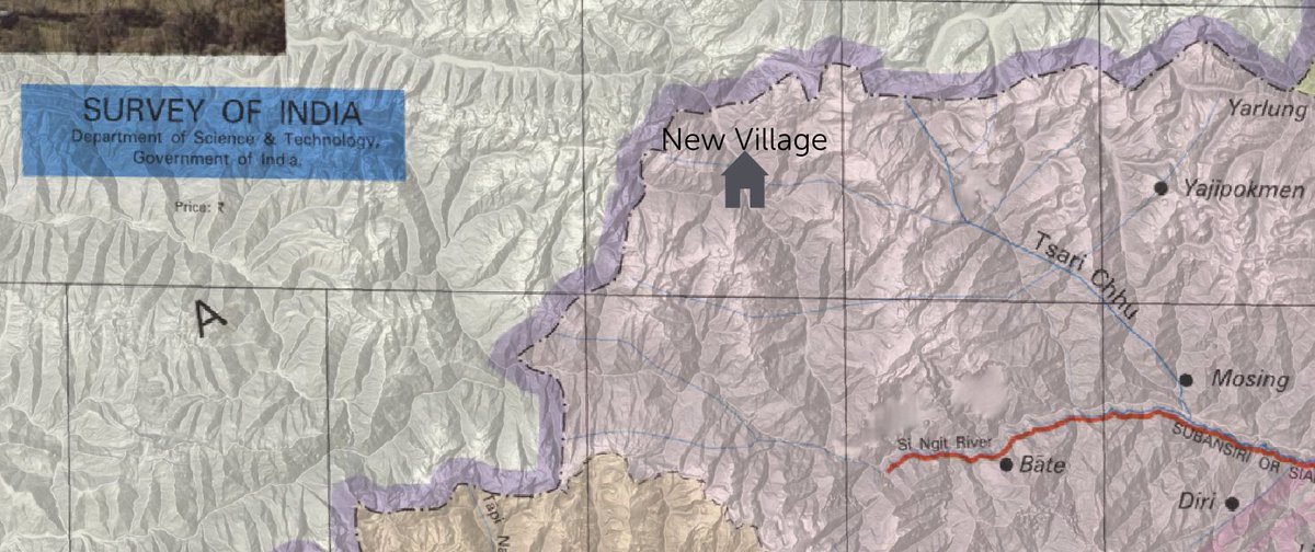
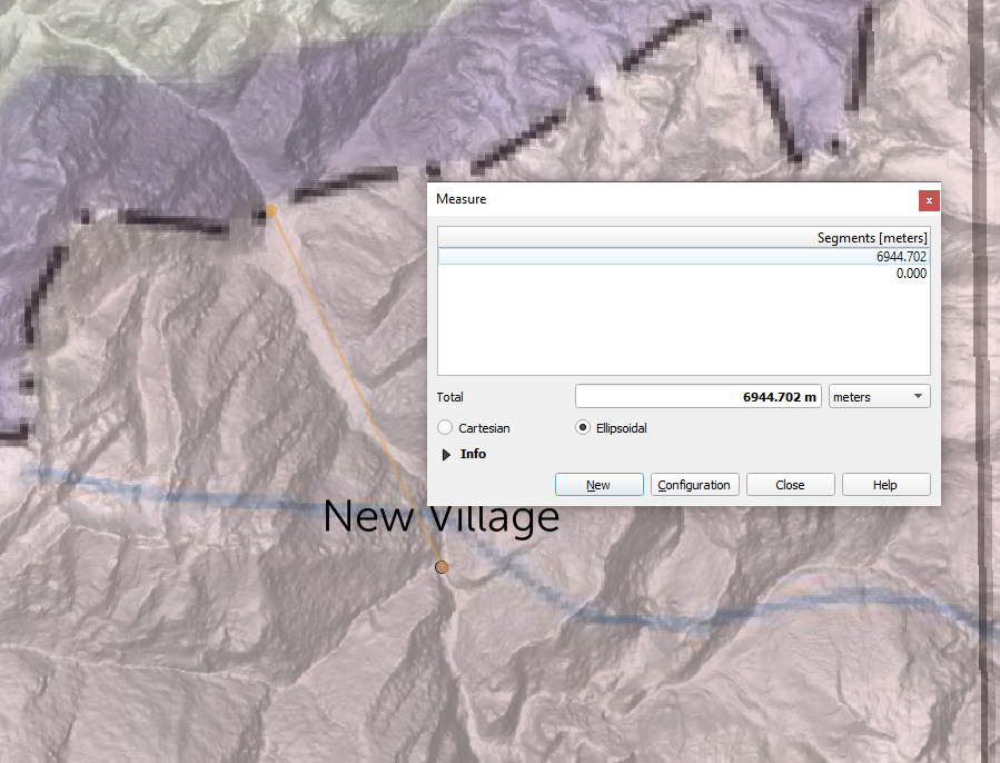
The two main places to look for India's perception of the claimline is the official state maps prepared by the Survey of India, see https://surveyofindia.gov.in/pages/state-maps
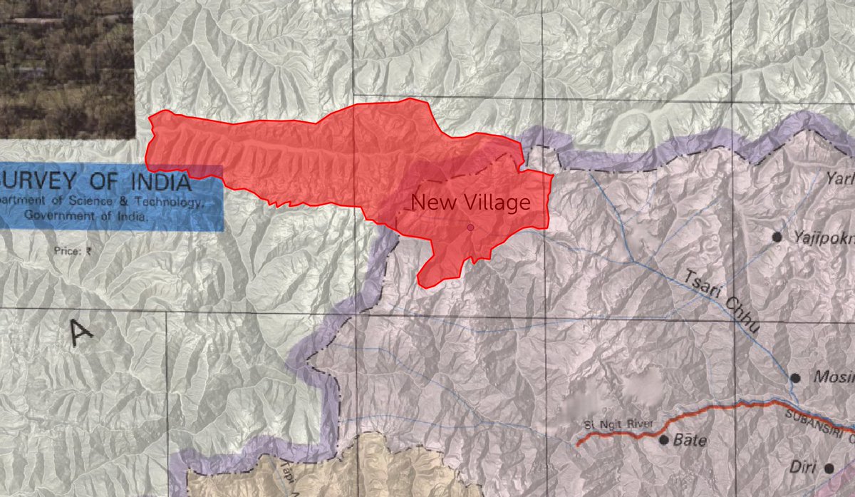
This is the map screenshotted in the top post. It shows the village 7km into Indian territory.
This is the map screenshotted in the top post. It shows the village 7km into Indian territory.
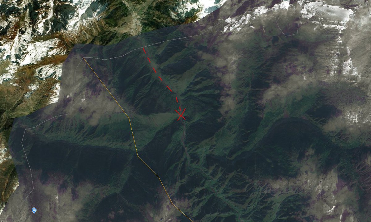
BharatMaps also shows the village 4km within Indian-claimed territory (red cross shows the village location, dashed line shows how far across the claim line it is). https://bharatmaps.gov.in/newversion/map.aspx
It's claim line is 2.9km beyond the international boundary demarked by the US state dept.
It's claim line is 2.9km beyond the international boundary demarked by the US state dept.
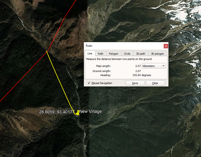
On that note, the US DoS LSIB is a global database of borders as recognised by the US government. In this part of India it appears to be what Google is using to mark its boundary. https://data.humdata.org/dataset/large-scale-international-boundaries-lsib
The village is 2km beyond that line.
The village is 2km beyond that line.
This is why I said it appears to be within Indian territory, because, according to Indian government sources, and US government sources, it is within Indian claimed and controlled parts of Arunachal Pradesh.
However it appears to be RIGHT on the edge of China's idea of the claim.
However it appears to be RIGHT on the edge of China's idea of the claim.
Most official Chinese maps show only their claim, and show all of Arunachal Pradesh as Chinese territory.
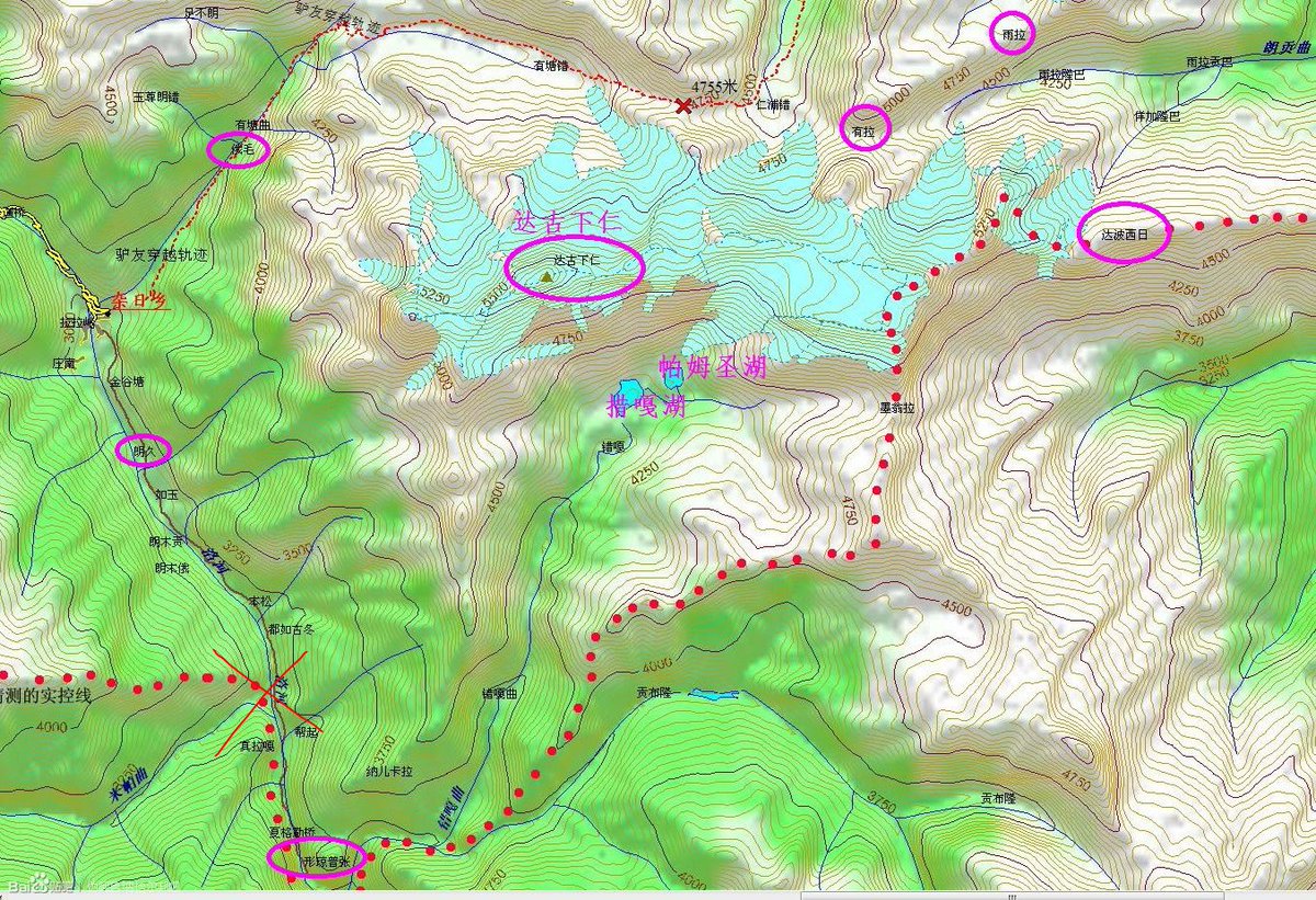
This is the best map I've seen showing the disputed territory in this part of the border. It appears to be a screenshot from a Chinese GIS service. Village = Red cross
This is the best map I've seen showing the disputed territory in this part of the border. It appears to be a screenshot from a Chinese GIS service. Village = Red cross
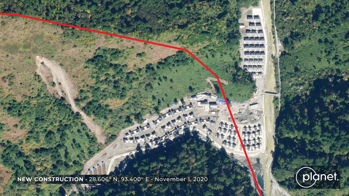
Although it should be noted that the residential area that has been constructed clearly expands across this border in areas. The red line on this satellite imagery shows approx. where that disputed claim begins per the above map.
Another Chinese source which is generally accurate is the township level boundaries, it often reflects areas under control. This is the official boundary of Migyitun township (扎日乡), which shows the whole area including the long-standing Chinese installations I'll get to soon
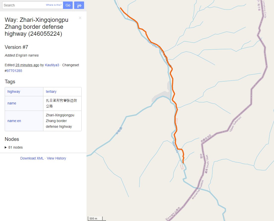
Another source worth checking is Open Street Map, here it shows a claim line different from any of the above sources (and shows the village beyond the Indian claim), so I'm not sure what to make of it here.
Because of so many different and contradictory versions of the claim lines, it's important for the Indian government to state whether they believe this village is within Indian territory. Something I suspect they will refuse to do.
It sure appears to be though.
It sure appears to be though.
Beyond the claims, let's look at the defacto control on the ground, which is where this contruction appears to be squarely within Chinese control. And appears to have been since at least 2000.
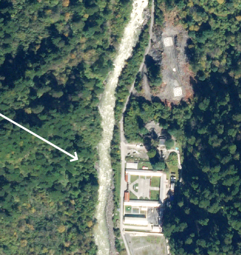
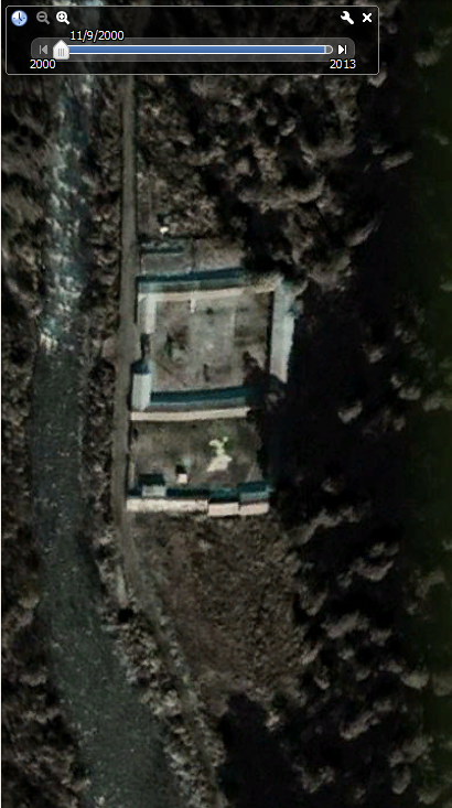
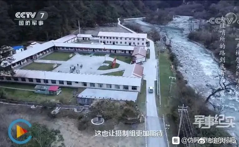
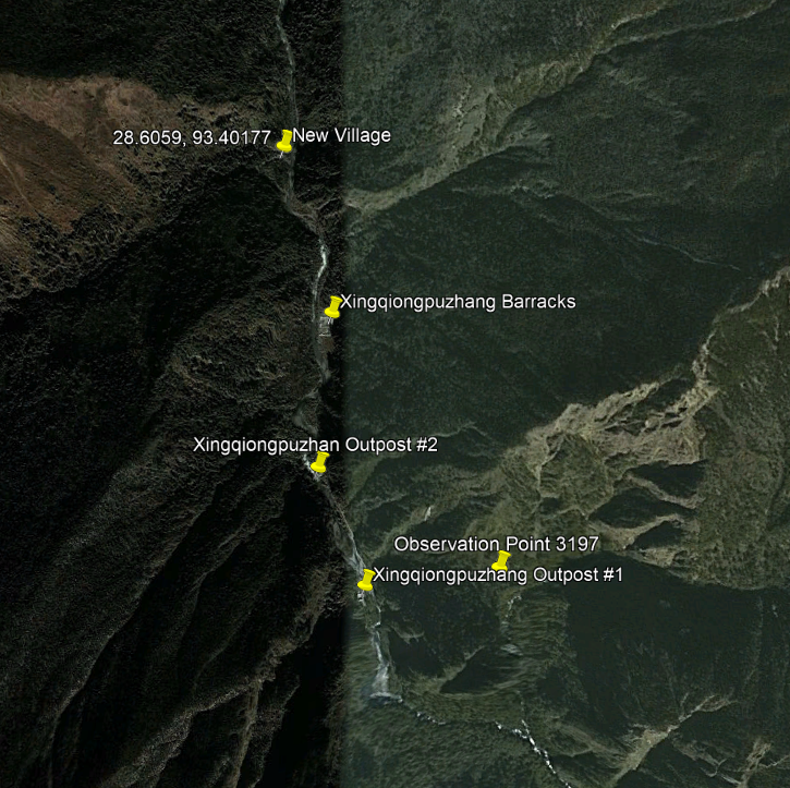
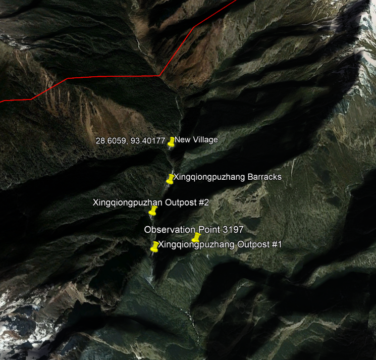
The imagery annotations included in the NDTV report mention an older military installation (形琼普张营地) that was constructed prior to the village. Google Earth shows it's been there since 2000.
The Xingqiongpuzhang barracks appear to be the barracks location for three or four futher outposts, the futhest most of which is apparently only 3km from the nearest Indian border post (I believe at Majia).
Indeed, the village itself is built along the Migyitun to Xingqiongpuzhang Defence Highway (扎日至形穷普张边防公路), which continues roughly 2.5km beyond the village.
I'm unsure of the name of the village, and can't find any local media reports about it. On OpenStreetMap it is tagged as "2020 Poverty Alleviation Village" (2020扶贫村) and was added to the map on Dec 15th 2019.
I suspect that means that China understands this construction is quite provocative and within Indian territory, as it hasn't heralded its construction, unlike a similar village built within internationally recognised Bhutanese territory. https://twitter.com/Nrg8000/status/1329414446633009152
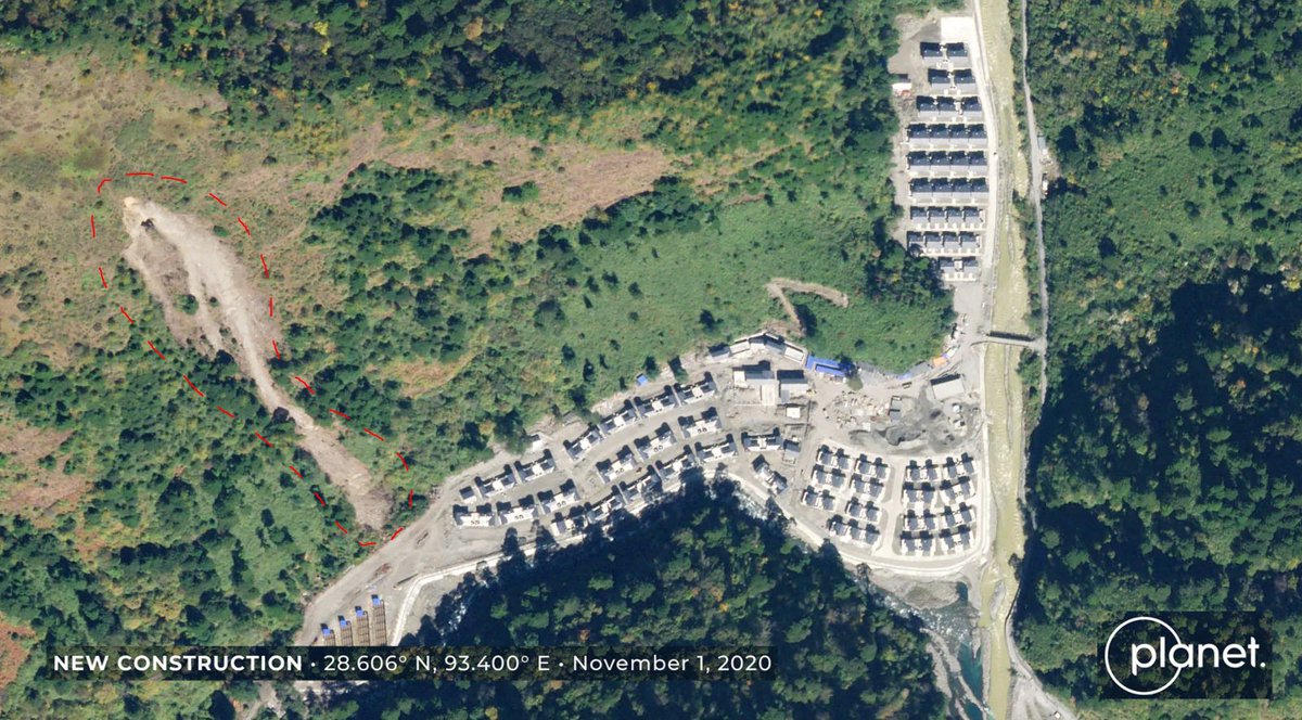
One final thing that I will note, something that shows how safety for the occupants and genuine poverty allevation isn't forefront in China's mind when it builds these villages in other countries. During construction there was a major landslide, coming within 40m of houses.
TLDR:
In 2020, China constructed a village of around 90 houses within what appears to be Indian territory, however it is roughly 2.5km North from a Chinese military border post that has existed for decades.
In 2020, China constructed a village of around 90 houses within what appears to be Indian territory, however it is roughly 2.5km North from a Chinese military border post that has existed for decades.
Apologies this thread was a bit rambling and without structure, I had dinner and (I'm pretty sure) broke my toe in the middle of it, so that knocked me off my game a bit.
Fin!
22/22
Fin!
22/22

 Read on Twitter