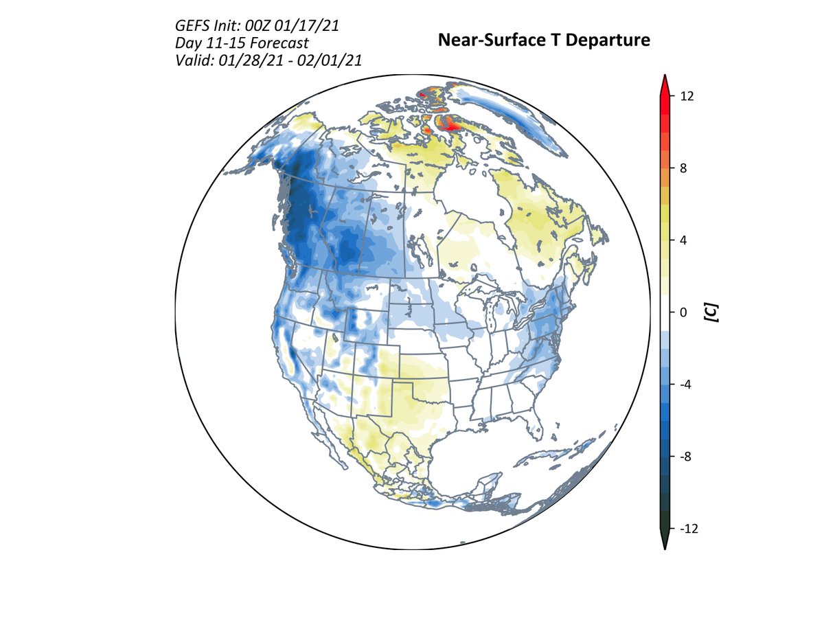
North America will start to undergo a pattern shift next week as low heights build across the western part of the continent. The response will be more cold to enter the western US and N CONUS. But, this isn't the best pattern for E Coast snowstorms. 1/
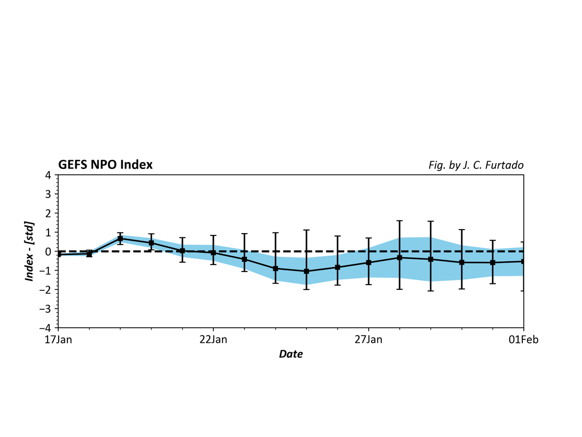
One of the big unknowns right now are conditions in the North Pacific, here represented by the NPO. Note the large range of possible solutions after Day 8. A +NPO vs. -NPO will make for big differences on the jet stream across the CONUS. 2/
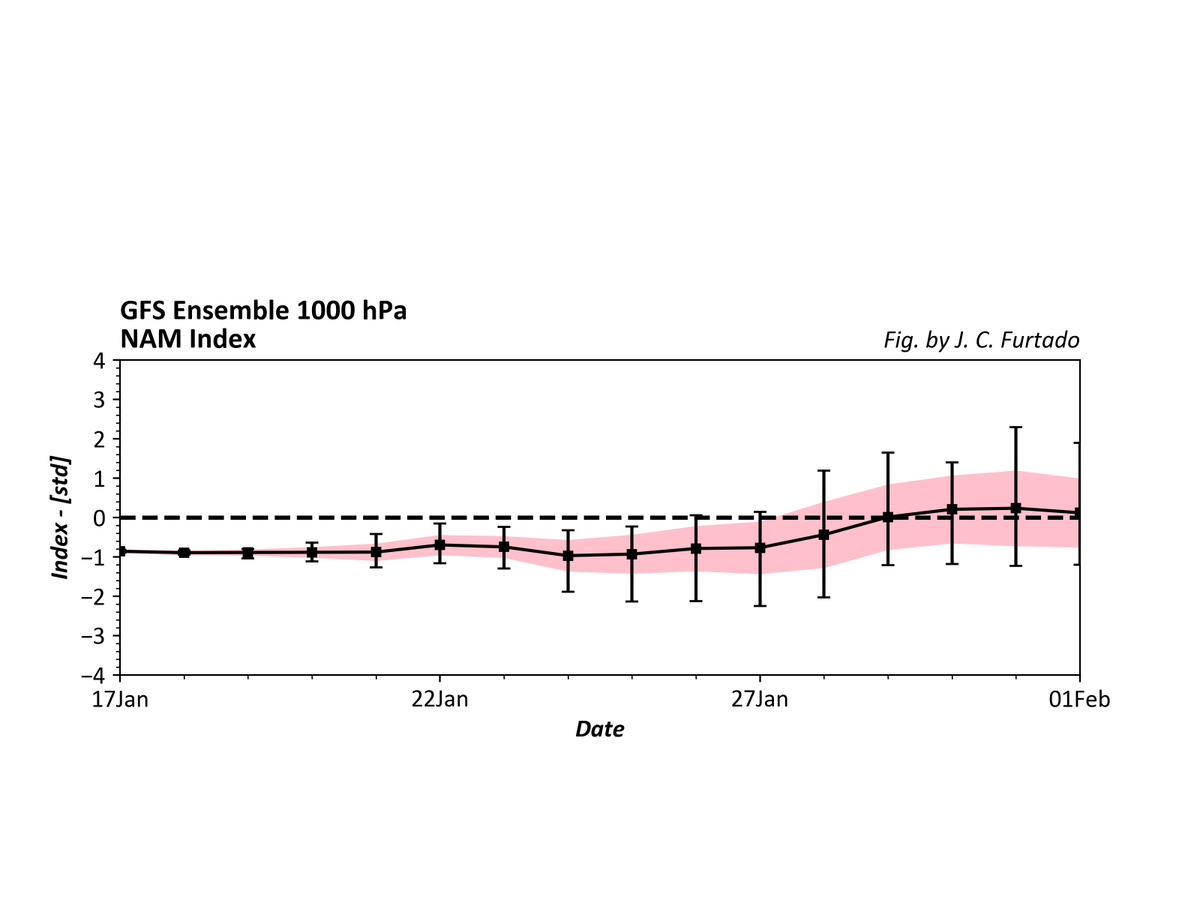
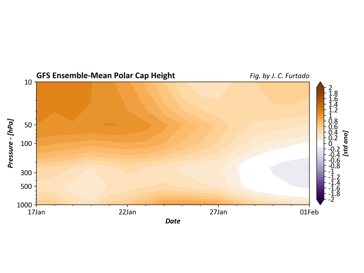
The 0Z GEFS is also showing that -AO conditions in the troposphere will become less negative / positive by the end of the period. This also shows up in the polar cap heights, with lowering heights (blue in the plot). If verifies, this means a pause in high lat blocking. 3/
Of course, we are still looking at the stratosphere and watching the #PolarVortex recover. But, this recovery won't be straightforward, with wave-1 (maybe wave-2?) forcing keeping recovery a bit slower than usual. Animation of 10 hPa heights below. 4/
Note the difference at 50 hPa - the vortex is clearly displaced into Eurasia and starts recovering, with only some weak ridging signals over the Pacific. Whether or not the anomalies at 10 hPa (a) occur and (b) project downward may determine the Feb hemispheric pattern. 5/5

 Read on Twitter


