So, what's going on with the anticipated colder #Weather in NW Europe mid-late next week?

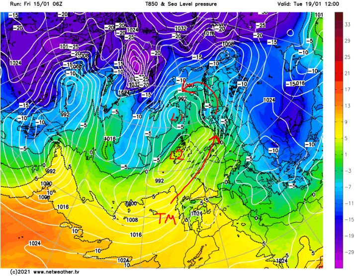
Well, to begin with, a low (L1) moves into a position that can move cold air across #UK... BUT another (L2) then races into it from the SW & brings a lot of mild tropical maritime (TM) air.
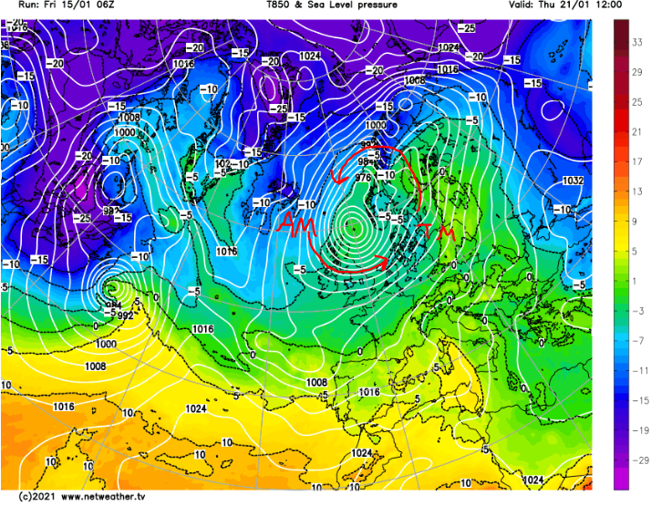
That TM air then mixes with some of the Arctic maritime (AM) air to the north. This means it doesn't become as cold across the #UK Wed-Thu. Falling #Snow may be restricted to high ground.

Meanwhile, the low draws in more AM air from the north northeast...
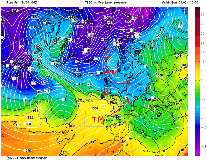
...while at the same time, new lows advance on #Europe from the west. This is where it may get dramatic.

As advertised for a week now, clashes of cold & mild air look to occur. On cold side, freezing temps & #snowfall. On mild side, springlike temps!

Positioning VERY uncertain.
You can follow @peacockreports.
Tip: mention @twtextapp on a Twitter thread with the keyword “unroll” to get a link to it.

Latest Threads Unrolled:

By continuing to use the site, you are consenting to the use of cookies as explained in our Cookie Policy to improve your experience.