Since 1991, NC has never had a full set of redistricting maps--either congressional and/or state legislative--survive a decade without undergoing revisions. Sometimes multiple maps in a 10 year timespan.
Concur w/ Will: redrawing & litigation in 2020s will likely continue #ncpol https://twitter.com/will_doran/status/1349076055643074565
Concur w/ Will: redrawing & litigation in 2020s will likely continue #ncpol https://twitter.com/will_doran/status/1349076055643074565
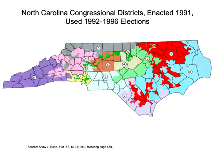
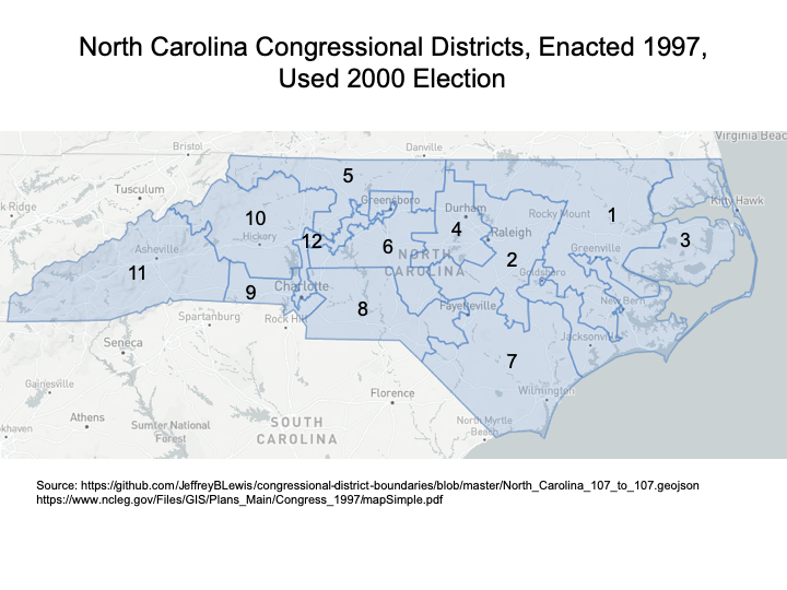
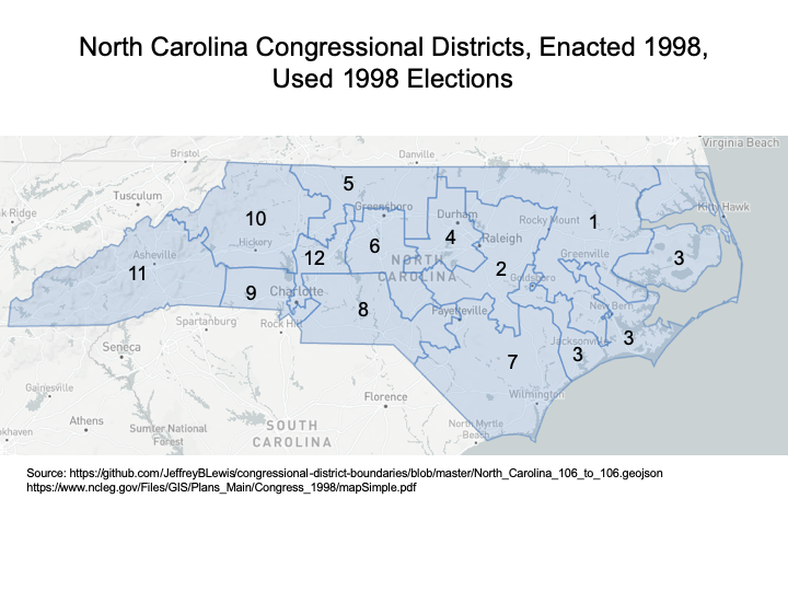
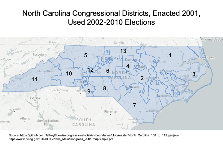
Just to give folks a sense of the congressional districts since the 1991 redistricting effort:
here are the maps used for that decade, drawn in 1991 (the 2nd attempt after DOJ denial of first map), 1997, and 1998.
here are the maps used for that decade, drawn in 1991 (the 2nd attempt after DOJ denial of first map), 1997, and 1998.
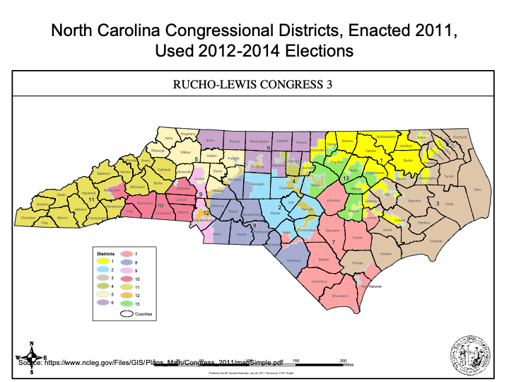
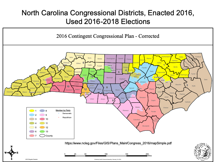
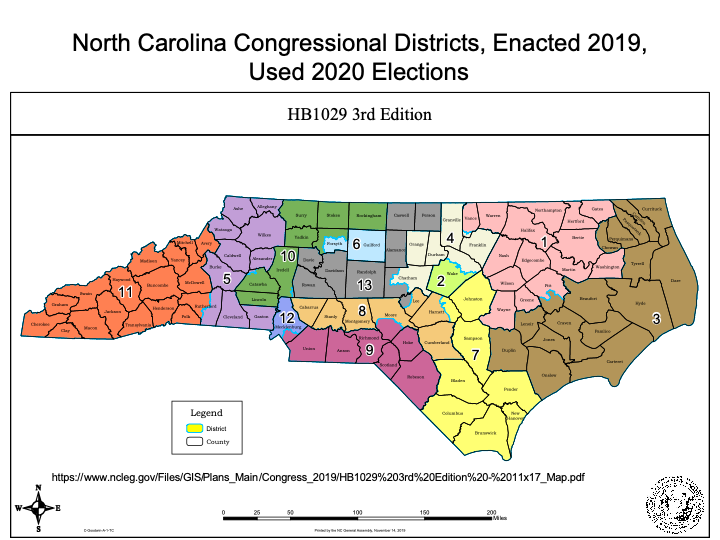
The 2000s congressional map survived, but the 2010s saw 3 different congressional district maps within that decade:
In the 2000s, state legislative maps went through 3 maps (and a total of 5 attempts) used in that decade.
Am hopeful a book that I just submitted last week, exploring NC's redistricting efforts from 1980 to 2020, will be out later this year.
Am hopeful a book that I just submitted last week, exploring NC's redistricting efforts from 1980 to 2020, will be out later this year.

 Read on Twitter