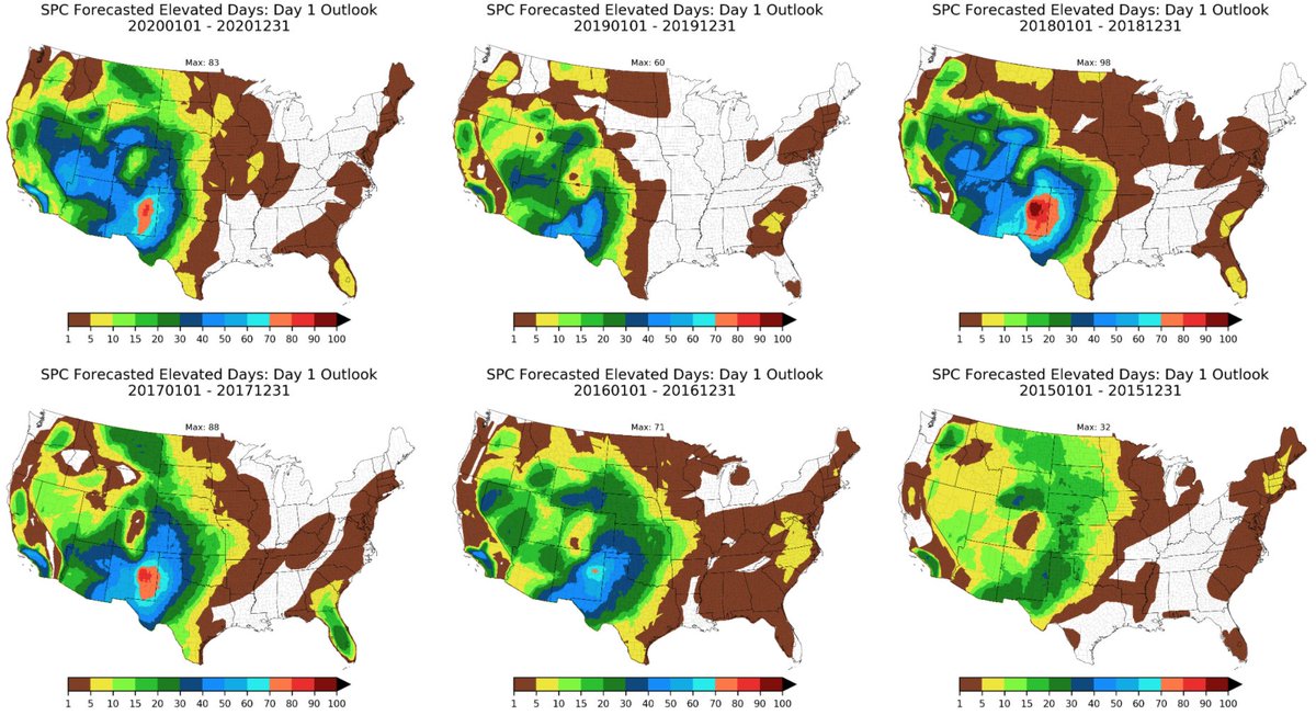
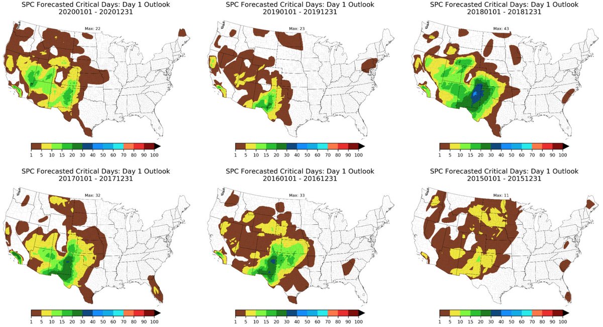
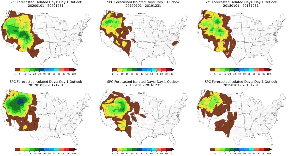
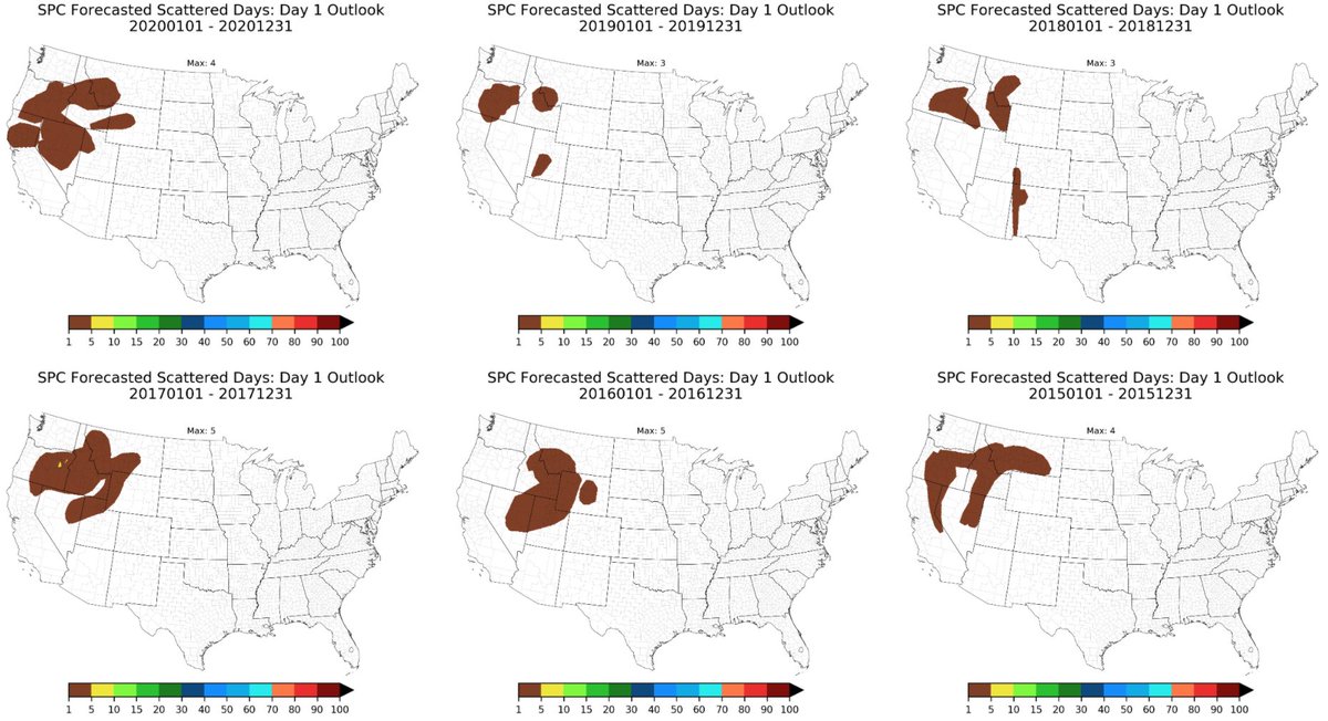
THREAD: Interested to see where (and how often) we issue Fire Weather Outlook areas across the CONUS? Attached are a series of graphics for the past 6 years (2015-2020) by risk level (elevated, critical, extreme; along with isolated dry T and scattered dry T)... 1/5

Elevated:
2/5... Critical:
3/5... Extremely Critical:
4/5... Isolated Dry Thunder:
5/5... Scattered Dry Thunder:
You can follow @NWSSPC.
Tip: mention @twtextapp on a Twitter thread with the keyword “unroll” to get a link to it.

Latest Threads Unrolled:

By continuing to use the site, you are consenting to the use of cookies as explained in our Cookie Policy to improve your experience.