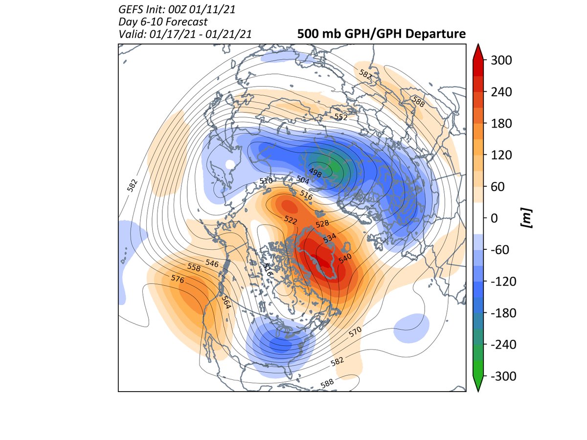
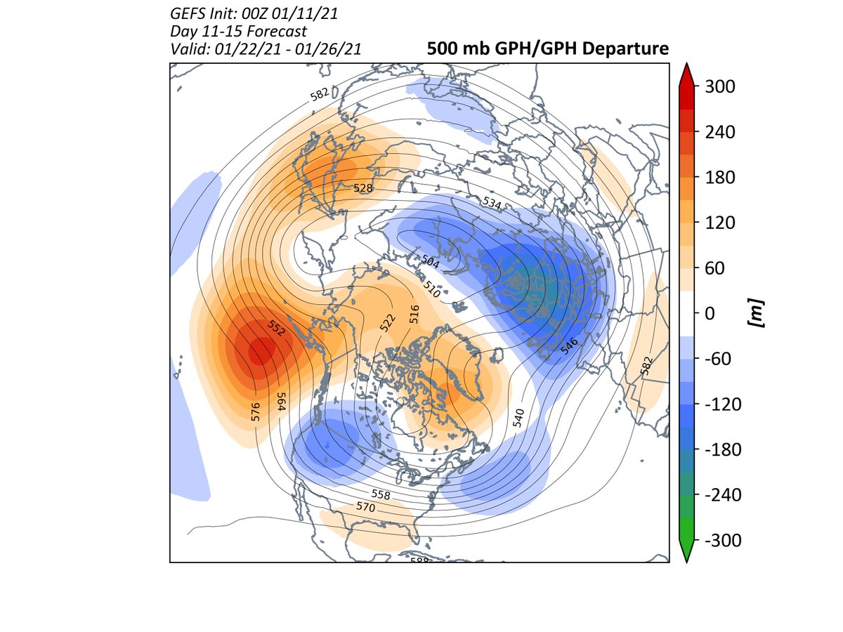
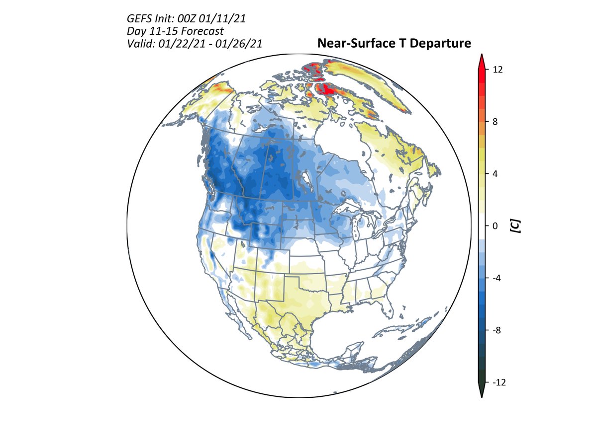
While Europe enters the Deep Freeze following the SSW event, North America will have to wait to see what happens in the Pacific. GEFS shows ridging building more in the Aleutians, which would allow cold to slide into the W US and Canada late Jan. 1/
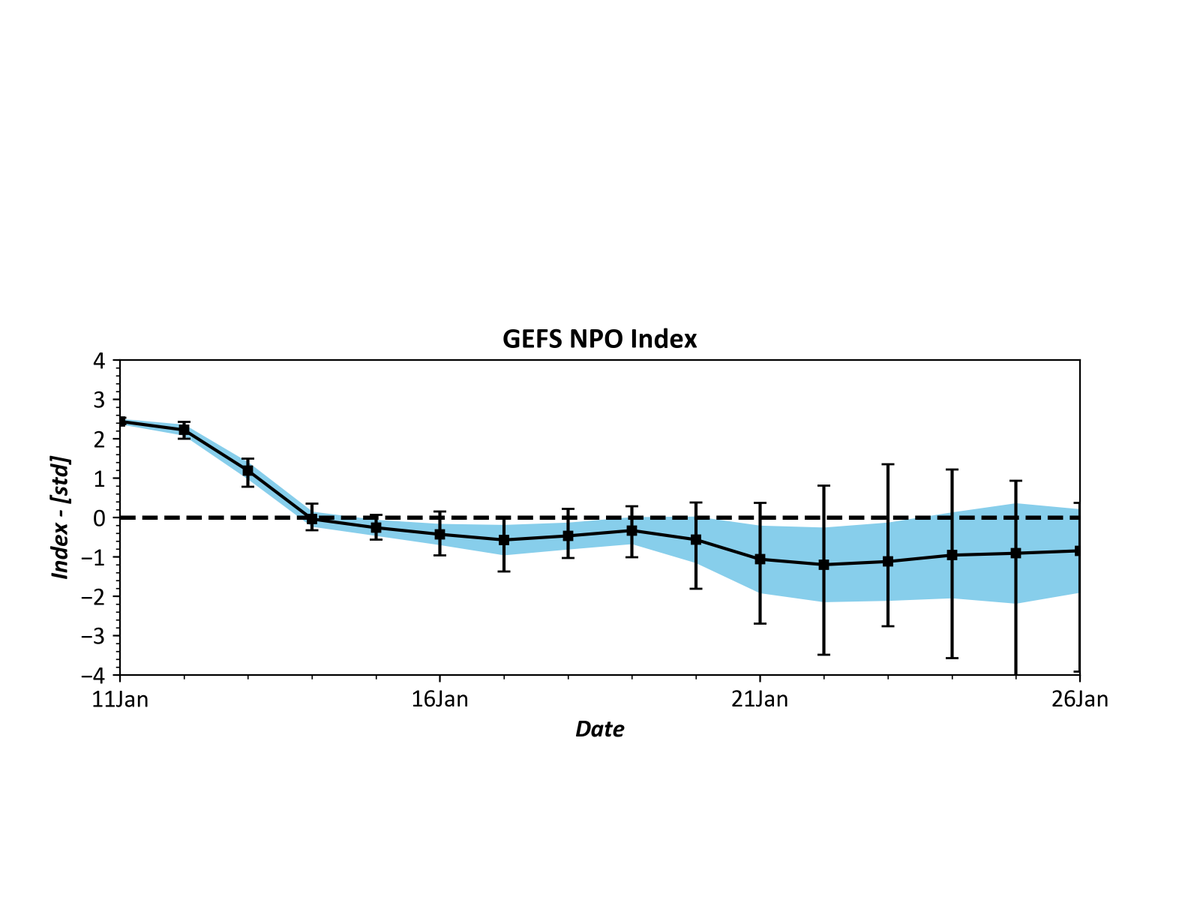
The North Pacific Oscillation (NPO - think NAO but in the North Pacific) will shift negative but very large spread in just how negative because the ensemble members don't agree on the placement of the ridge. If you want major cold in the E US, you want a largely -NPO. 2/
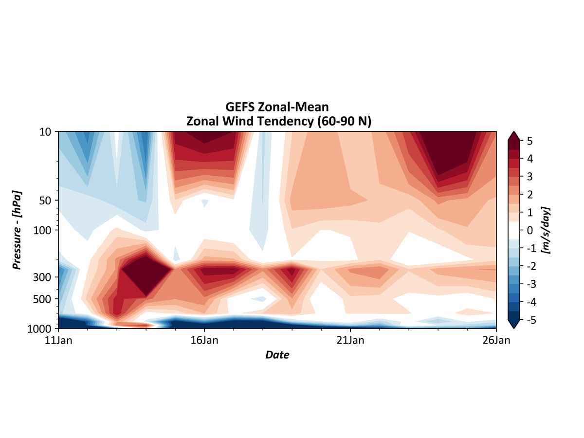
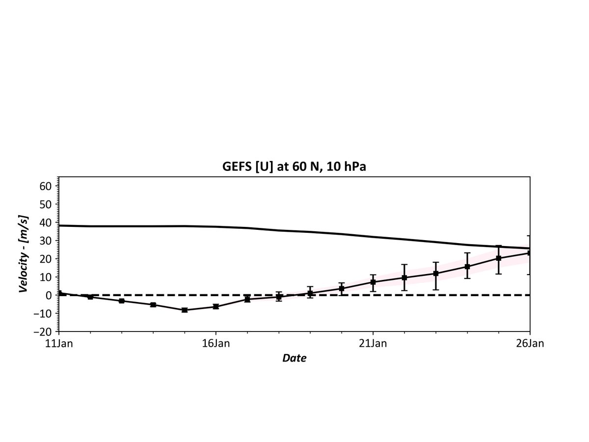
Meanwhile, in the stratosphere, the #PolarVortex looks like it will be making its recovery with strong westerly acceleration (1st image, red colors) likely and a rapid rise in the winds at 10 hPa, 60 N. 3/
Here's an animation showing that recovery at 10 hPa. 4/
Quick summary: The SSW event is progressing as expected right now. Things look fairly locked in for Europe and northern Asia right now. The key for North America will be what happens in the Pacific. But, the US can expect an active pattern developing over the next 2 weeks.

 Read on Twitter