Atlas of (Dys)Function: Power (& lack thereof) in Karachi & the region.
Here is the 1st chapter of my proposed atlas that I’ve completed over the last 10, wrist-breaking days. I’d taken time off from work to focus on this labour of love, & produce at least 1 complete artifact.
Here is the 1st chapter of my proposed atlas that I’ve completed over the last 10, wrist-breaking days. I’d taken time off from work to focus on this labour of love, & produce at least 1 complete artifact.
On the front is a map, geographically accurate, & slightly exaggerated, laying out all power production facilities (> 50 MWs) in & around the city. I added the missing ones from the last iterations, cleaned up the icons & standardised the colours for clarity.
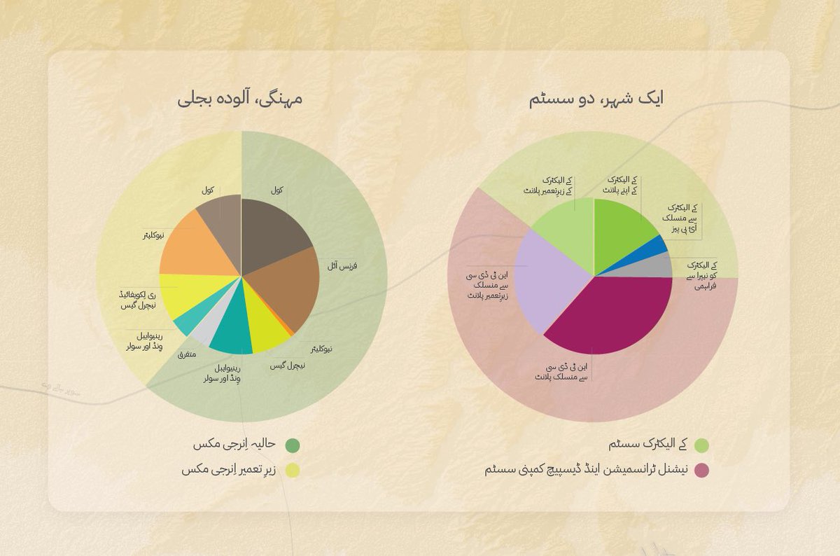
On the top right are two charts: 1 showing the challenge of the network divided into two T&D systems (with little connectivity) & the other shows the energy mix as it will shape up over the next two years.
On the back is an ordered list by each plant: its name, installed capacity, primary fuel & relationship to the two networks (KE & NTDC’s). There’s also an icon for each that I made myself. This was the most tedious, albeit fulfilling, part.
Now that I’ve finished it, I’m wondering why I did this in the first place. Maybe I’ll find the time to print it, sell some copies to enthusiasts & cash in on my labour. Maybe a publisher will see this & commission the whole atlas that I can then work on over the next few years.
But this was a LOOOTTT of work. I spent my entire 10-day holiday on this. But this is done, and I’ll be back to my regular work tomorrow. Thank you for all the feedback. Parting shot to my fav, useless plant, DHA Co-Gen, like whom I will now put this project on snooze. 


Special thanks to the wonderful folks at NEPRA who have made a mountain of documents and publications accessible online. Haven’t seen this accessibility & transparency in any provincial or local govt dept. 


 Read on Twitter


