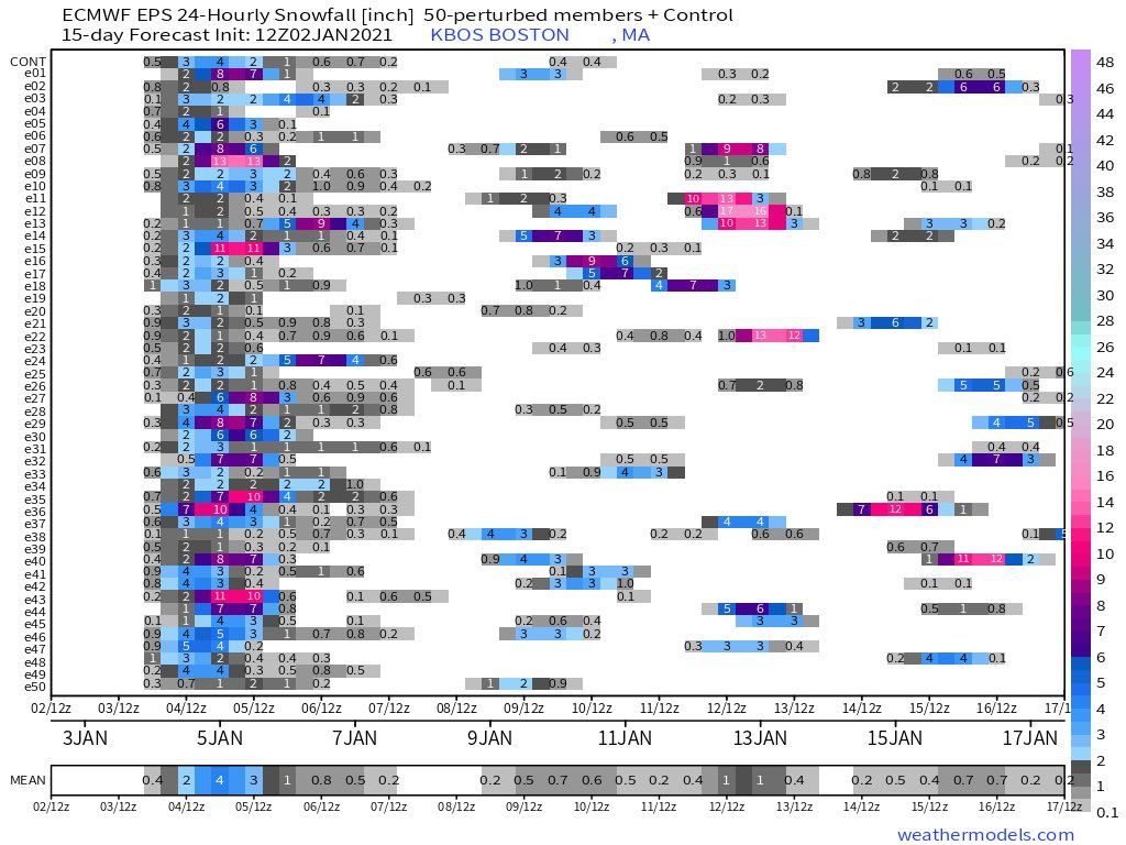
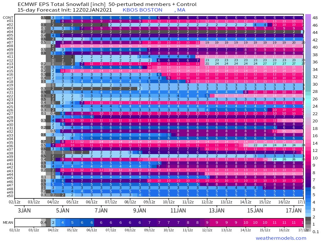
Huge spread for Monday’s snow event, between 1” and 15”. Unfortunately, this event has the potential to bust badly (not saying it will), since the rain-snow line will likely start well west of the city, but then move east and stall somewhere very close.
1/4
1/4
Models differ on QPF, but if Boston stays west of the line the more bullish (6”+) forecasts have a chance to verify, but if it stays just east, the storm will begin with many hours of rain, followed by some snow that would likely amount to an inch or two.
2/4
2/4
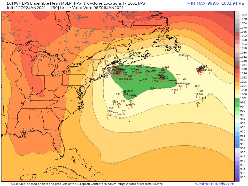
Rain changes to snow for pretty much everyone by noon Monday, should a track closer to the coast occur (what the HRRR, ECMWF, RGEM, UKMET, and virtually all EPS members show). IMO the HRRR handles the storm well, keeping the rain-snow line right near Boston for a few hours.
3/4
3/4

 Read on Twitter


