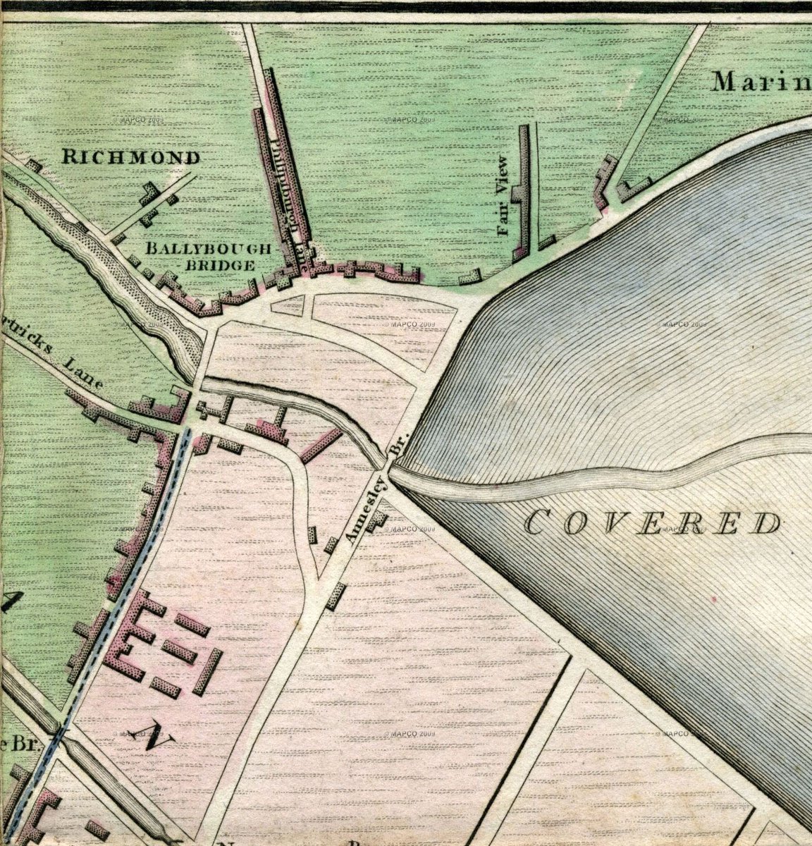
This series of historic map extracts captures the gradual reclaiming and development of the triangle adjacent to the river Tolka and Annesley Bridge.
A late as Bernard Scalé's map of 1777, Ballybough Bridge was the last crossing over the Tolka before it flowed into mudflats.
A late as Bernard Scalé's map of 1777, Ballybough Bridge was the last crossing over the Tolka before it flowed into mudflats.
An act of parliament in 1792 permitted building of a new bridge to provide more direct access from the city to Clontarf and the northern suburbs. This involved construction of substantial causeways, reclaiming a large area of land in the process - as seen here on a map of 1798.
Half a century later, the land was still being drained, as depicted by the 1847 OS map. Viable development of this land was hindered by the vast vitriol (sulphuric acid) works on the south bank of the Tolka, now the site of Ballybough House flats on Poplar Row.
It was only in the opening years of the 20th century that the distinctive triangle was formally reclaimed for housing as Addison and Cadogan Roads - the latter only half built on this map of 1907. By this stage, the vitriol works had transformed into a fertilizer works.
Today, Addison and Cadogan Roads present rare Dublin examples of streetscape differential settlement by reclamation, where houses visibly roll in waves along their terraces. The benefits of flexible traditional construction ensure their continued viability and attractiveness.
This curveball, a Wide Streets Commission map of 1823 from @dubcilib, shows the intention to cut through the lands of John McKenny to link Clonliffe Road with the new bridge. A toll house and gates regulates movement onto Fairview, prior to the 1920s emergence of Fairview Park.

 Read on Twitter


