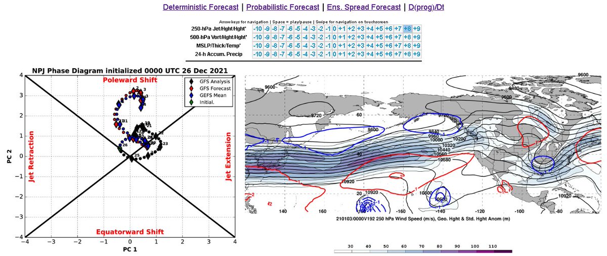
Coming back to the forecasted Pacific jet extension, here on the North Pac Jet Phase diagram, we can see that this registers strongly in the Poleward Shift section of the plot. See: http://www.atmos.albany.edu/facstaff/awinters/realtime/Deterministic_NPJPD.php
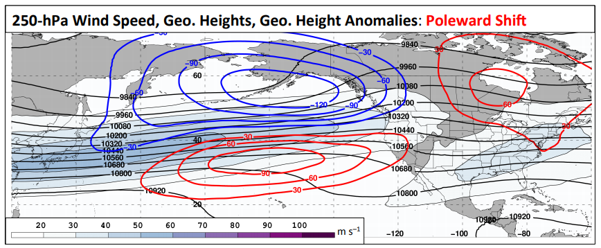
The upcoming forecast is a very close match to the Poleward Shift composite where we see the jet extend all the way to the Pacific Northwest and negative low anomalies move into the North Pacific & Alaska (blue contours). See: https://www.weather.gov/media/sti/nggps/Presentations%202017/08%20NGGPS17_PImeeting_Bosart.pdf
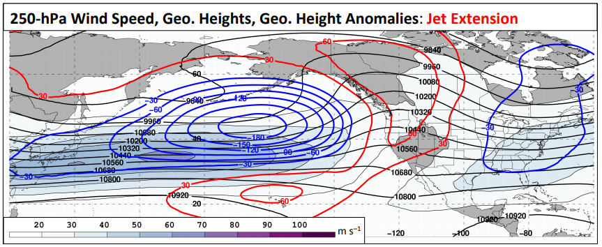
This is in contrast to the Jet Extension composite which is a bit south compared to the Poleward Shift composite. Note the +PNA ridging in W North America. Also, the jet isn't extended as far east (which is interesting given the name 'Jet Extension')
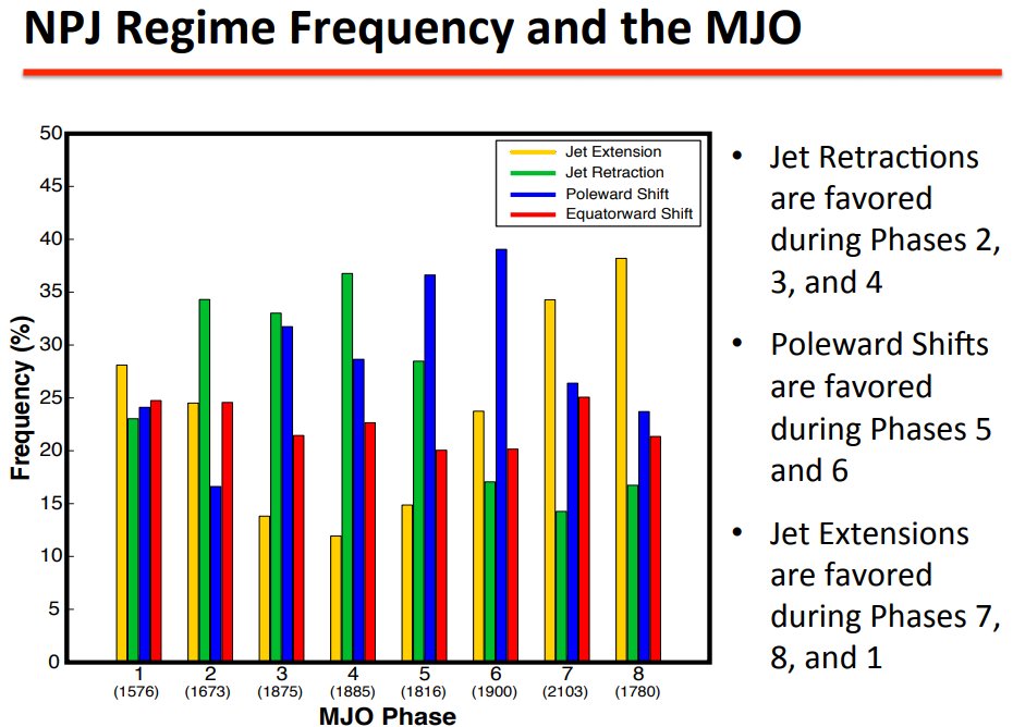
Accordingly, the Poleward Shift phase is also most common during MJO Phases 3-6 (note that Phases 5 & 6 are indicated in the text on the right, but the 4 highest Poleward Shift values are for MJO Phases 3-6)
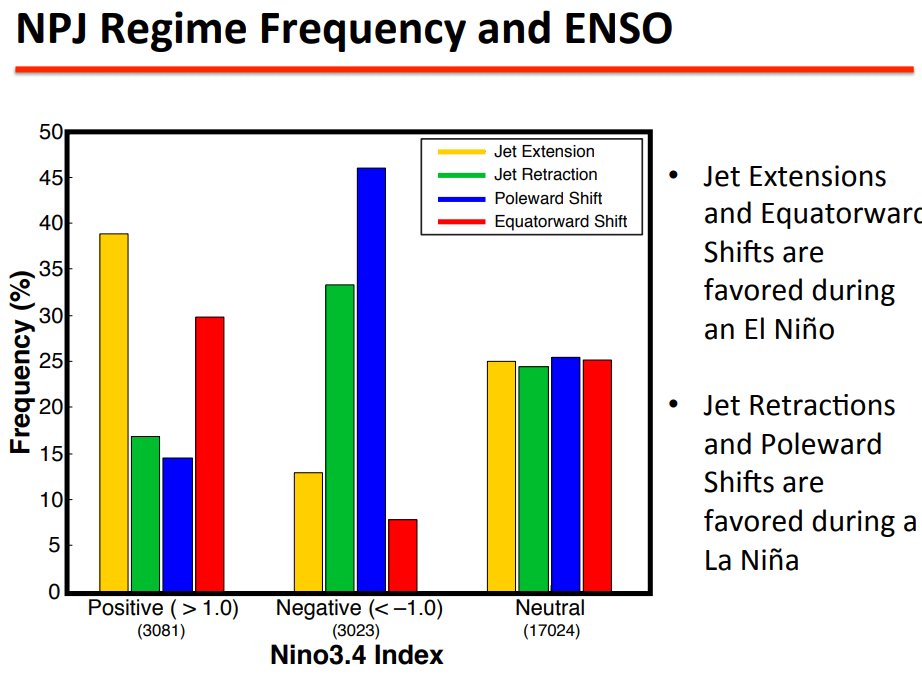
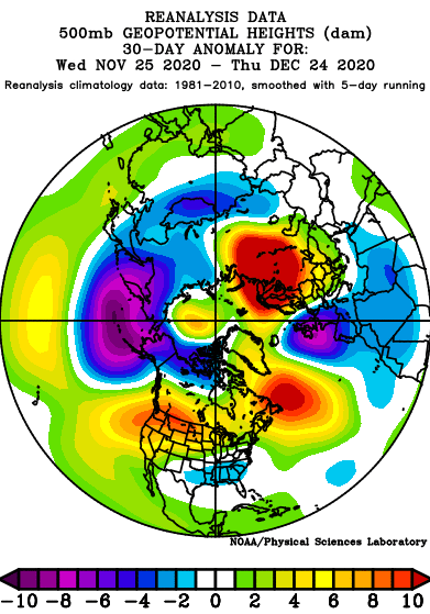
While we have seen some El Nino like features in the 500mb pattern over the last 30 days (W U.S. ridge / SE U.S. trough), we've also seen some La Nina features (North Pac / Aleutian / AK Low that is farther north than El Nino climatology).
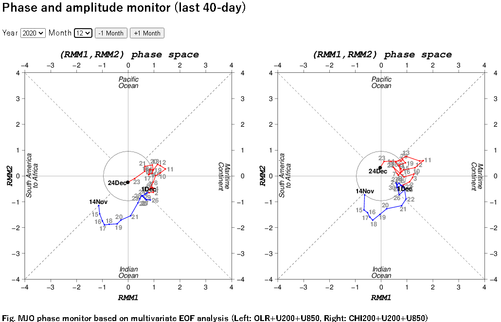
After making an MJO Phase 8-1-2-3 circuit in November, the RMM plot shows quiet activity in December. However...
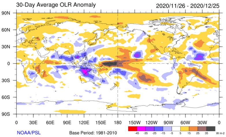
The OLR Anomaly plot over the past 30 days is quintessential La Nina (essentially stationary MJO Phases 3-6) with enhanced convection in the Indian Ocean & Indonesia, and suppressed convection in the Central Pacific / Dateline region
Thus, Pacific jet extensions will likely continue to send low height anomalies into the North Pac / Alaska, as seen here on today's Euro Ensemble
And the jet extensions themselves are being fostered by the near constant Urals ridging that is sending surface high pressure systems into E Asia, leading to +East Asian Mountain Torque events (and associated jet extensions)
Which, by the way, the near constant Urals ridging is weakening the stratospheric polar vortex
But in order to get out of this cycle in a meaningful way, we'll need to see the tropical convection move east out of Indonesia, and maybe temper the Urals ridging a bit (and associated +EAMT)
One thing to look for...along with a stratospheric warming (or official SSW) in the polar cap, there will be an opposite effect in the tropical stratosphere whereby cooling will ensue. This may aid to re-ignite the MJO allowing it to make a circuit across the Western Hemisphere
Here at 30mb in the stratosphere we can already see the effects of early warming in the polar cap above 60N as it leads to cooling along the equator. This will increase and should occur down in lower levels of the stratosphere as well, facilitating enhanced tropical convection.
That is all

 Read on Twitter