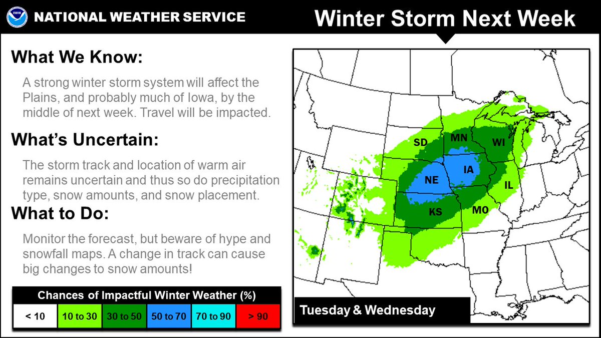
Us: So, you've likely heard about the winter storm that will pass through the region next week (about 4-5 days away)?
You: Yes. How much snow are we going to get?
Us: It's complicated. Depends on track, amount of moisture, and temperature to just name a few. #iawx
THREAD
You: Yes. How much snow are we going to get?
Us: It's complicated. Depends on track, amount of moisture, and temperature to just name a few. #iawx
THREAD

What does a change in storm track or temperature look like for a fictitious winter storm? Let's look at different scenarios for low pressure moving northeast through the region. #iawx
Here's a GIF showing a northern, central, and southern storm track. Each track gives a different amount of snow as well as wintry precipitation.
For example, a...
 central track gives city A heavy snow
 southern track gives city A no snow
#iawx
For example, a...
 central track gives city A heavy snow
 southern track gives city A no snow
#iawx
Let's keep the various storm tracks, but make temperatures warmer in this GIF.
For a northern track at city B in the previous tweet, moderate snow was expected. Now, with warmer temperatures less snow is expected with just light snow amounts. #iawx
For a northern track at city B in the previous tweet, moderate snow was expected. Now, with warmer temperatures less snow is expected with just light snow amounts. #iawx
Let's flip to colder temperatures in this GIF.
A central track at city C with colder temperatures yields heavy snow compared to no snow in the warmer scenario and first example. #iawx
A central track at city C with colder temperatures yields heavy snow compared to no snow in the warmer scenario and first example. #iawx
So back to reality. We've told you what we don't know. Here is what we DO KNOW:
 There is a winter storm next Tuesday/Wednesday
 There will be various forms of wintry precipitation
 Travel will be impacted
 Winds blustery
 Highest snow totals the farther north in Iowa
#iawx
 There is a winter storm next Tuesday/Wednesday
 There will be various forms of wintry precipitation
 Travel will be impacted
 Winds blustery
 Highest snow totals the farther north in Iowa
#iawx

 Read on Twitter


