As there has been lots of talk and debate over the weather in the coming couple of weeks and possibly longer term as well. As this is the case I want to give my opinion of the weather in the coming weeks. Read thread below...
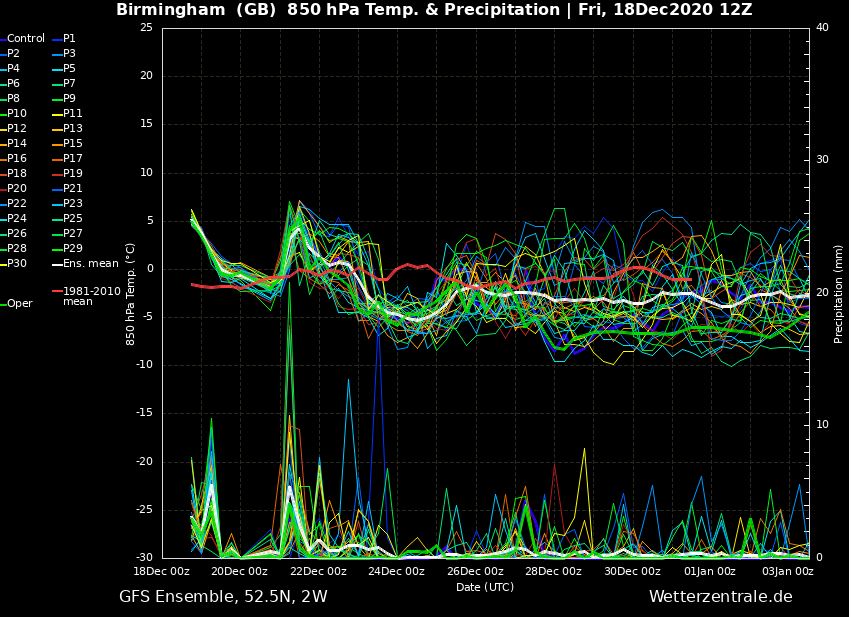
I firstly want to talk about the overall GFS ensemble pattern and the first thing i notice is that it looks like from the middle part of next week onwards towards Christmas it will feel relatively cool with temperatures likely a little below average and average rainfall... 1/10
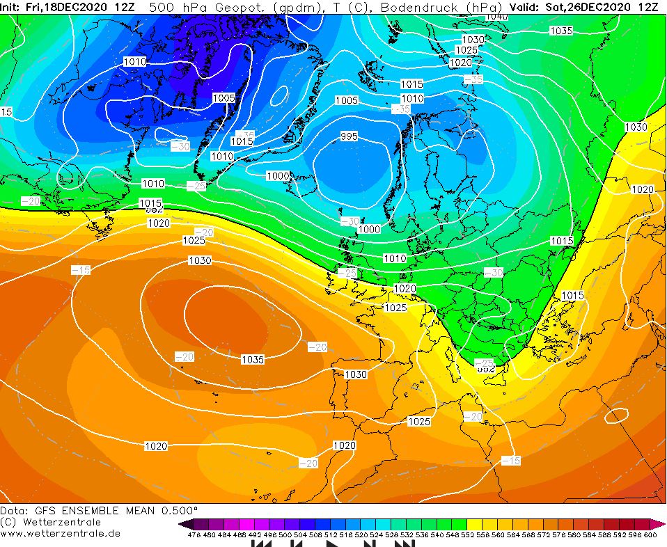
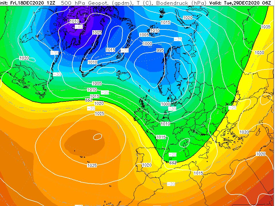
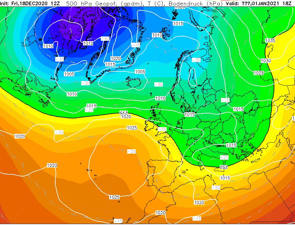
However there are some ensembles indicating a warmer signal at times but they aren't noteworthy enough to say that it will be very unsettled and mild. Looking at the ensemble mean it would suggest that High pressure will generally dominate to the Southwest and a trough 2/10
will most likely sit over central and eastern Europe and to the north of Europe. This suggests a more of a North-westerly wind flow across the Uk with the possibilities of even a north or north easterly if Heights can build to the N. This more NW flow will favour frequent... 3/10
Snow showers to the north west of the UK and possibly wintry showers along the east coasts if the flow is more northerly in nature. I do think for southern areas ( SW in particular) it will generally be more settled with average or slightly cooler than average temperatures. 4/10
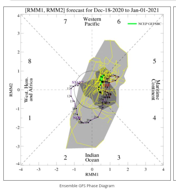
The MJO confirms this more NW flow with it being more favoured in Phase 5 and maybe phase 6 in the coming few weeks. For late December and January these phases do match with the GFS ensemble analysis as those phases are favoured with a NW flow across the UK. 5/10
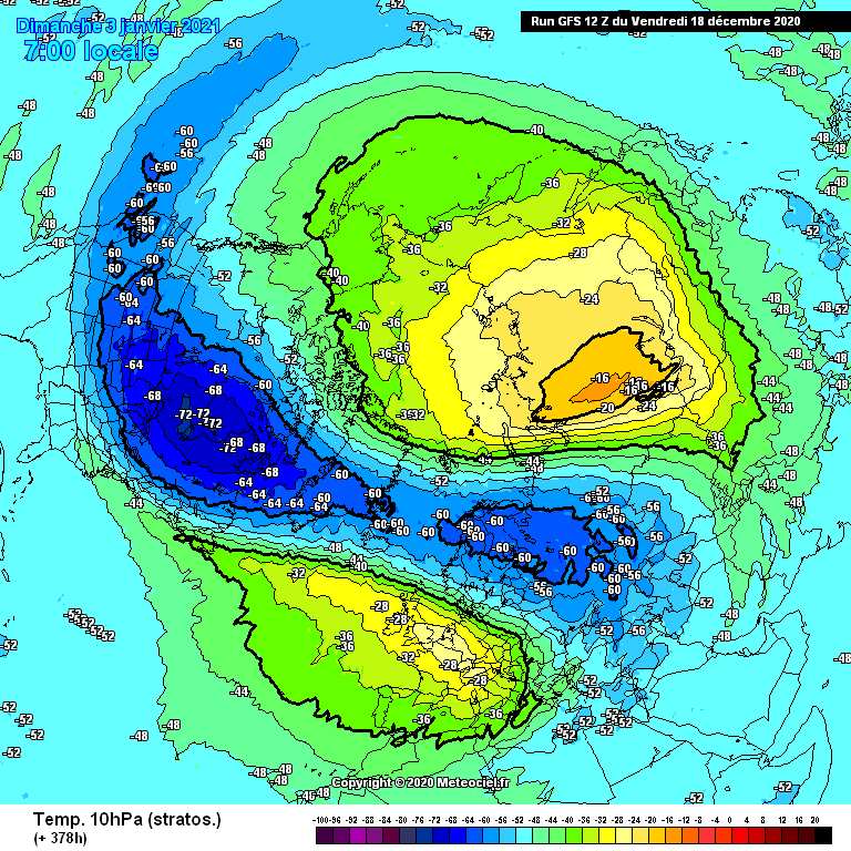
The GFS runs are being consistent now with the prospects of a significant warming in the stratospheric levels and possibly a SSW may occur. If we can get a " Signifcant weakening " of the PV due to this, this would allow the PV to reverse and allow a more dominant easterly..6/10
flow as this could really ripple the Jet stream and cause a large Trough across the UK bring low pressure from NE to SW or Greenland or Scandivavian blocking would allow easterlies across the UK. This does need to be taken with caution as these blocking set ups or..., 7/10
Deep troughs bring lows from NE to SW can occur anywhere in the N hemisphere and even then this isn't Guaranteed. But there is this increased possibility of more widespread snowfall in late December and early January across northern areas and if the trough to the east... 8/10
.. Lines up correctly this would allow a greater chance of Significant snow to many areas, even to the SE of England. However this looks unlikely unless if a PV split occurs then its something which we may be allowed to get more excited about as long as we are in phases 5-8... 9/
.. then this could be more favoured for the UK to get a more significant colder and snowy spell.
Conclusion:
> A general NW flow for the mid term though we need to watch how the possible SSW evolves and how the MJO behaves in January. 10/10
Conclusion:
> A general NW flow for the mid term though we need to watch how the possible SSW evolves and how the MJO behaves in January. 10/10

 Read on Twitter
