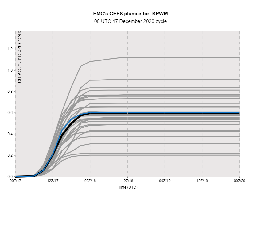
GEFS QPF plumes from 00Z 17 December showed just how much spread there was for Portland. QPF ranged from 0.2" to 1.12" with less than 12 hours from the start of the storm.
The spread on global model suites definitely made this forecast a bit tougher. However, if you drop the big outliers and focus more on storm track and how that would favor some moisture transport here, you can deduce that the middle outcomes are more reasonable.
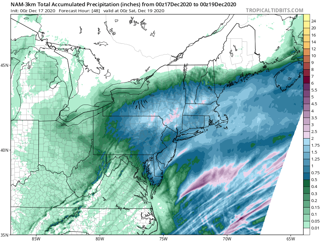
The forecast QPF by mesoscale models was generally better. Pictured below is the 00Z 17 December NAM run, showing a solid 0.5-1" of QPF in southern Maine.
Given all of this data (plus the other models and their output...but this isn't a model thread as much as it is just my personal thoughts), the QPF forecast for PWM to end up above half and inch and below an inch was pretty solid.
The caveat, though, is snowfall ratios. Model snowfall output uses a 10:1 ratio for many of the snow maps you see being passed around social media. This would mean that for every inch of QPF (total liquid precip), you would get 10" of snow.
Without getting too technical, the normal 10:1 ratio rule was looking pretty good locally. Since it was so cold, though, we ended up with a forecast of 6-12" for Portland to account for dendrites which stack well. The "fluff factor," if you will
A slightly higher ratio like 12:1 or slightly lower like 9:1 would still be a pretty solid forecast. But that's not how it happened. Instead, Portland and the surrounding areas ended up with 20:1 ratios! https://twitter.com/RyanBretonWX/status/1339693494105980933?s=20
This helped to inflate totals and pushed those numbers up. I've got a full blog coming on our website with all of this info plus some extra goodies coming shortly

 Read on Twitter


