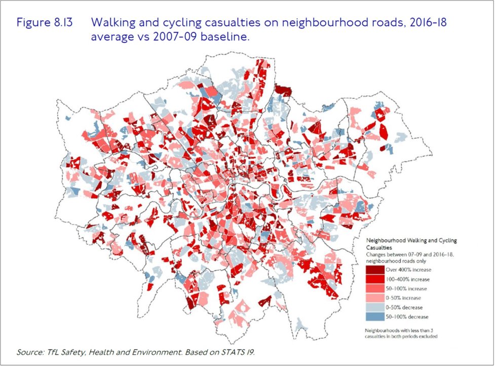
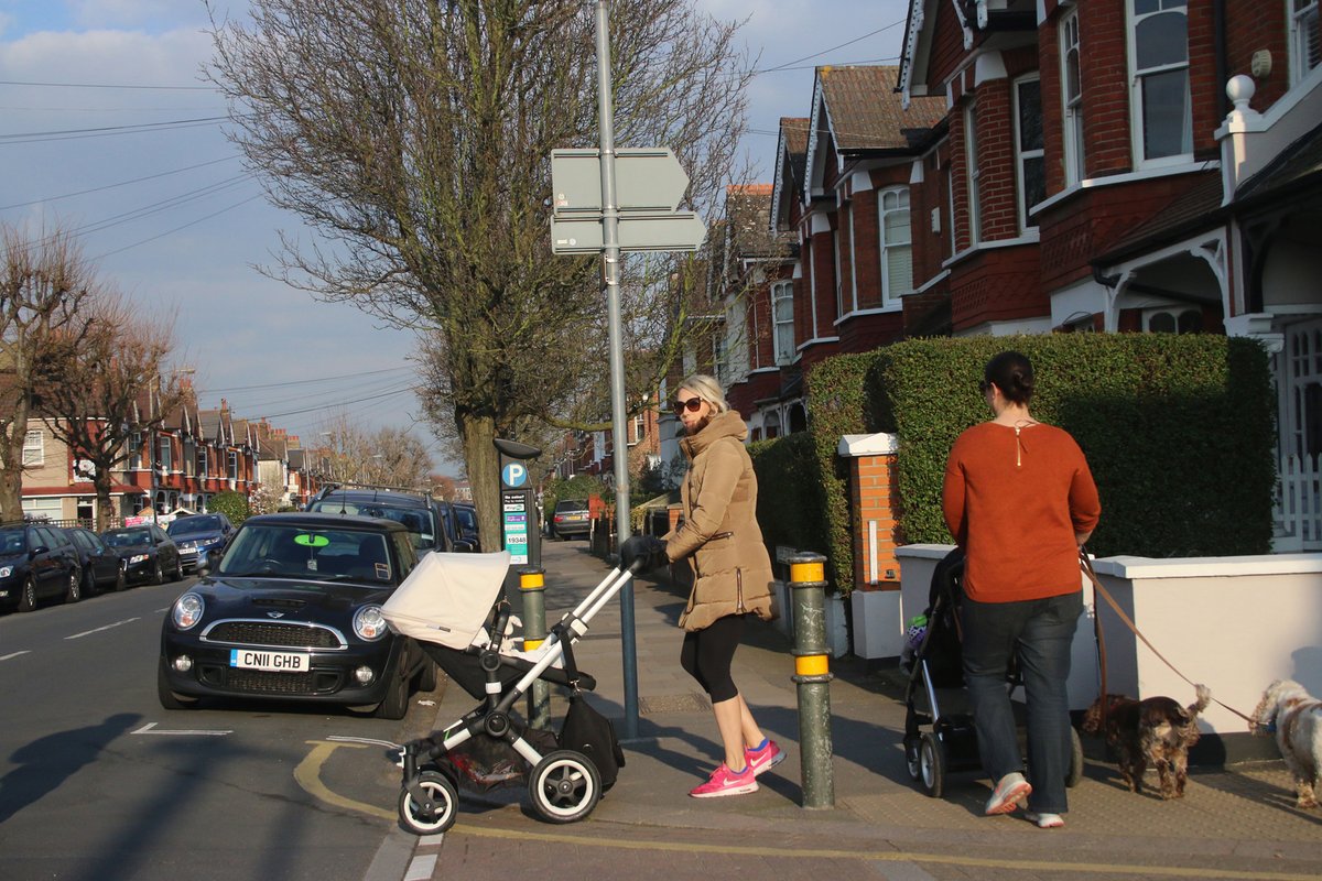
1/n. Just drawing a few themes together on #RoadDanger on neighbourhood roads in #London. From @TfL's Travel in London 13 report (p205), casualties on neighbourhood streets have been increasing at a greater rate than on main roads. http://content.tfl.gov.uk/travel-in-london-report-13.pdf
#VisionZeroLDN
#VisionZeroLDN
2/n. Figure 8.13 of the report shows that this has a disproportionate impact on some areas. “Over 300 neighbourhoods recorded at least double the number of #Walking and #Cycling casualties in 2016-18 compared to 2007-09”.
#RoadSafety #VisionZeroLDN
#RoadSafety #VisionZeroLDN
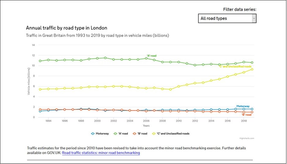
3/n. As others have noted, the widespread take-up of Sat-Navs since 2008 has caused large increases in motor traffic volumes on these neighbourhood streets.(Unclassified roads = yellow line below).
#RoadDanger #VisionZeroLDN
#RoadDanger #VisionZeroLDN
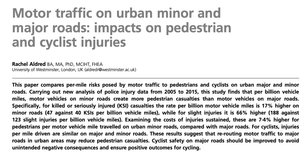
4/n. Research by @RachelAldred ( http://bit.ly/38ewJut ) shows that for killed or seriously injured (KSI) casualties the rate per billion motor vehicle miles is 17% higher on minor roads; for slight injuries it's 66% higher.
5/n. Overall then, #London is now seeing far higher traffic volumes on roads where the risks are far greater (especially to pedestrians (see above research)) for every mile driven. The result is increasing numbers of injuries on these roads.
#VisionZeroLDN #RoadDanger
#VisionZeroLDN #RoadDanger
6/n. Low Traffic Neighbourhoods are then an essential response to these changes, ensuring that danger is not increased further in neighbourhood streets that are vital to the communities who live on them…
#LowTrafficNeighbourhoods #VisionZeroLDN
#LowTrafficNeighbourhoods #VisionZeroLDN
7/n. …and making sure that London’s #VisionZero goals are not undermined by the rising numbers of casualties caused by these new journeys on these streets and roads.
#VisionZeroLDN #RoadSafety
#VisionZeroLDN #RoadSafety

 Read on Twitter
