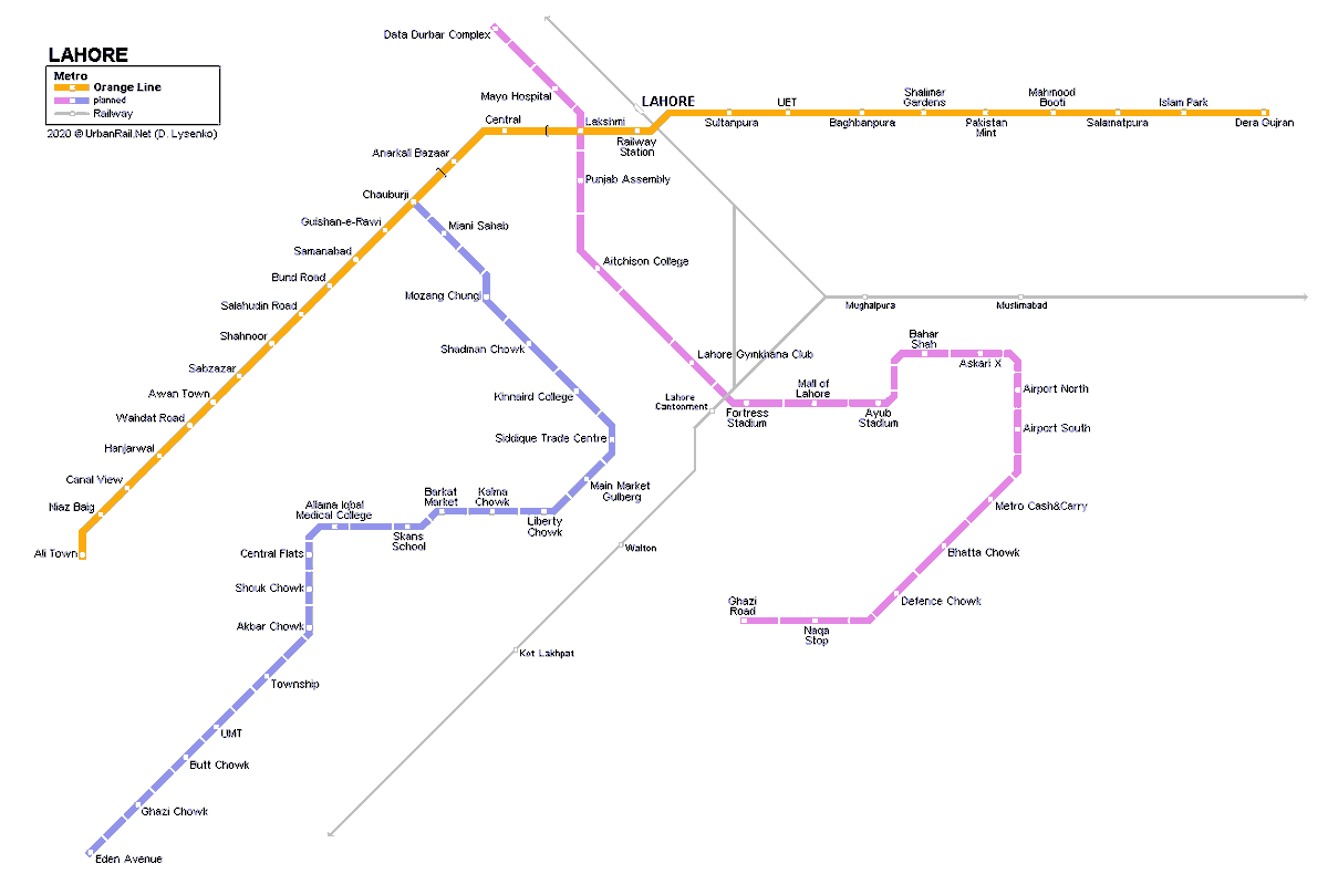
Worked on a mini-project this week. I created a reimagined map of the rapid mass transit system in #Lahore categorized by towns. It includes the Green line BRT , the Orange line metro
 and the planned Blue and Purple lines.
 This is what I learned during the design process.
 , the Orange line metro
 and the planned Blue and Purple lines.
  This is what I learned during the design process.
First step in the design process was to research the various maps documenting Lahore. Preferably ones with some granularity of geo data.
Discovered this map but it contains a few gaps. It does not include the Greenline BRT route and major towns.
Link: https://bit.ly/2JZzMyH
Discovered this map but it contains a few gaps. It does not include the Greenline BRT route and major towns.
Link: https://bit.ly/2JZzMyH
Through examining official document plans, I found a published JICA survey (2012) charting the Lahore Urban Transport Master Plan (LUTMP).
The following map is a 2010 prediction of worsening traffic conditions by 2030. This is in the absence of a rapid mass transit network.
The following map is a 2010 prediction of worsening traffic conditions by 2030. This is in the absence of a rapid mass transit network.
Reading further, this map presents a bird's eye view of the towns that make up the Greater Lahore area. However, this one does not show geo points or any connected route.
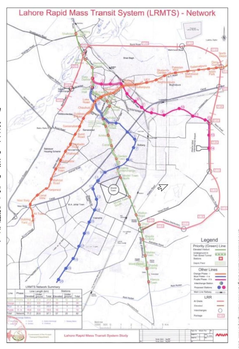
This map showcases the plan design of the Lahore Rapid Mass Transit System (LRMTS), taken from the government of Punjab website.
Close inspection gives us the required details about the stops of existing and planned transit lines.
Link: https://epd.punjab.gov.pk/system/files/Section-3-Project%20Description.pdf
Close inspection gives us the required details about the stops of existing and planned transit lines.

Link: https://epd.punjab.gov.pk/system/files/Section-3-Project%20Description.pdf
There is a Google-powered app where you can view areas in Lahore with the most updated boundaries. Through this tool, we can deduce which bucket  the stops fell into with great precision. The search tool
  can also be used to find the exact geo point.
 the stops fell into with great precision. The search tool
  can also be used to find the exact geo point.
With the acquired data, we can group the stops together by town. With the geo points searchable with the tool mentioned above, we start building the map.
 Using #Figma as the design tool, creating the map blueprint took a few iterations. Highlighting a few constraints:
- Keeping the stops equidistant.
- Keeping the angles in degrees of, 45, 90 and 135
- Minimize word clutter.
Since the map is not drawn on scale, there was flexibility in adjusting the boundaries to accommodate the points falling in the intersection of two towns.
The towns look like 'islands' to emphasize the bus/train stops.
The towns look like 'islands' to emphasize the bus/train stops.

 Ending the thread here. Eager to get back and hear from designers, urban planners and map enthusiasts!
  If you're interested in getting the full copy of the map, connect with me!
 Will share another blueprint that would be drawn to scale, in the next post.

 Read on Twitter


