Made this thread on 23/11 warning that Azerbaijan will attack Hin Tagher & Khtsaberd because all maps show the areas falsely under Azeri control and here we are 3 weeks later, they’re under attack. No public discussion on deployment of Russian peacekeepers there this entire time. https://twitter.com/zinvor/status/1330946940650074115
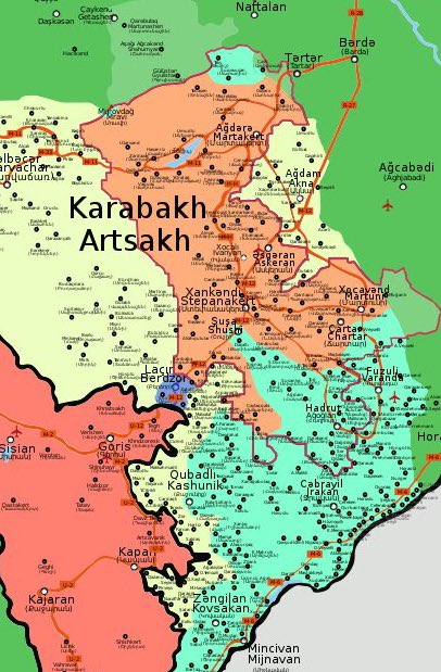
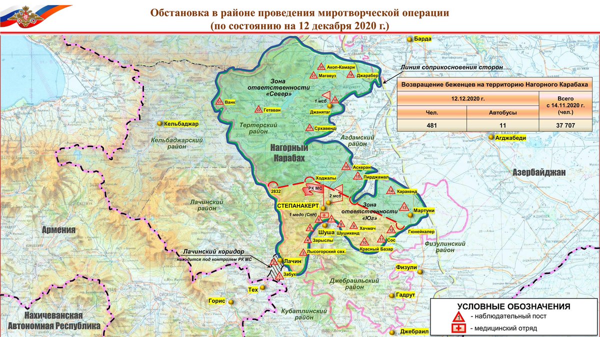
Maps that “explain” why Hin Tagher & Khtsaberd are under Azeri attack.
Map 1: What Armenians control. See southwest tail in orange? That’s where these villages are. They’re within ex-NKAO & not subject to any handover.
Map 2: Russian peacekeepers map never included that area.
Map 1: What Armenians control. See southwest tail in orange? That’s where these villages are. They’re within ex-NKAO & not subject to any handover.
Map 2: Russian peacekeepers map never included that area.
Once again stressing that all of this was predictable at least THREE WEEKS AGO. People surprised that this could happen because they have no clue that this area went unaddressed as grey zone outside of Russian peacekeeper map. We found out we control them weeks after agreement 


 Read on Twitter


