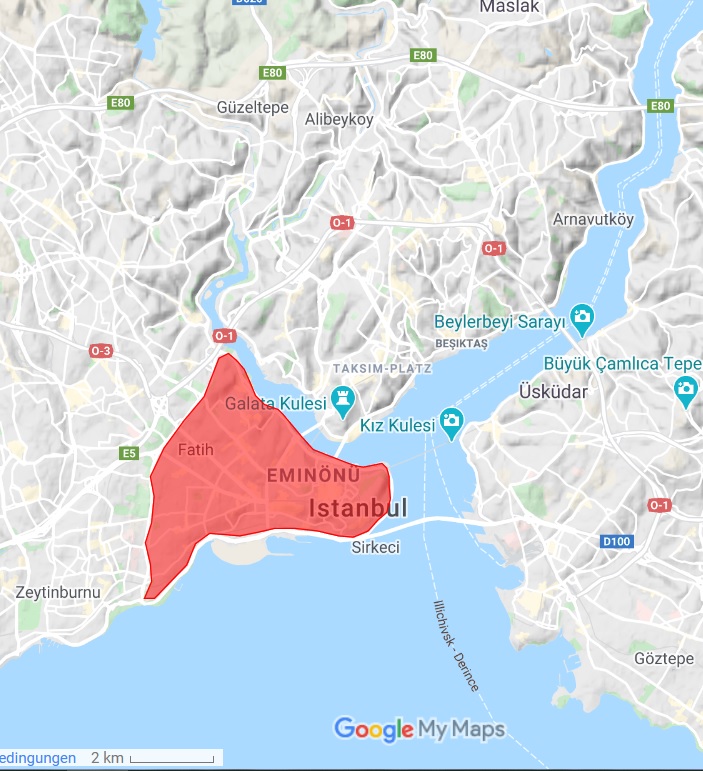
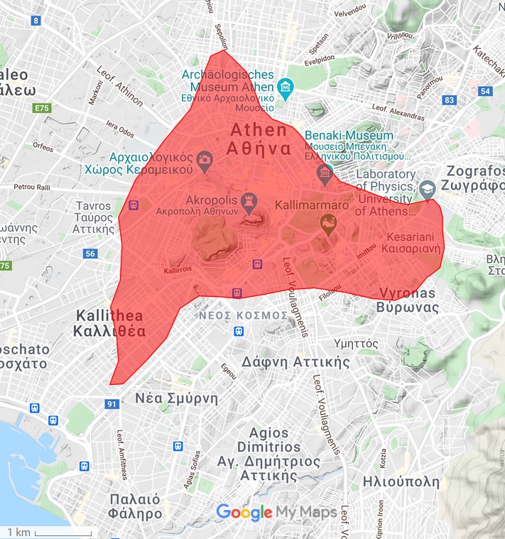
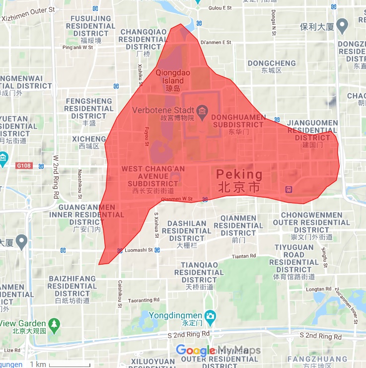
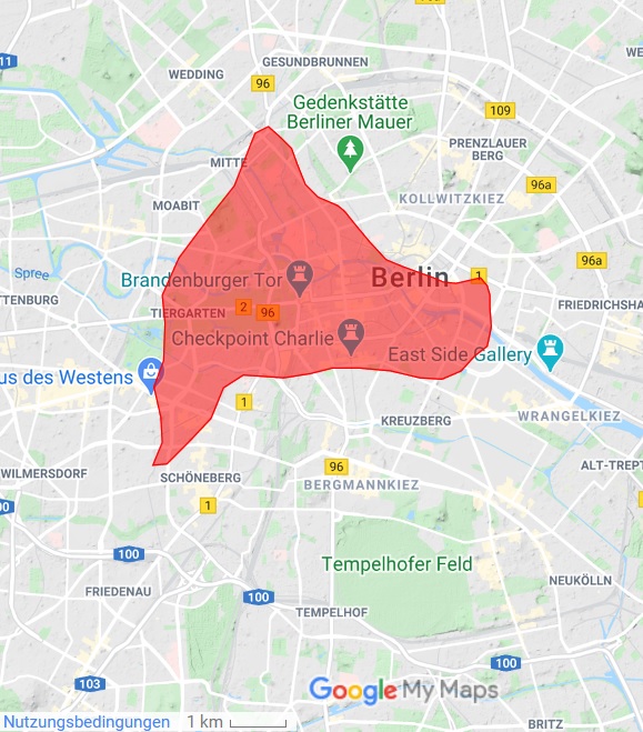
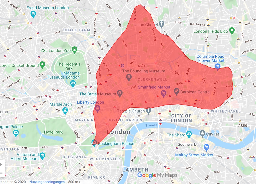
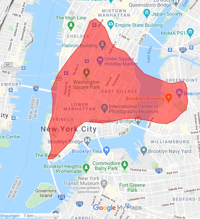
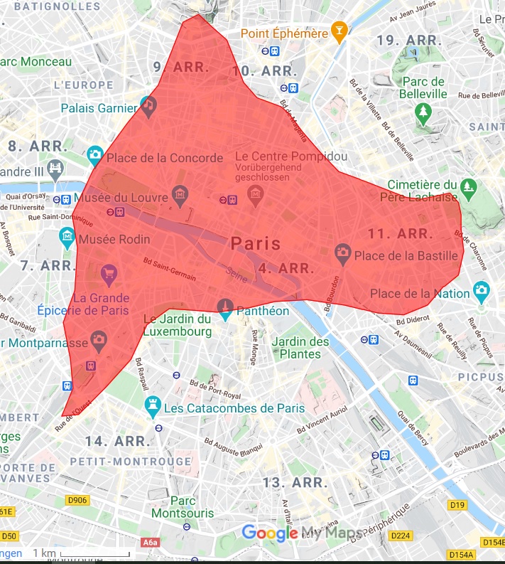
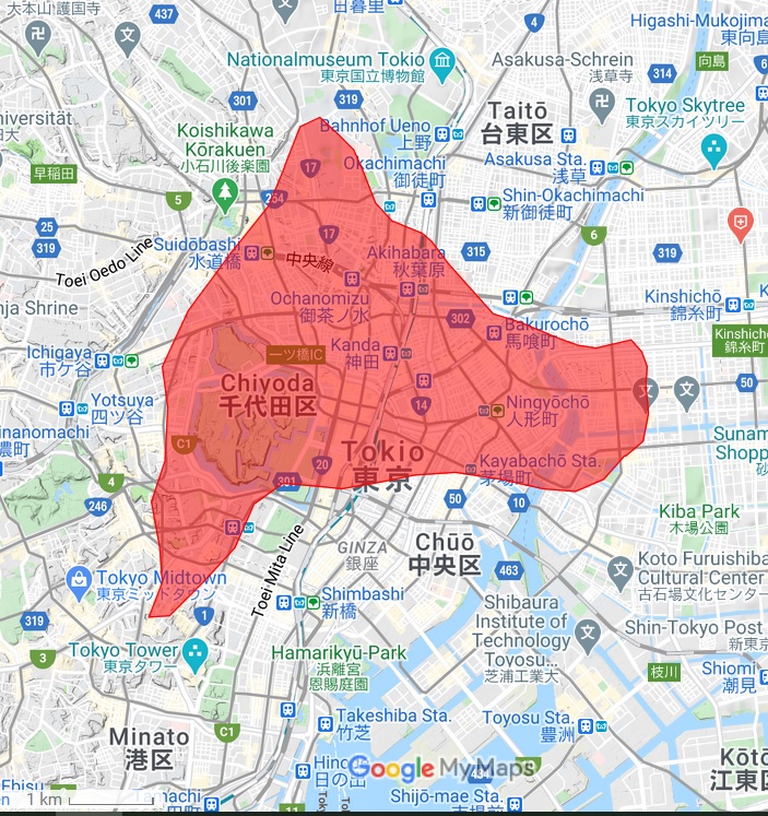
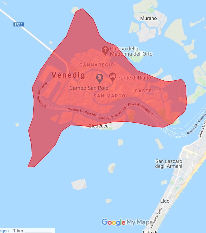
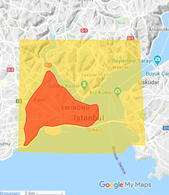
How big was the #NewRome? The spatial extent of #Byzantine #Constantinople within a modern map of #Istanbul (and several other cities will follow in the tweets below)
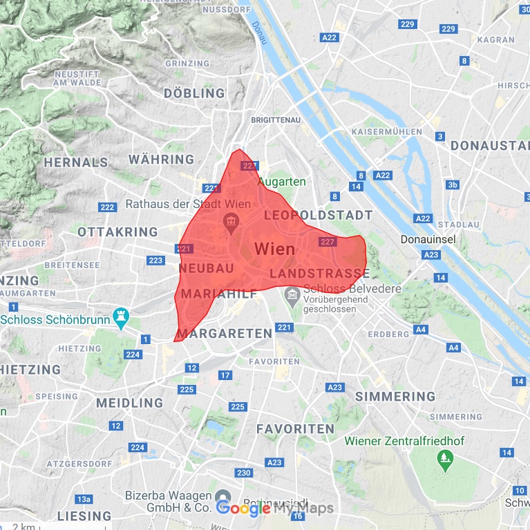
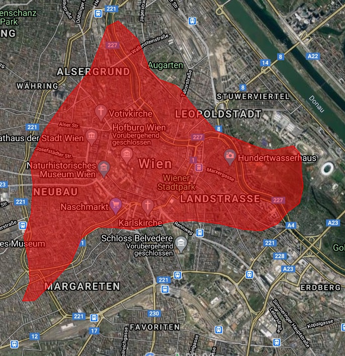
The spatial extent of #Byzantine #Constantinople within a modern map of #Vienna
Die räumliche Ausdehnung des byzantinischen mittelalterlichen Konstantinopel in einem modernen Stadtplan von #Wien
#Byzanzforschung, @imafo_oeaw @oeaw
Die räumliche Ausdehnung des byzantinischen mittelalterlichen Konstantinopel in einem modernen Stadtplan von #Wien
#Byzanzforschung, @imafo_oeaw @oeaw
But just to bring things into a global medieval perspective: the spatial extent of #Byzantine #Constantinople (red, 14 km²) in comparison with that of the #Chinese capital of Chang´an (yellow, under the Tang, ca 600-900 AD, 80 km²) on a modern-day map of #Istanbul 


 Read on Twitter