I've been thinking about this for a little while.
And how fundamentally incorrect the premier is.
So let's do a quick thread looking at every province in Canada when it comes to its data. https://twitter.com/CHEK_News/status/1329262234707451905
And how fundamentally incorrect the premier is.
So let's do a quick thread looking at every province in Canada when it comes to its data. https://twitter.com/CHEK_News/status/1329262234707451905
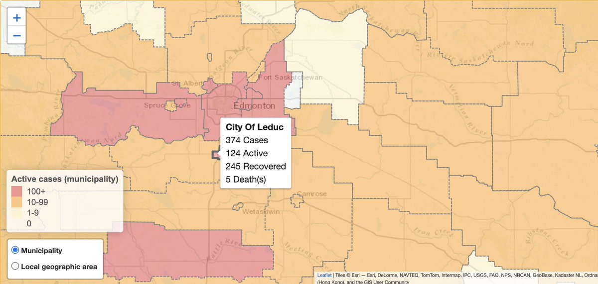
Alberta: tons of data on lots of detailed health regions, updated daily.
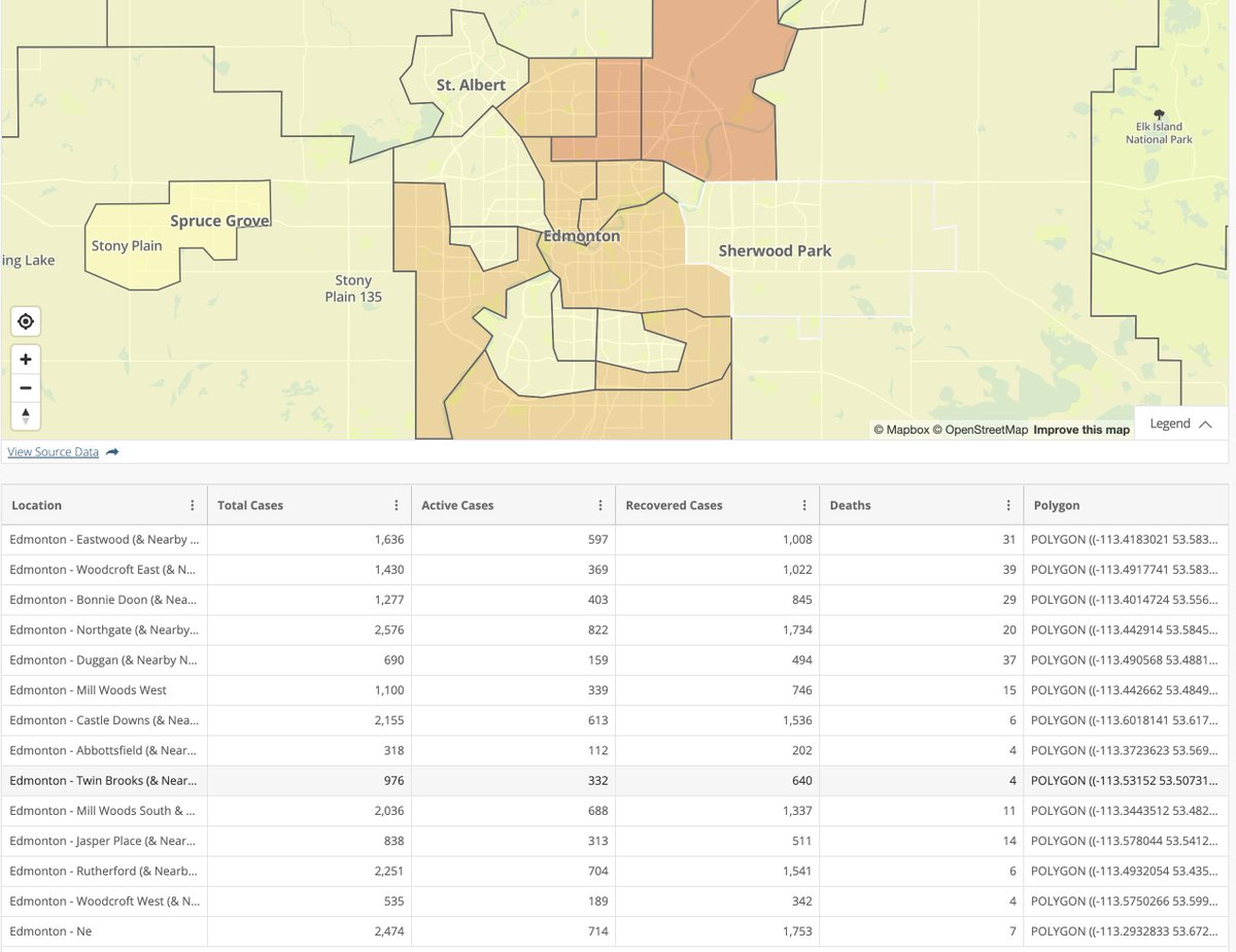
In Edmonton and Calgary, we get total cases, active cases and deaths on a neighbourhood level.
https://www.alberta.ca/stats/covid-19-alberta-statistics.htm
In Edmonton and Calgary, we get total cases, active cases and deaths on a neighbourhood level.
https://www.alberta.ca/stats/covid-19-alberta-statistics.htm
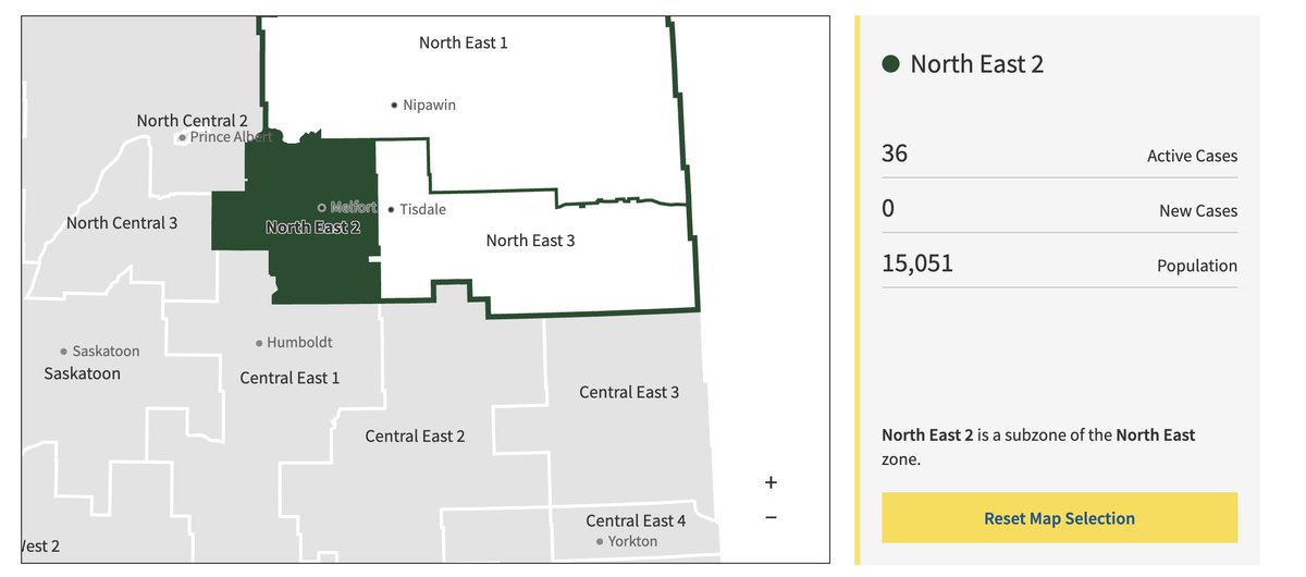
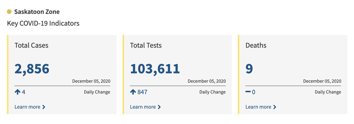
Saskatchewan: Divided up into 13 health regions updated daily, some of which are divided into further sub-regions.
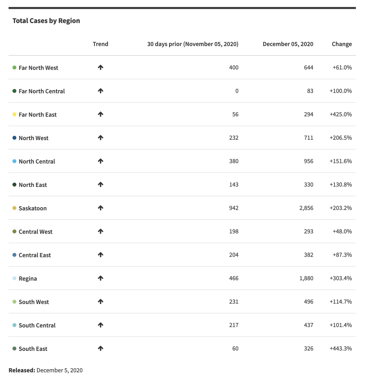
We've also got specific data for Saskatoon and Regina updated daily, which is pretty swell.
https://dashboard.saskatchewan.ca/health-wellness/covid-19/cases
We've also got specific data for Saskatoon and Regina updated daily, which is pretty swell.
https://dashboard.saskatchewan.ca/health-wellness/covid-19/cases
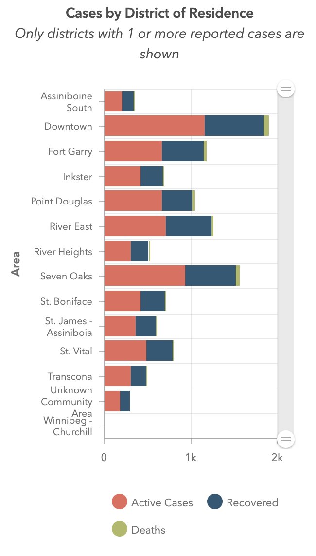
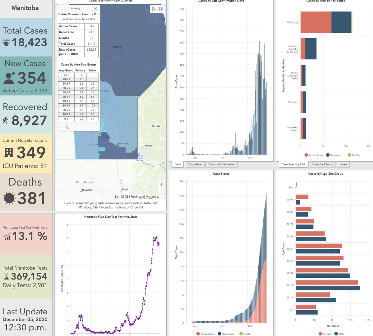
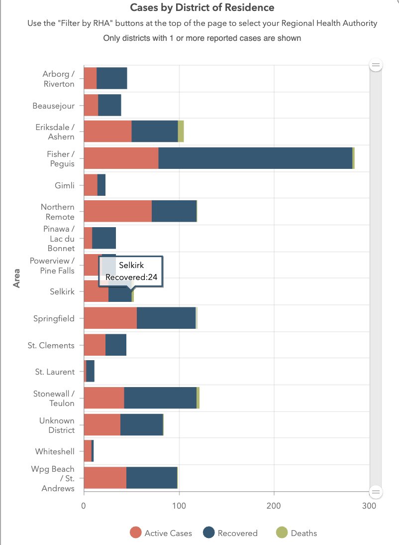
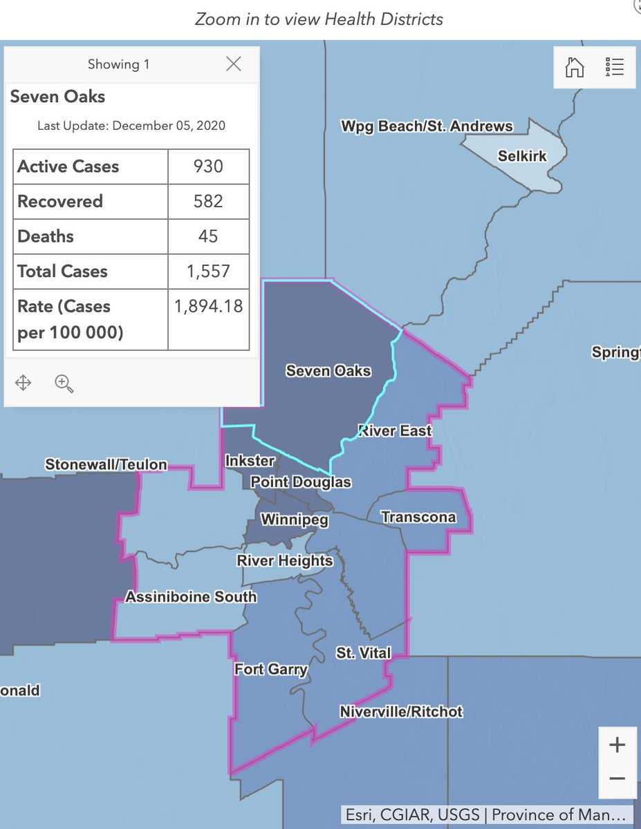
Manitoba: we've got a dashboard similar to B.C., and five health regions, also like British Columbia.
However, each health region is divided into separate regions updated regularly, which means we get neighbourhood data in Winnipeg.
https://www.arcgis.com/apps/opsdashboard/index.html#/29e86894292e449aa75763b077281b5b?rha=Winnipeg
However, each health region is divided into separate regions updated regularly, which means we get neighbourhood data in Winnipeg.
https://www.arcgis.com/apps/opsdashboard/index.html#/29e86894292e449aa75763b077281b5b?rha=Winnipeg
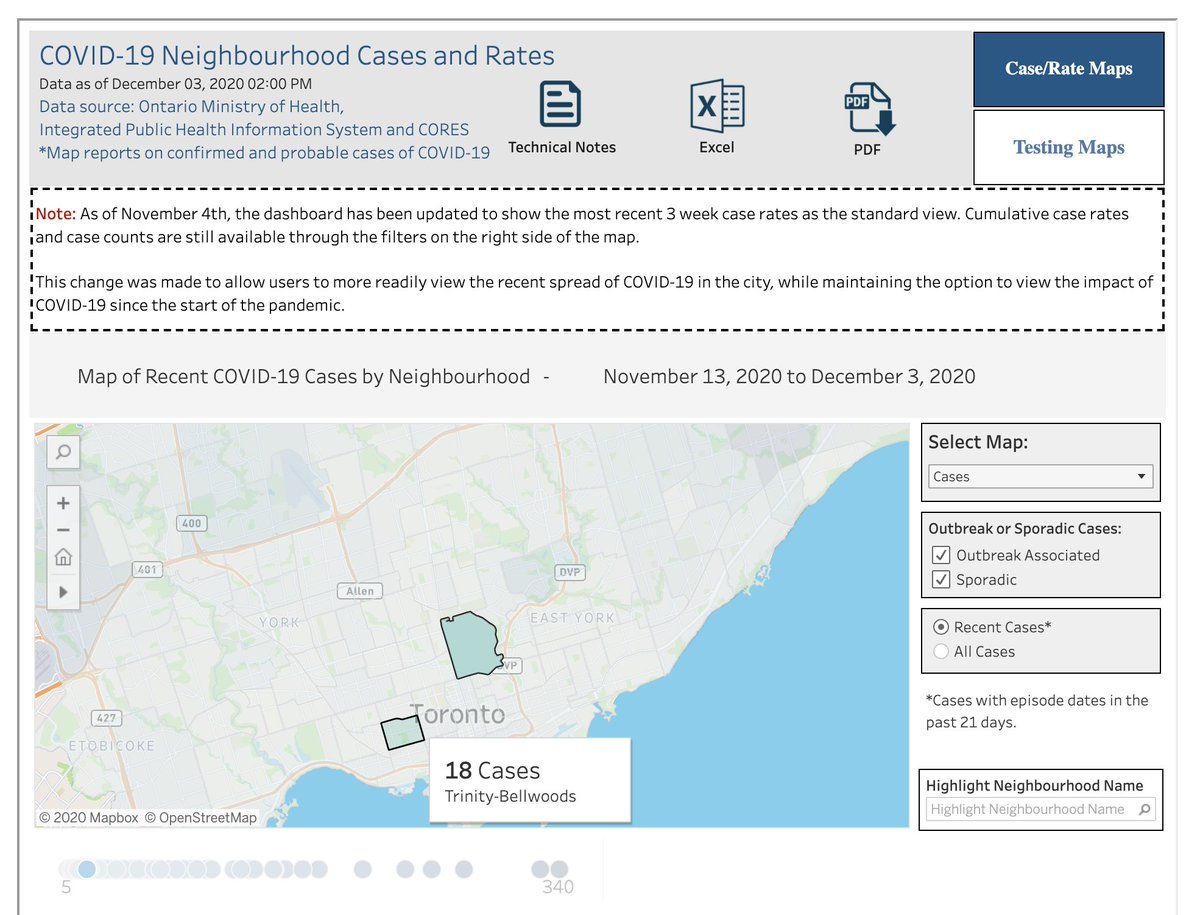
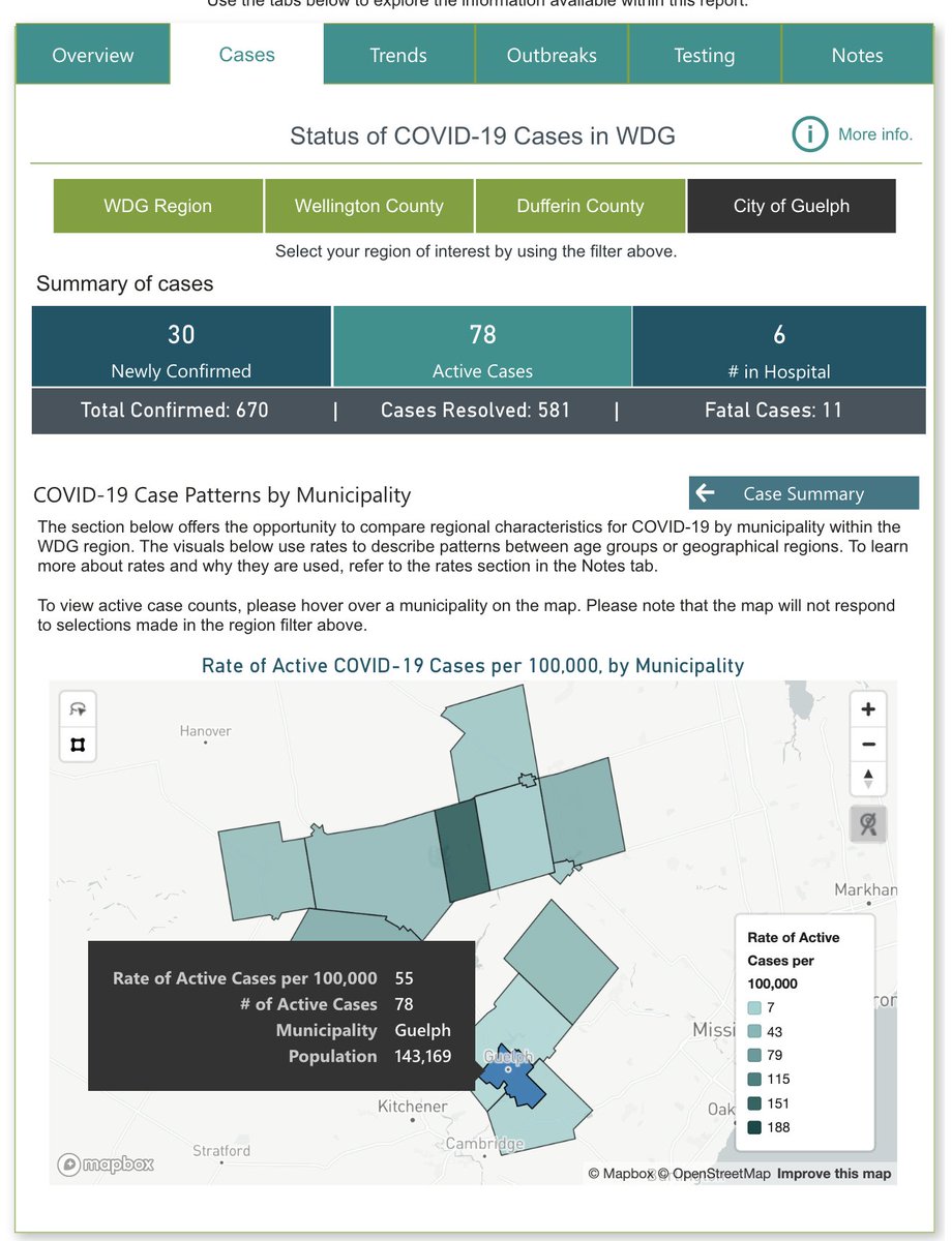
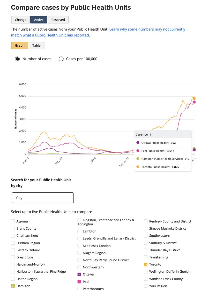
Ontario: ridiculously easy to find total cases, active cases and deaths in your city.
Toronto is broken down into neighbourhoods as well, which is nice.
It is very annoying when Ontario is much better at something than my province, but such is life!
https://covid-19.ontario.ca/data
Toronto is broken down into neighbourhoods as well, which is nice.
It is very annoying when Ontario is much better at something than my province, but such is life!
https://covid-19.ontario.ca/data
Quebec: souvent en français, mais c'est bien!
(je m'excuse)
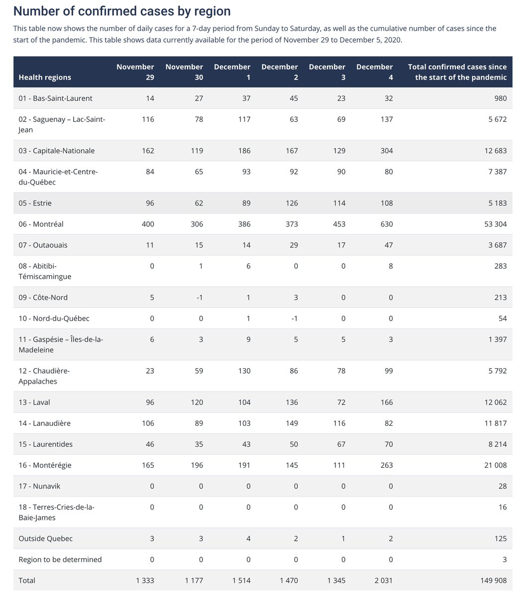
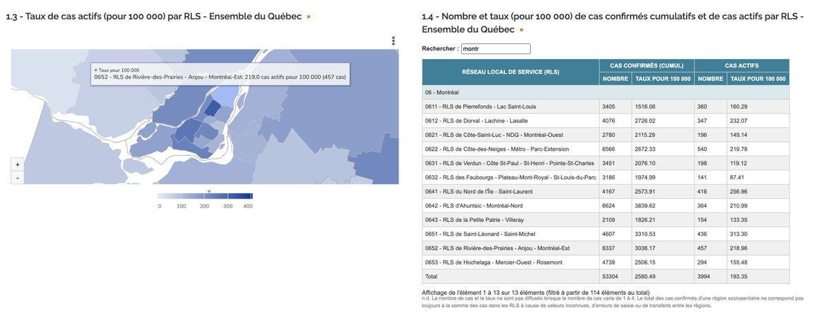
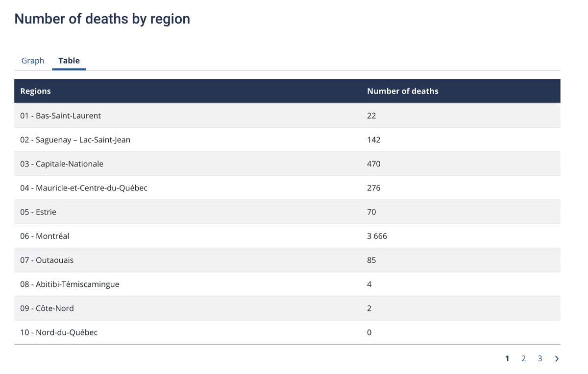
Anyways, we've got a lot more health regions with daily information, and once again we get detailed information for neighbourhoods in the province's biggest city.
https://www.quebec.ca/en/health/health-issues/a-z/2019-coronavirus/situation-coronavirus-in-quebec/
https://www.inspq.qc.ca/covid-19/donnees/par-region
New Brunswick: now we're getting into comparisons that merely Horgan look misleading.
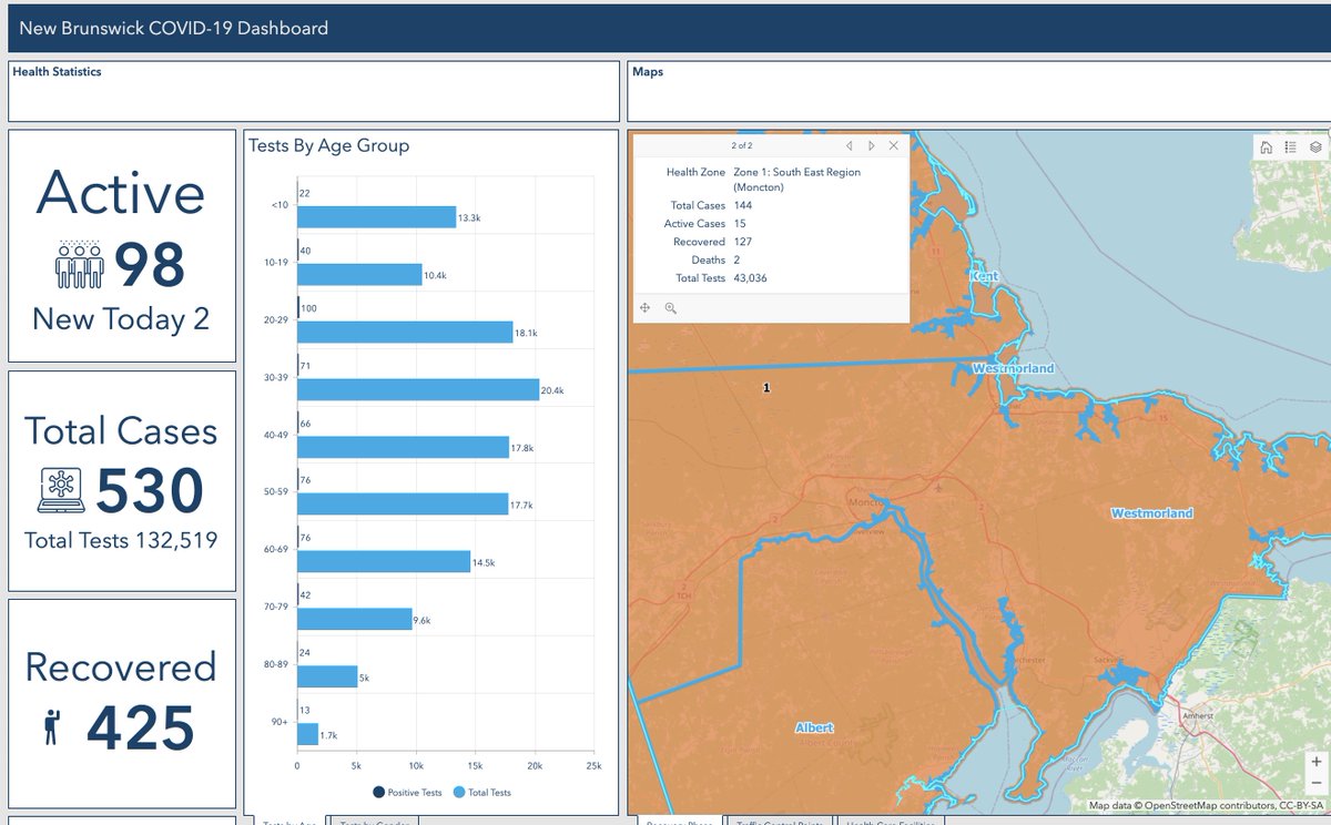
They have a similar system to B.C., except there are seven health regions, instead of B.C.'s five.
New Brunswick has 8% of B.C.'s size, and 15% of its population.
https://experience.arcgis.com/experience/8eeb9a2052d641c996dba5de8f25a8aa
They have a similar system to B.C., except there are seven health regions, instead of B.C.'s five.
New Brunswick has 8% of B.C.'s size, and 15% of its population.
https://experience.arcgis.com/experience/8eeb9a2052d641c996dba5de8f25a8aa
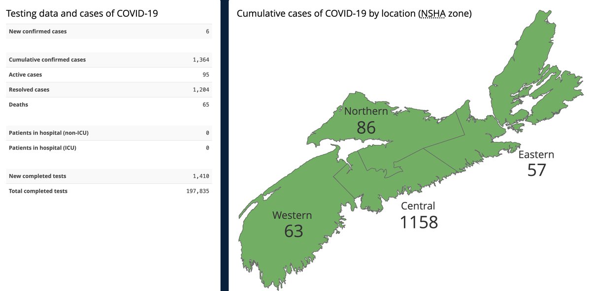
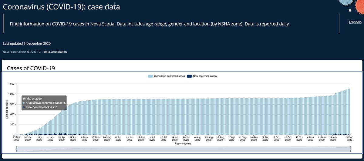
Nova Scotia: worse than B.C.
Minimal data, only four zones (still more on a per capita basis than B.C.), and we're starting to see a push for more data: https://www.thechronicleherald.ca/news/provincial/nova-scotians-deserve-more-covid-data-prof-524028/
https://novascotia.ca/coronavirus/data/
Minimal data, only four zones (still more on a per capita basis than B.C.), and we're starting to see a push for more data: https://www.thechronicleherald.ca/news/provincial/nova-scotians-deserve-more-covid-data-prof-524028/
https://novascotia.ca/coronavirus/data/
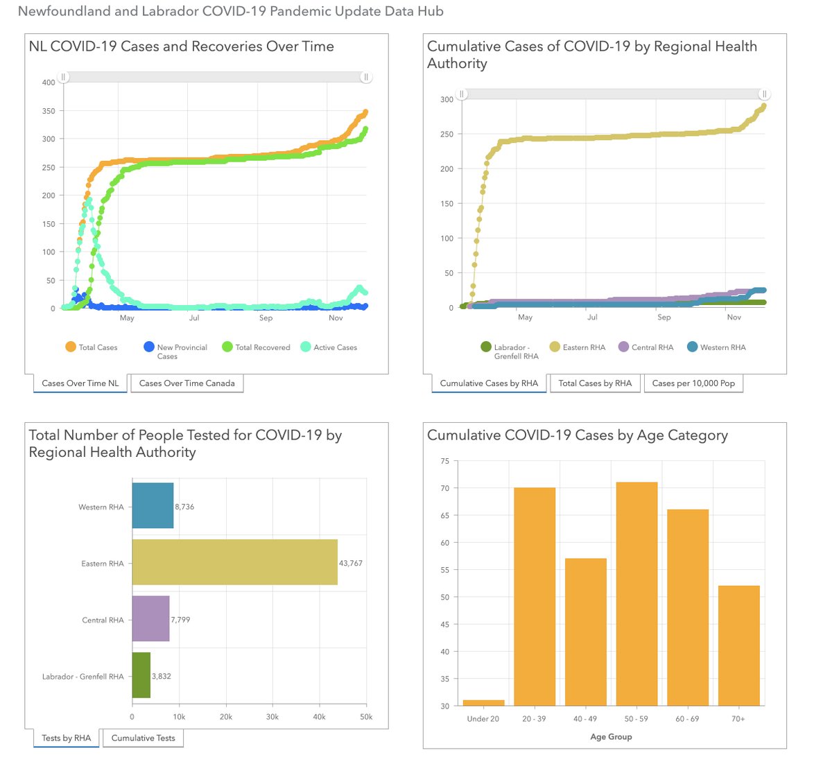
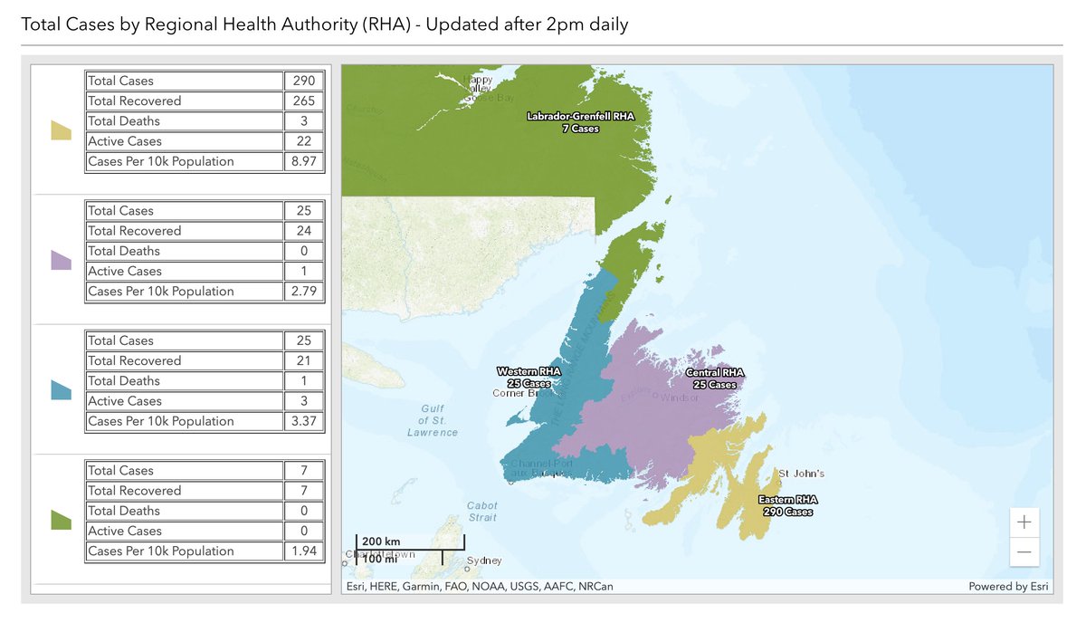
Newfoundland & Labrador: similar situation to New Brunswick, where it's roughly the same data as B.C., with four health regions.
Except Newfoundland has about 40% of B.C.'s size and 11% of its population, so in that sense it's much more granular.
Except Newfoundland has about 40% of B.C.'s size and 11% of its population, so in that sense it's much more granular.
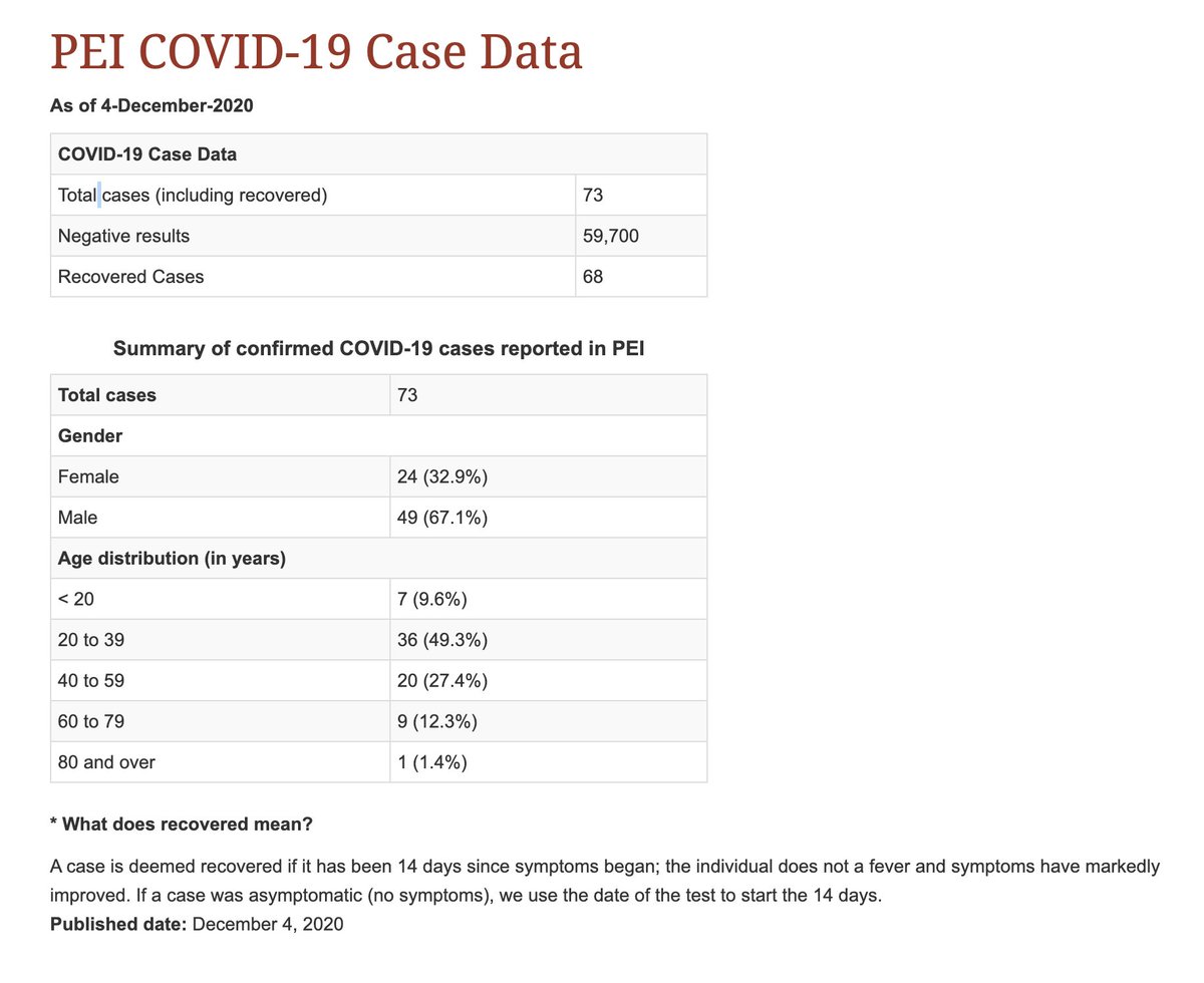
Prince Edward Island: no regional information on cases. The only province with much less geographic transparency than B.C.
Of course, Prince Edward has had 73 #COVID19 cases during the pandemic, while British Columbia has had 36,132.
so you know
https://www.princeedwardisland.ca/en/information/health-and-wellness/pei-covid-19-case-data
Of course, Prince Edward has had 73 #COVID19 cases during the pandemic, while British Columbia has had 36,132.
so you know
https://www.princeedwardisland.ca/en/information/health-and-wellness/pei-covid-19-case-data
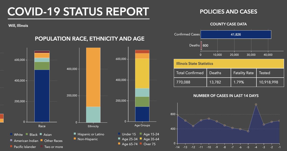
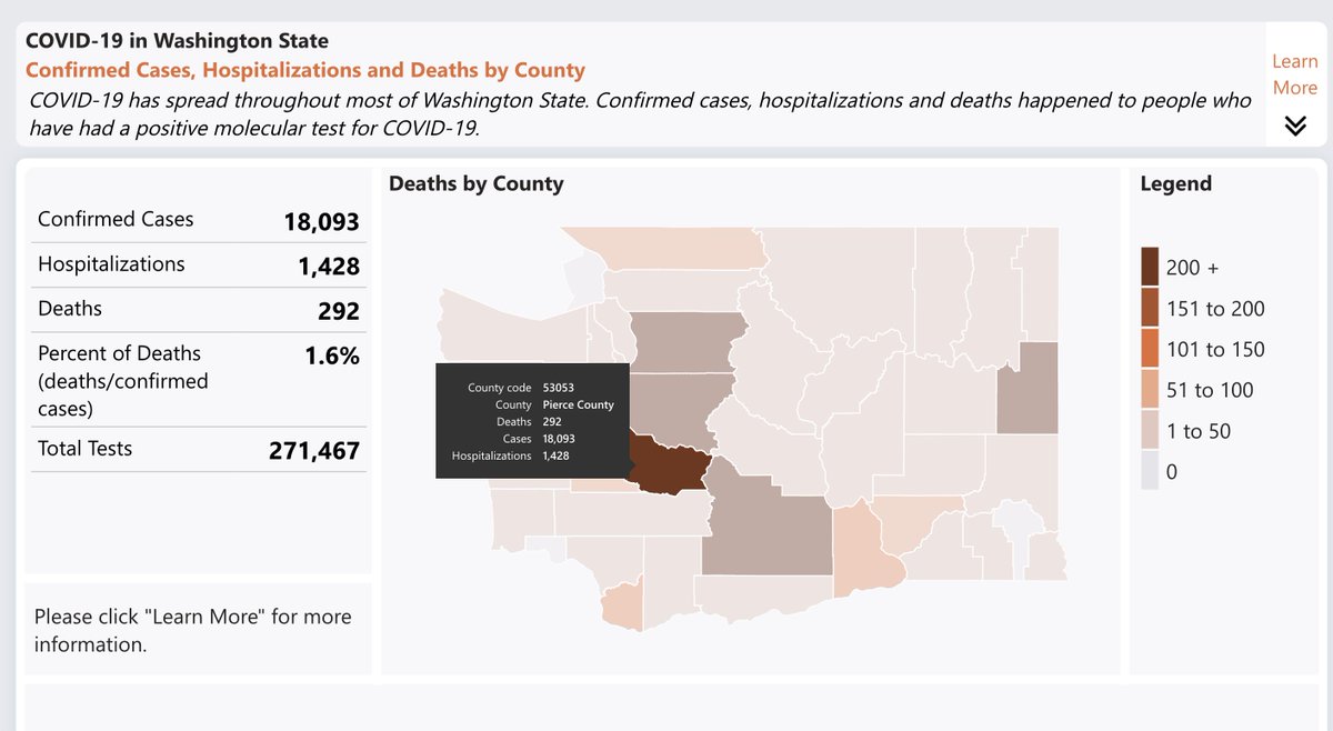
Of course, Horgan said "North America", so maybe he was just comparing B.C.'s response to the United States.
Here's data from two random counties in two different states, which I found in about five minutes.
Here's data from two random counties in two different states, which I found in about five minutes.
Anyways.
British Columbia provides less geographic data about a worldwide plague than any other province in Canada with a significant outbreak.
That's the objective truth, no matter what the premier says.
British Columbia provides less geographic data about a worldwide plague than any other province in Canada with a significant outbreak.
That's the objective truth, no matter what the premier says.
(i look forward to ndp mlas sharing this thread as much as they do my promise tracker, and will now attempt to go back to my long weekend, which i specifically took to try and avoid covid work for a few days)

 Read on Twitter