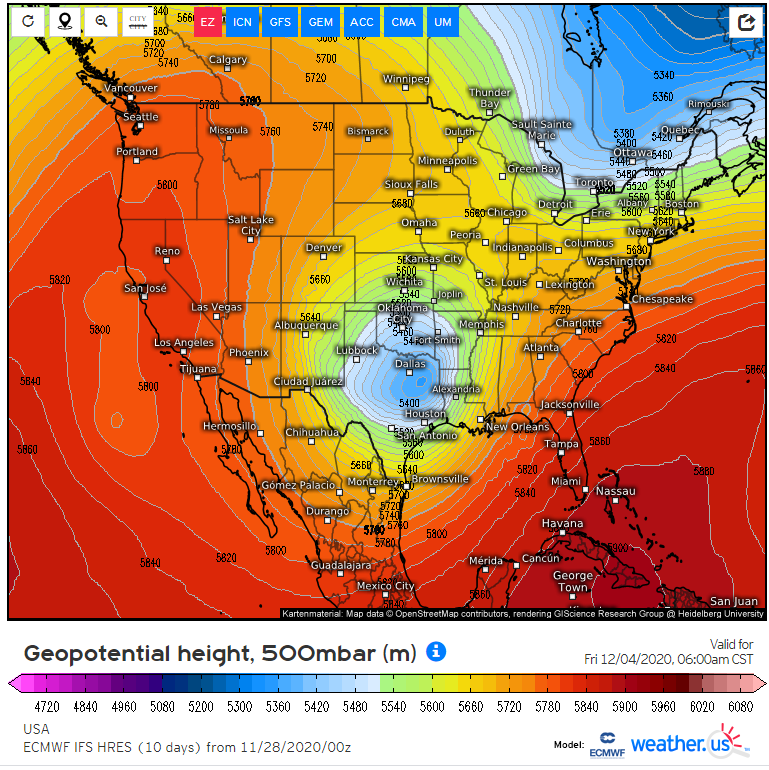
The euro solution in the upper air pattern seems crazy, so I went searching for similar scenarios in the past that produced snow in north Arkansas.
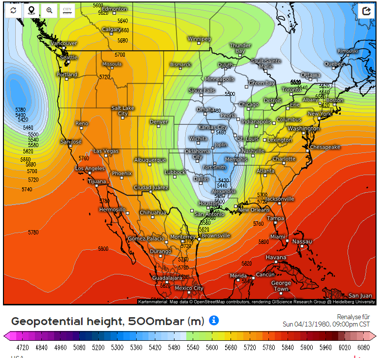
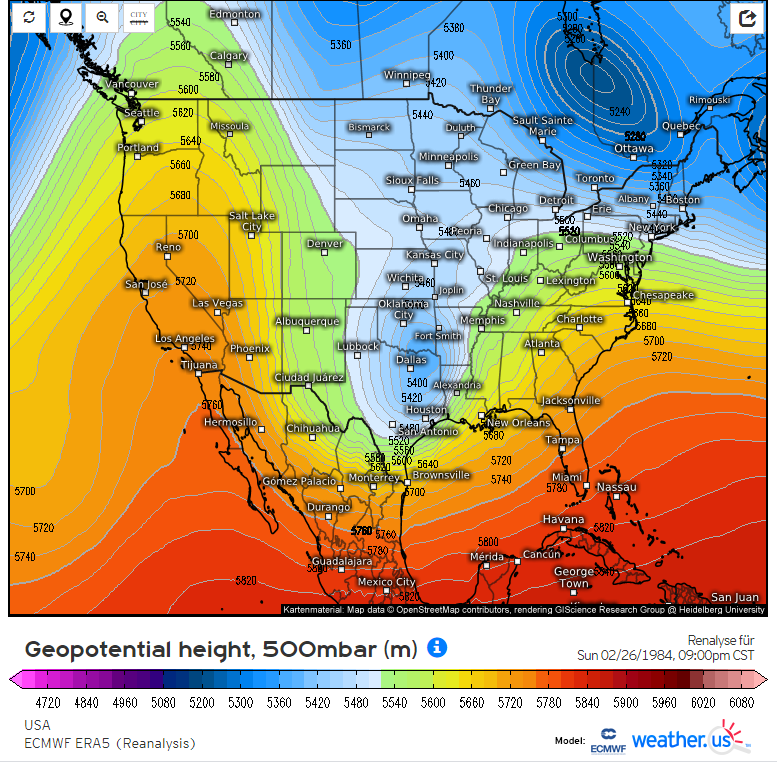
I could not find anything this anomalous (leading me to believe it's unrealistic), however I did find a few similar setups (1/4).
I could not find anything this anomalous (leading me to believe it's unrealistic), however I did find a few similar setups (1/4).
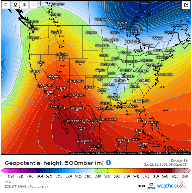
4/13/1980, 2/26/1984, & 3/1/2009 looked similar, but the system in March 2009 was a true closed low like the one we may see later this week.
One thing that sticks out to me about March 2009 is how hard the forecast was leading up to it. Low confidence until day before! (2/4)
One thing that sticks out to me about March 2009 is how hard the forecast was leading up to it. Low confidence until day before! (2/4)
My thinking now is that the current Euro solution, while not impossible, is very unrealistic and probably will not produce significant snowfall for Arkansas.
If things end up lining up, northern Arkansas would be favored, but don't get those hopes up! (3/4)
If things end up lining up, northern Arkansas would be favored, but don't get those hopes up! (3/4)
Also, in the 3 storms listed, Little Rock received almost no snow. This setup is usually a northern deal it seems. (4/4)

 Read on Twitter


