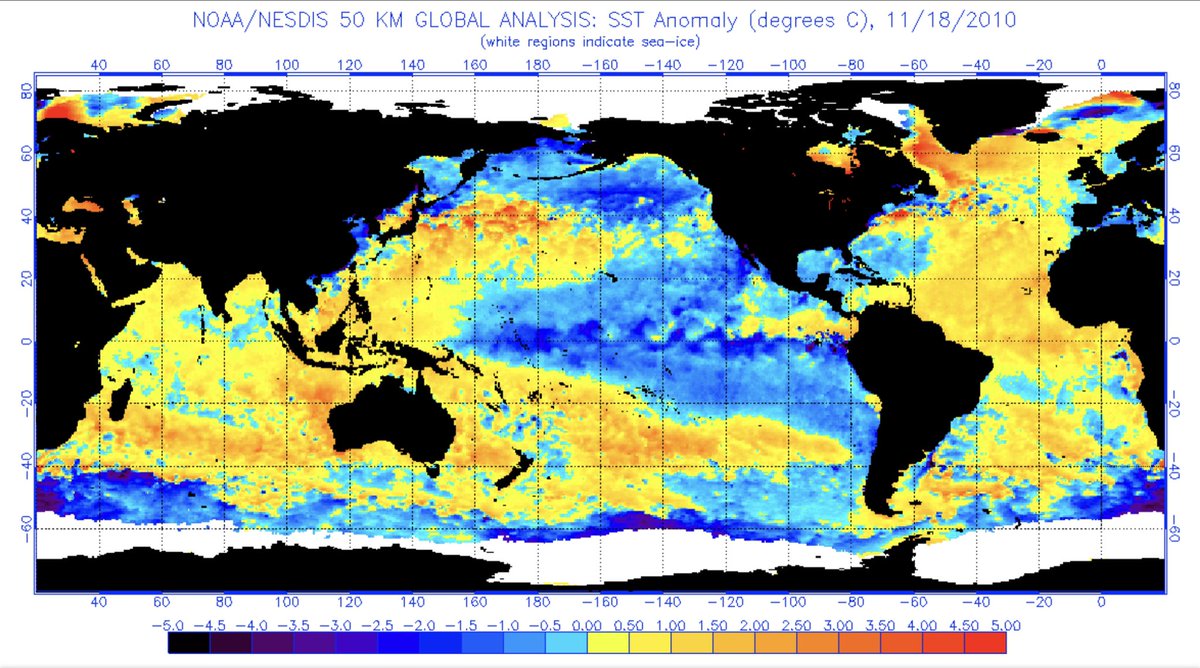
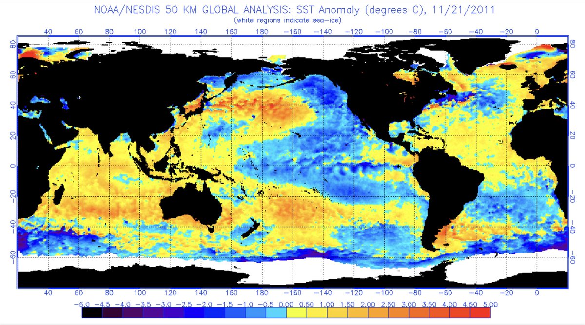
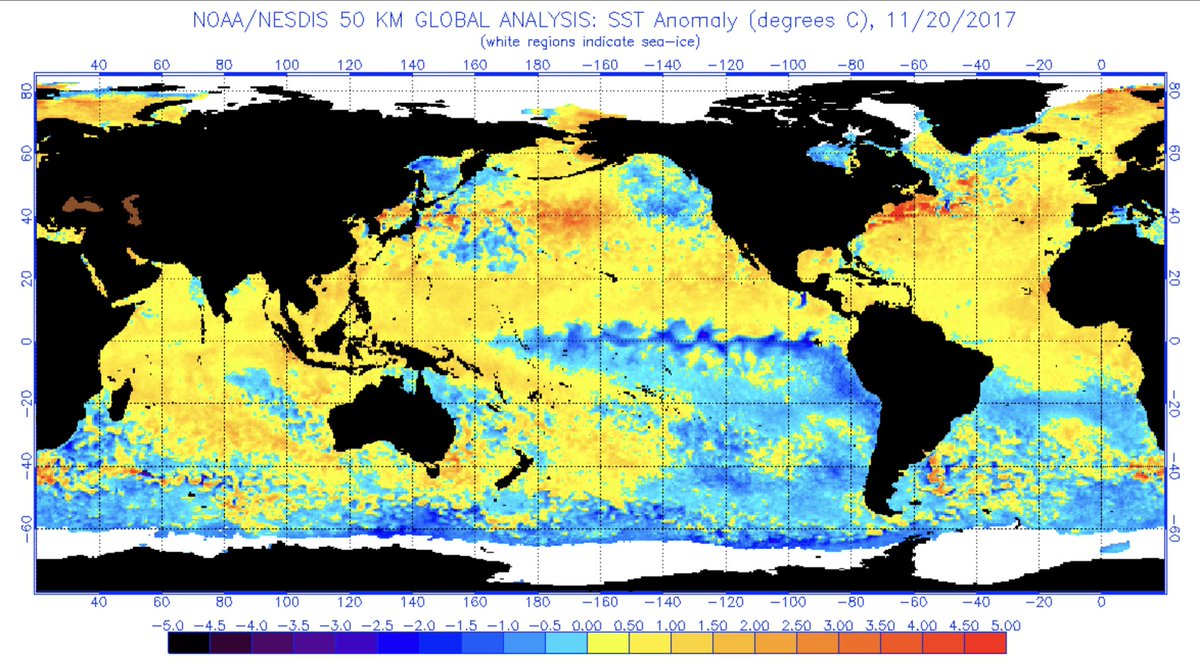
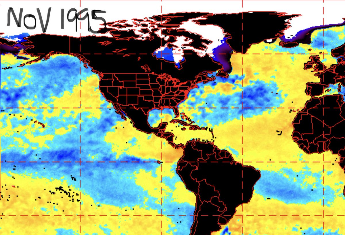
One thing that separates this La Niña from others in RECENT years is the sst South of Alaska for November. Notice from weak-strong La Niñas all contain cooler SST S of Alaska. So how does that compare with this year’s La Niña. 

Notice here S of Alaska is not only warm. But well above average. Typically sometimes referred to as the blob but a little displaced from where we usually find the blob. This is much different from La Niñas in recent years. Also notice there are no cooler sst departures off...
the SE US coast too unlike any of the varying La Ninas selected. What does this mean for winter forecasts and winter in general? If you think you what is going to happen exactly this winter based on past winters your absolutely wrong and don’t know what you’re talking about...
Also, I get this is a very small sample size of La Niñas but I just wanted to get different types of La Niñas in more RECENT years to show this difference between those and our current La Niña which is unlike any of them. Also if you 100% believe the long range modeling then...
You’re just guessing at this point and don’t really know what you’re talking about. Winter Forecasts are educated guesses, not just guesses. TBH, nothing is certain right now. And I don’t buy a non snowy or snowy NE winter for a second. So stay tuned and hope for the best...
The main thing I’m looking for this year is a disruption in the PV.Typically it takes 4-6 weeks for PV to be disrupted. So look for maybe something interesting to happen mid-late winter possibly.For now just speculation as you only need a couple big storms to make a winter.Not 10

 Read on Twitter
