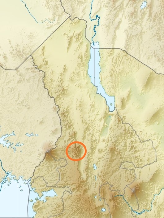
Cherangany Hills forest are found on the eponymous Hills that form part of the western escarpment of the Great Rift Valley.
The forested Hills are technically a mountain range that extends north-south and partly to the Trans Nzoia plateau in the west.
The forested Hills are technically a mountain range that extends north-south and partly to the Trans Nzoia plateau in the west.
Cherangany Hills forest consists of 13 blocks that cover the peaks of the Hills.
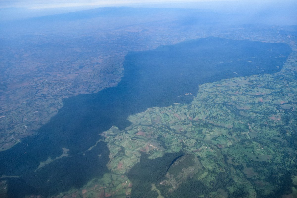
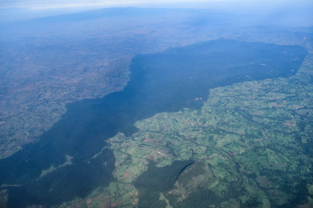
Kapcherop forest (pictured) forms the largest contiguous block. The eastern flank near the escarpment is also largely contiguous but central parts consist of fragmented forests & human settlements.
Kapcherop forest (pictured) forms the largest contiguous block. The eastern flank near the escarpment is also largely contiguous but central parts consist of fragmented forests & human settlements.
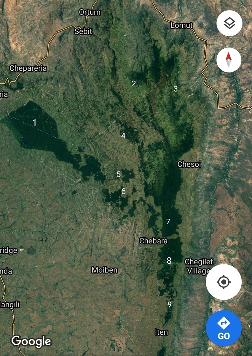
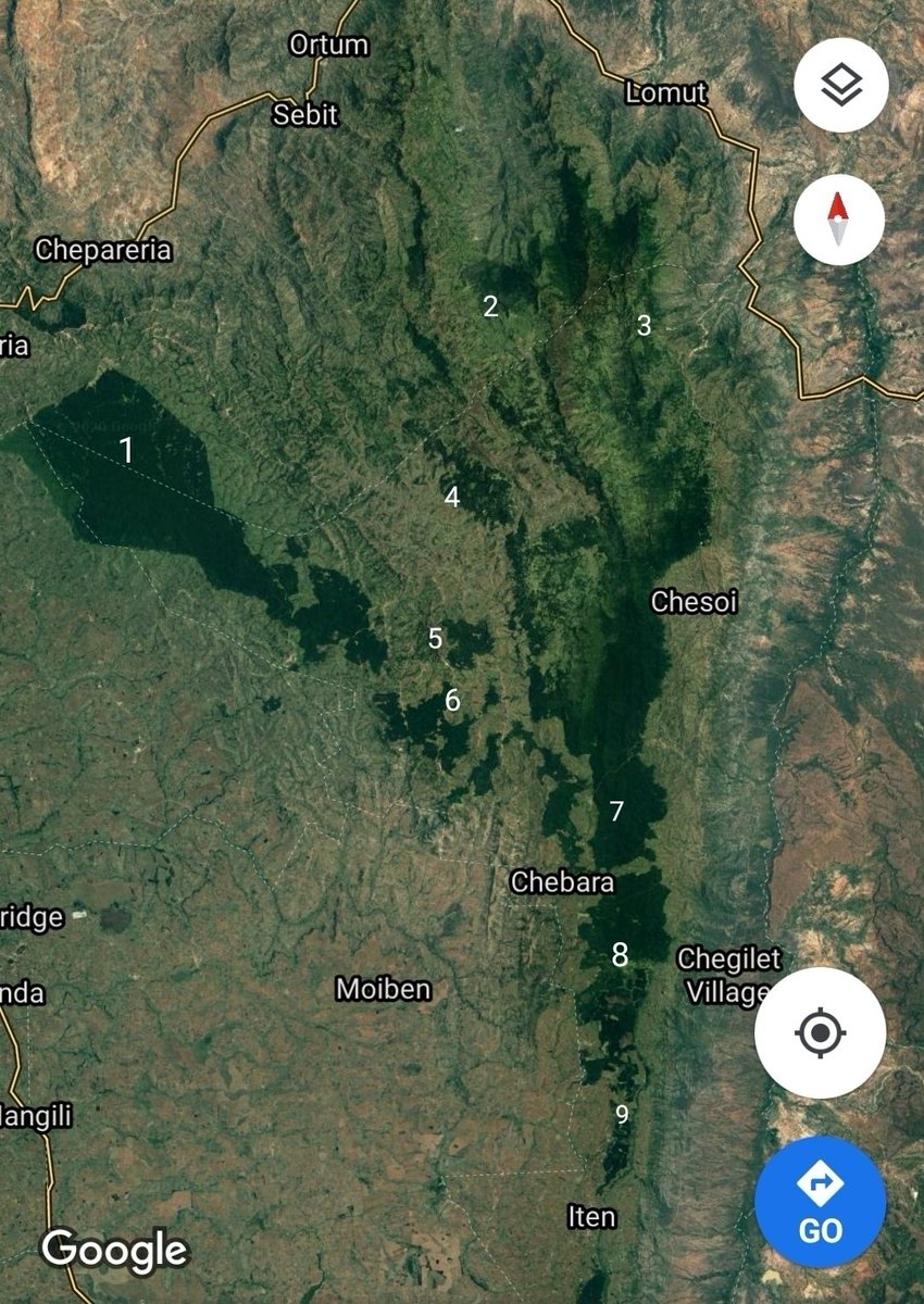
The blocks of forest that form the Cherangany Hills Forest are highlighted in this image.
1. Kapcherop (Kapkanyar, Kapolet & Kiptaberr forest blocks).
2. Lelan
3. Embobut
4. Kererr
5. Kaisungurr
6. Toropket
7. Sogotio
8. Kapchemutwa
9. Bugar
10. Chemurokoi
1. Kapcherop (Kapkanyar, Kapolet & Kiptaberr forest blocks).
2. Lelan
3. Embobut
4. Kererr
5. Kaisungurr
6. Toropket
7. Sogotio
8. Kapchemutwa
9. Bugar
10. Chemurokoi
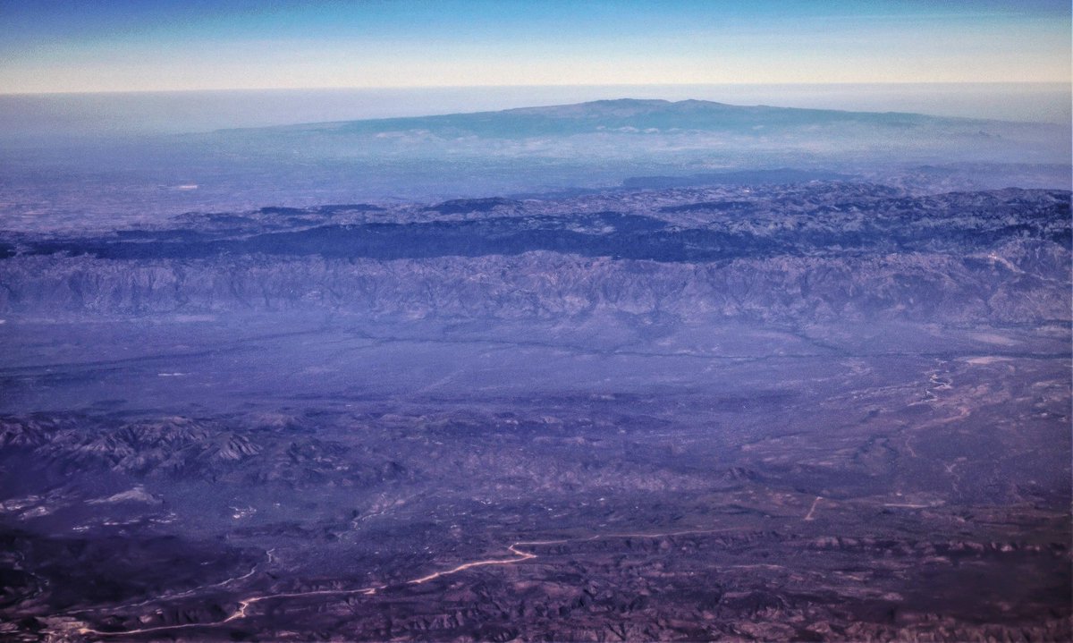
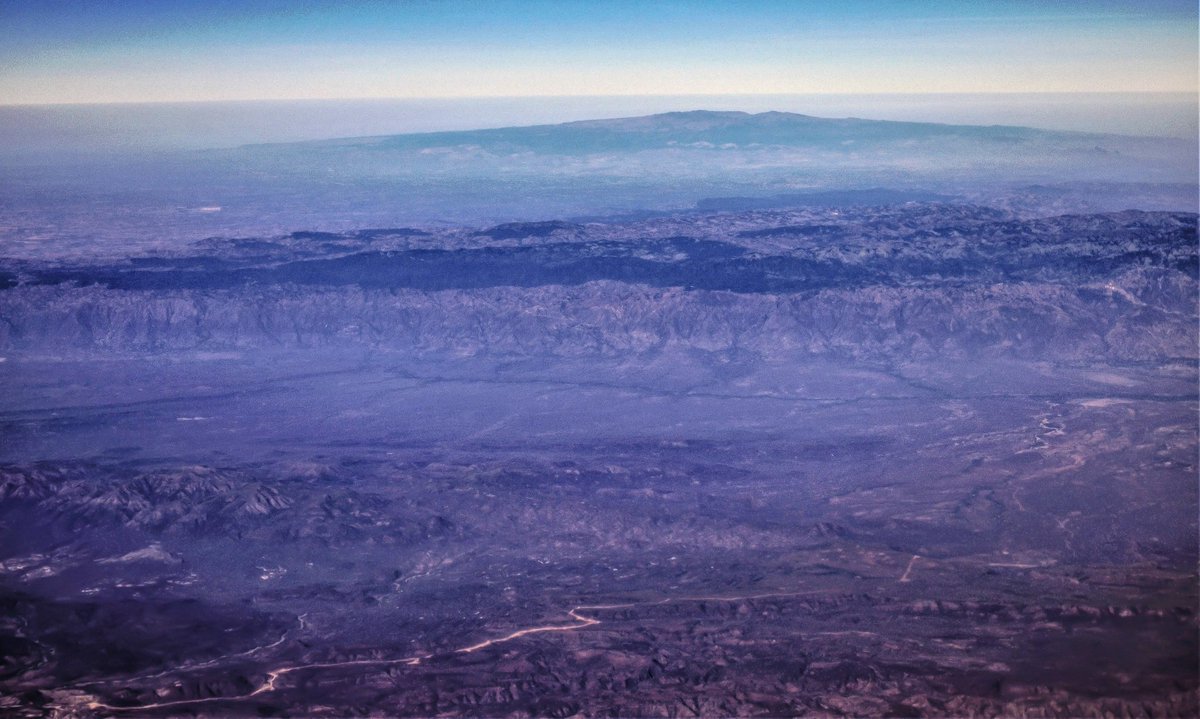
Cherangany Hills is one of the highest places in Kenya and has numerous peaks rising above 3000m. The Rift valley floor drops to the east by upto 1500m. To the west is Trans Nzoia plateau and Mt. Elgon.

 Read on Twitter