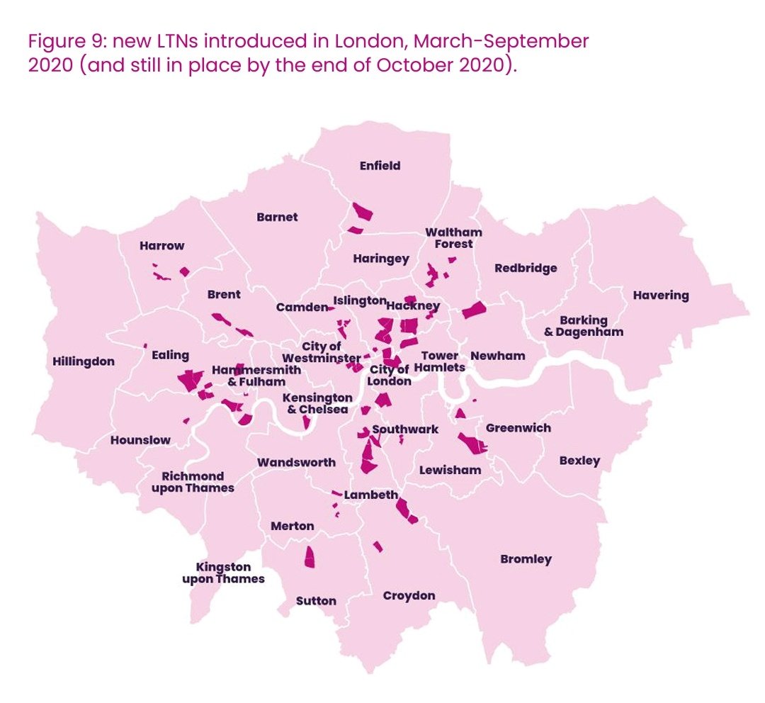
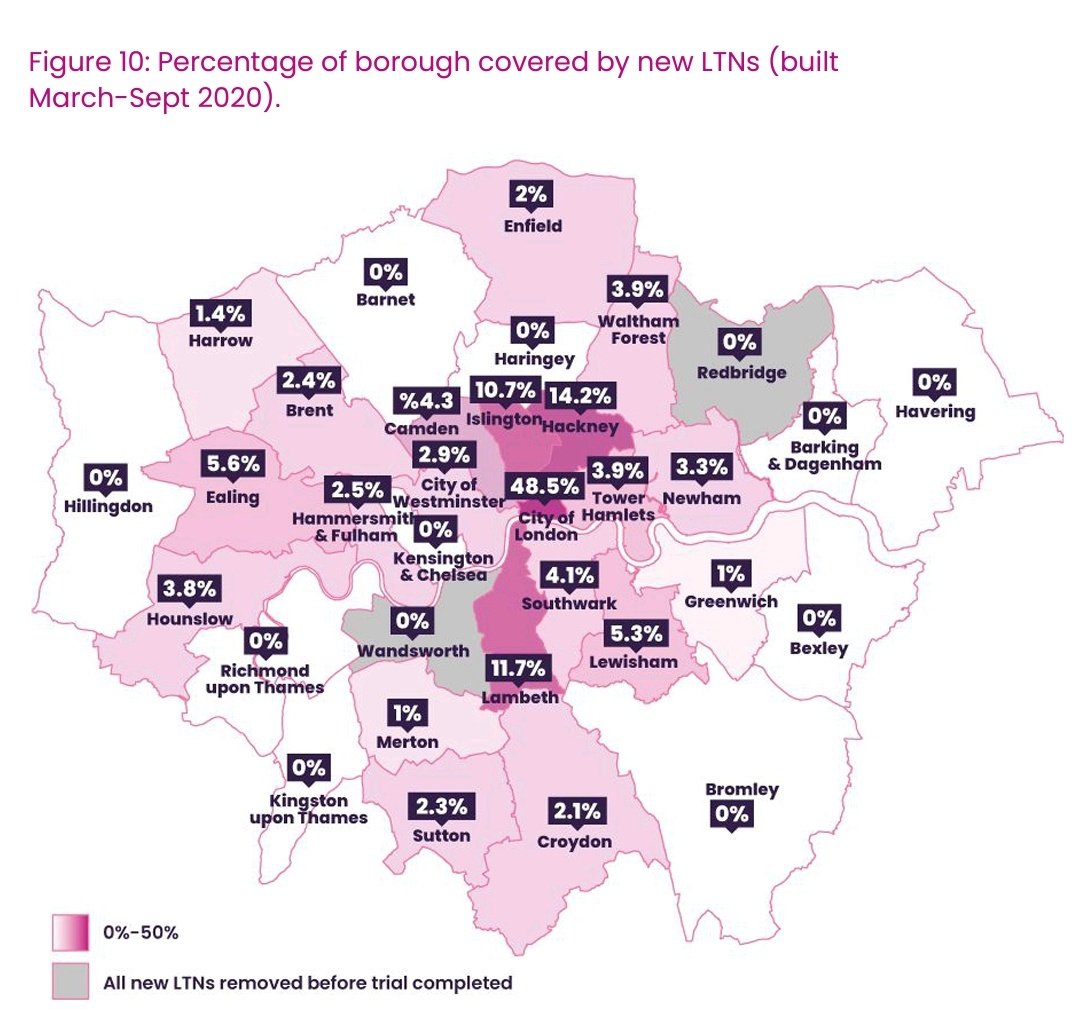
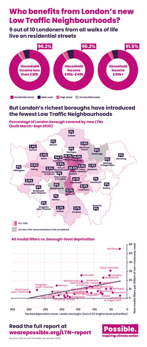
Pulled these interesting maps of the new London #LTNs & % coverage by borough, from the 'LTNs for all?' report by @Active_ATA with @_wearepossible & @KRFoundation
City highest at 48.5% but small area and low residential, Hackney has 14.2% of new LTN infra covering the borough.
City highest at 48.5% but small area and low residential, Hackney has 14.2% of new LTN infra covering the borough.
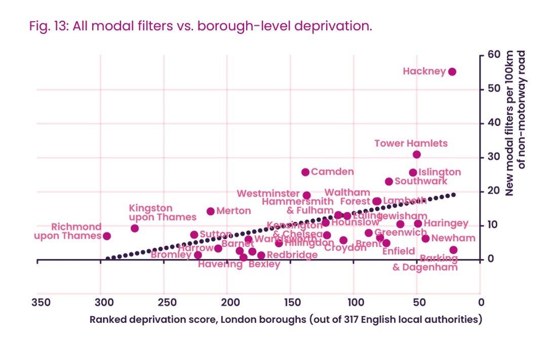
The report analyses #LTNs, social deprivation and car ownership. It counters claims that LTNs benefit only wealthy people living inside the LTN by displacing traffic onto main roads where low income ethnic minorities live.
The report states over 90% of people of different ethnicities and levels of income live on residential streets. The people who benefit from #LTNs are Londoners from all walks of life.
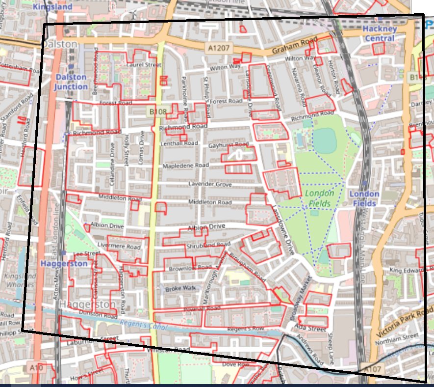
(This is also highlighted in map of my local #LTN in London Fields, HT @GJHollands)
(This is also highlighted in map of my local #LTN in London Fields, HT @GJHollands)
The authors recommend boroughs without #LTNs introduce them and to consider equity in their placement to benefit those living without access to private green space or safe public spaces.
Read the report here: http://wearepossible.org/LTN-report
Read the report here: http://wearepossible.org/LTN-report

 Read on Twitter