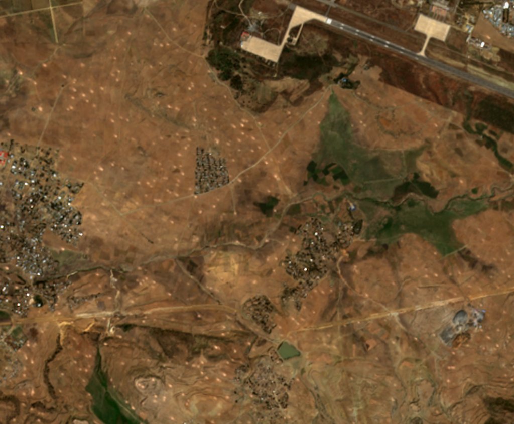
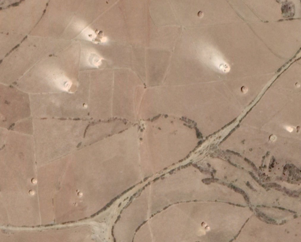
THREAD. A reminder that background knowledge and context is important to satellite analaysis. This timelapse shows the surrounds of Mekelle airport over the past few weeks. On first glance it looks like very extreme and sustained shelling around the airport. It's NOT...
... To some extent confirmation bias plays a role here, I was specifically looking for satellite evidence of the effects of war in Ethiopia's Tigray region, and specifically following reports of airstrikes affecting agricultural lands around Mekelle
https://twitter.com/GebremeskelGeb8/status/1327227036214190080 ...
https://twitter.com/GebremeskelGeb8/status/1327227036214190080 ...
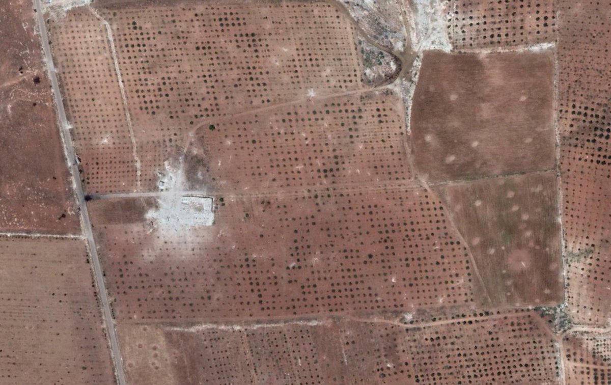
... When you look at heavily shelled areas in combat zones you see a similar pattern of disturbance. See, for example https://twitter.com/Nrg8000/status/1315638504093704192 or impact craters like this in Syria...
... However in this case near Melelle, the distburbances started appearing by October 30th, before the conflict began in earnest (though it's possible shelling started days before), and you also saw similar patterns in November on previous years, here for example is 2018...
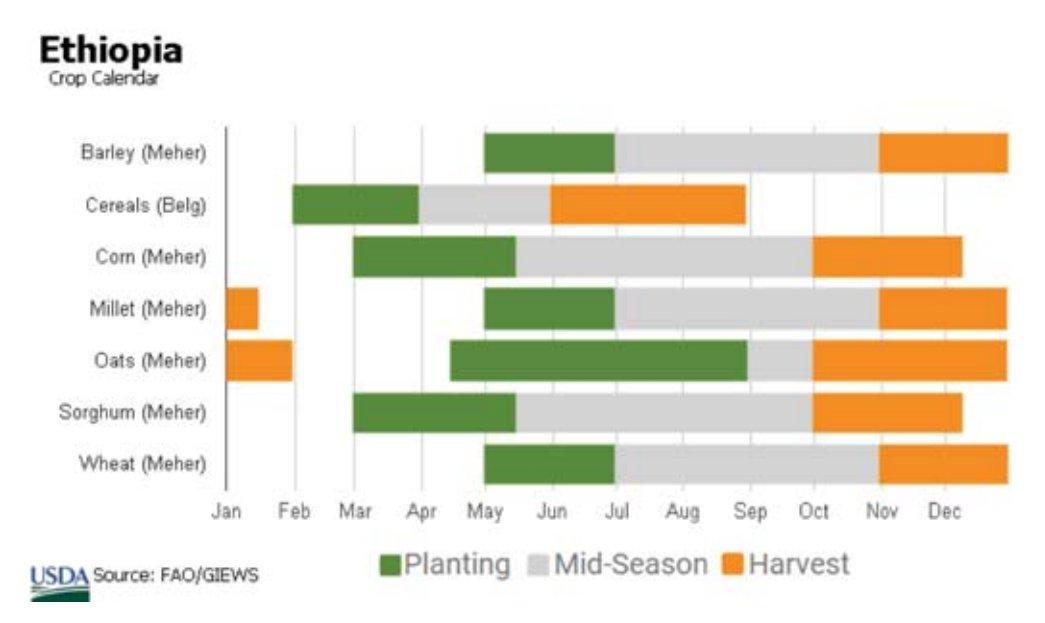
... Similar patterns at the same time in different years suggest it is something agricultural, and looking at crop calendars for Ethiopia, you can see that most crops begin harvesting in October/November...
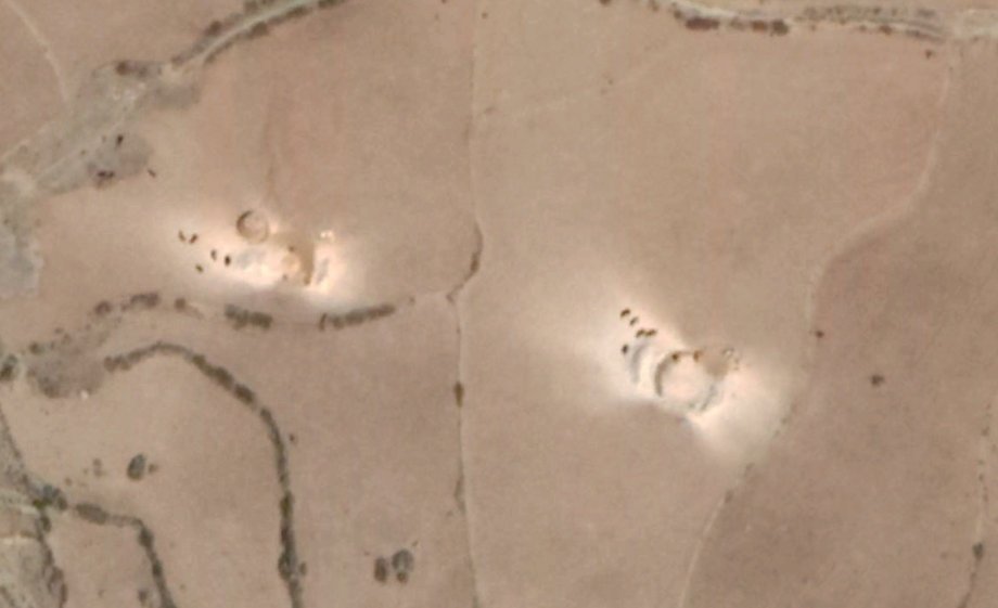
...Looking at higher resolution imagery from previous seasons (here in 2018 again) you can actually see that those marks are drying areas for crops that have just been harvested and piled up, that just happened to coincide with a major military offensive this year...
...Going on YouTube you can find videos of what's happening
And It's VERY clear that what you're seeing is regular agricultural practice and not intense shelling...
And It's VERY clear that what you're seeing is regular agricultural practice and not intense shelling...
... Anyone from the region, or even with knowledge of the region would immediately see these patterns as the regular harvest, but me, helicoptering in and by the chance of when this military offensive started/the limiting resolution of Sentinel-2 went OOOH HOld up!...
So I guess the lesson here is the importance of contextual understanding to satellite analysis, and the pitfalls of looking for patterns that you often see in one part of the world to an area you hardly know.
But, as always, Scott here sums up the lesson here much better than my random ramblings! https://twitter.com/wslafoy/status/1328150371777343490

 Read on Twitter